
Dholavira
A Harappan Metropoly
Khadir Bet, Great Rann of Kutch
A four and a half hour drive from Bhuj, deep in the arid desolation of Kutch, lies an island in the salt pans. Here the ruins of a mega city from the times of the Indus Valley Civilization, known locally as Kotada timba, were discovered. Dholavira’s location is on the Tropic of Cancer and it is one of the five largest Harappan sites and the most prominent site in India.
Located on the Khadir bet island in the Great Rann of Kutch it is the grandest city of its time. It lay between two seasonal streams, Mansar in the North and Manhar in the south. Recent research suggests that the site was occupied beginning from circa 3500 BCE and continued until around 1800 BCE.
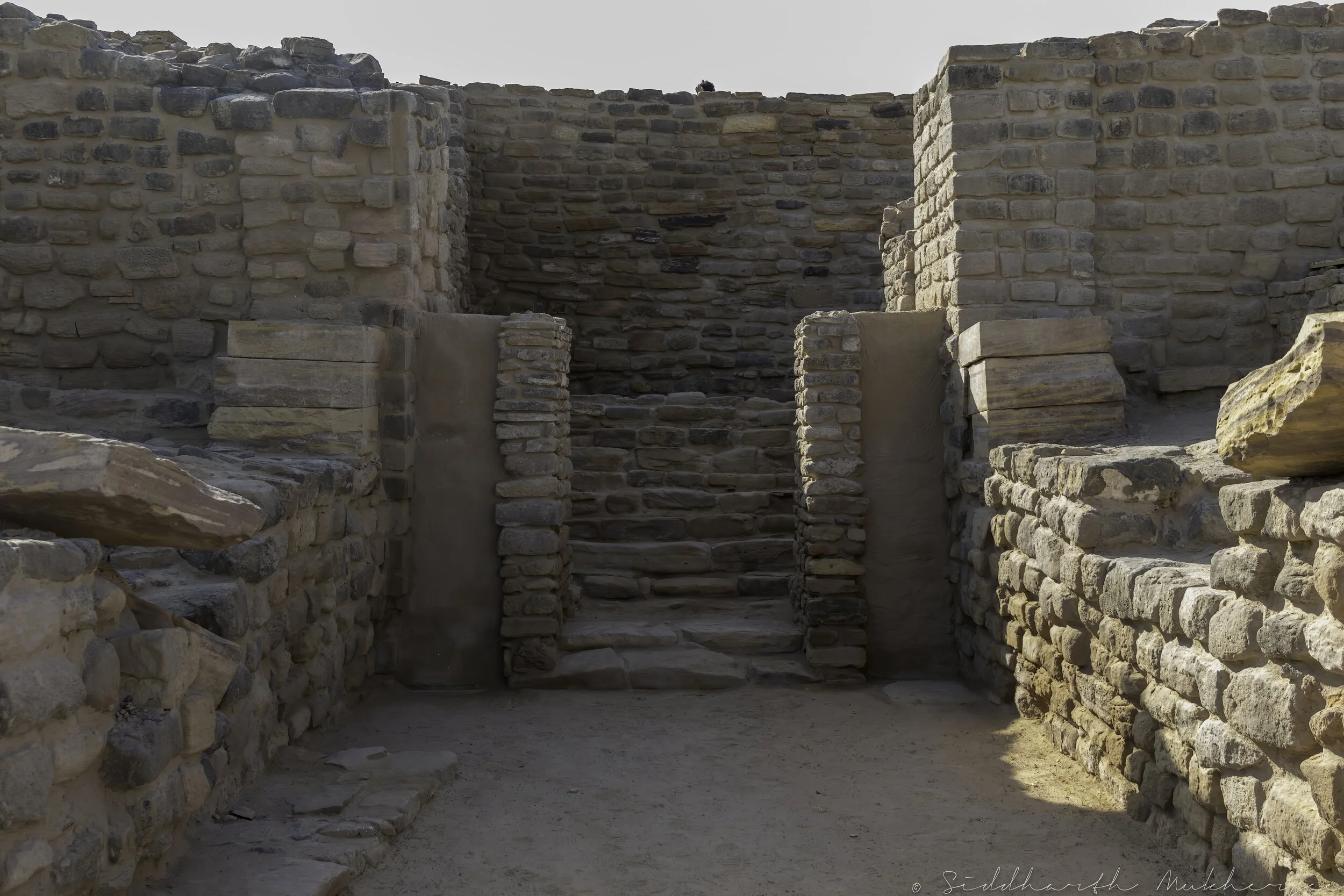
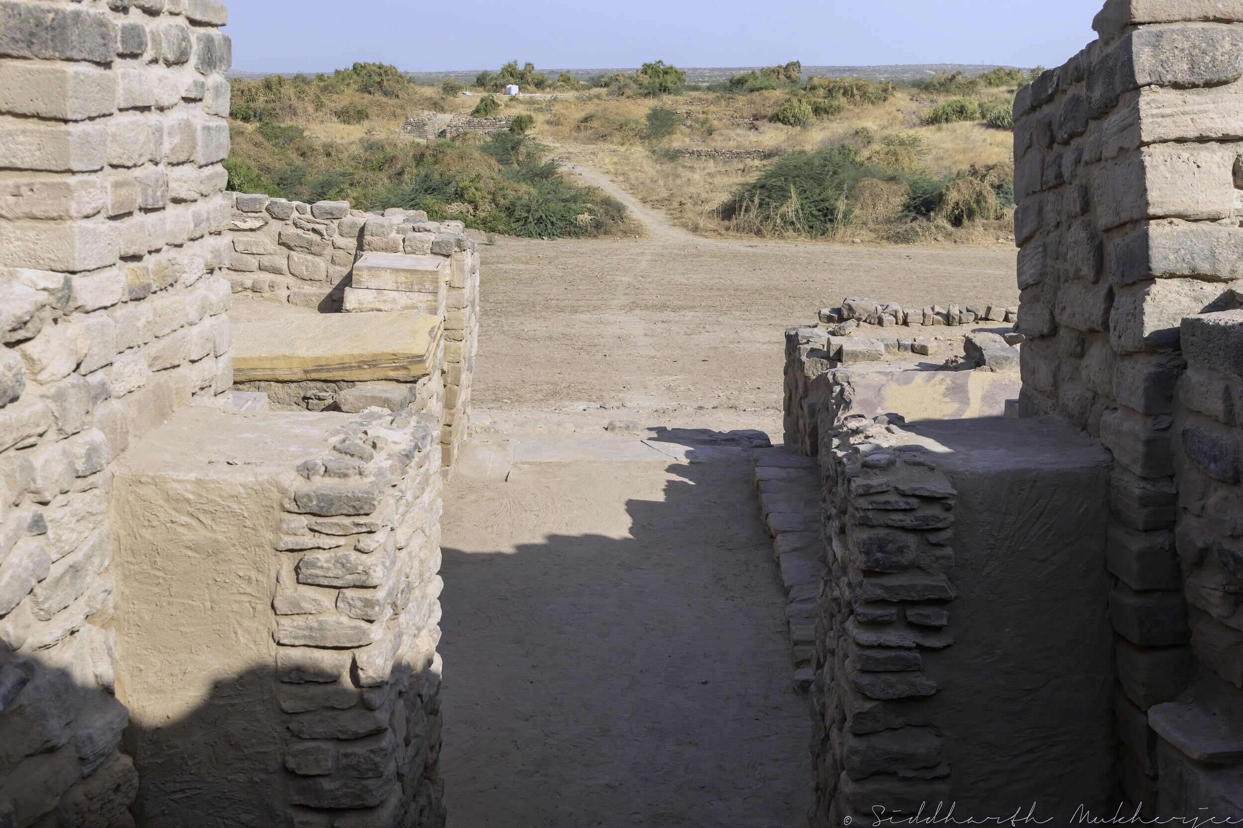
Northern Gate into the citadel where the famous Signboard was found. There are Guard houses on either side.
First discovered by archaeologist J. P. Joshi in 1956, excavations started in 1900 under R. S. Bisht of the ASI. Spread over 100 hectares, the site shows a continuous evolution and studies here have brought out some fascinating aspects of the Harappan civilization. Excavations tell the story of the seven stages of the Harappan Civilization, from development to maturity to decay, the last of which hints at a strange piece of history with more questions than answers. There are hints that after its brief abandonment between 1900-1850 BCE the settlers returned with a markedly deurbanized culture. They willingly chose to simplify their lives, rather than try to ride the collapse of their once glorified civilization. Here on the ruins one has the chance to contemplate what progress and civilization mean and what, if anything, is truly permanent.

Dholavira Layout
The earliest phase of Dholavira shows evidence of a pre-Harappan culture with scattered settlements and a rudimentary style of pottery. But then the city seems to have evolved into a sophisticated and mathematically well-planned city, a trademark of the mature Harappan period. The evidence of the planning can be seen in the geometric excellence evident in the site plan pictured here and in the photos. It continued to be a great urban center till 1900 BCE. Like most other cities of the time, Mohenjodaro, Harappa and Kalibangan, Dholavira too had monumental structures, a sophisticated underground drainage system and large gateways. The city itself is shaped like a parallelogram with smaller structures in a square or rectangular form and stairs leading underground to vast cisterns and yet to be excavated surprises.
We stayed at the Dholavira Tourism Resort which is on the Khadir Bet island and a short distance from the metropolis itself. Sitting on a small hillock which entails a good bit of walking one comes up, quite suddenly, on the 5000-year-old necropolis. First, after walking past the museum we reached the earliest reservoir and from there we made our way past the imposing wall into the ruins.

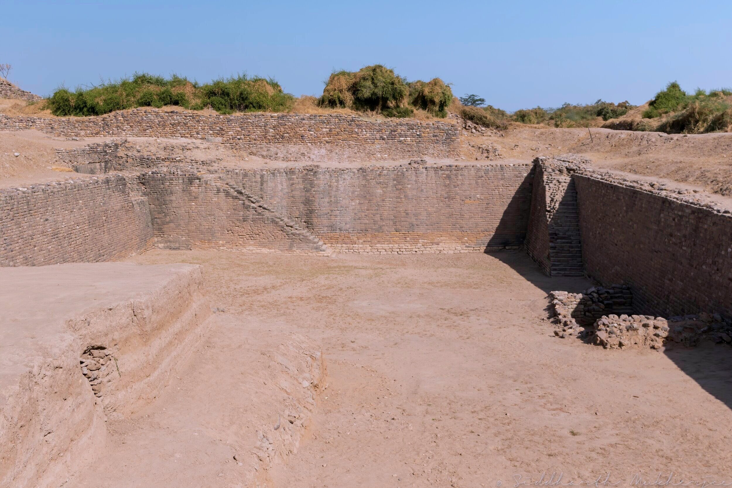
The perfect angles of the 33 foot thick wall of the castle.
Entrance to the underground labyrinth of water channels and passageways.
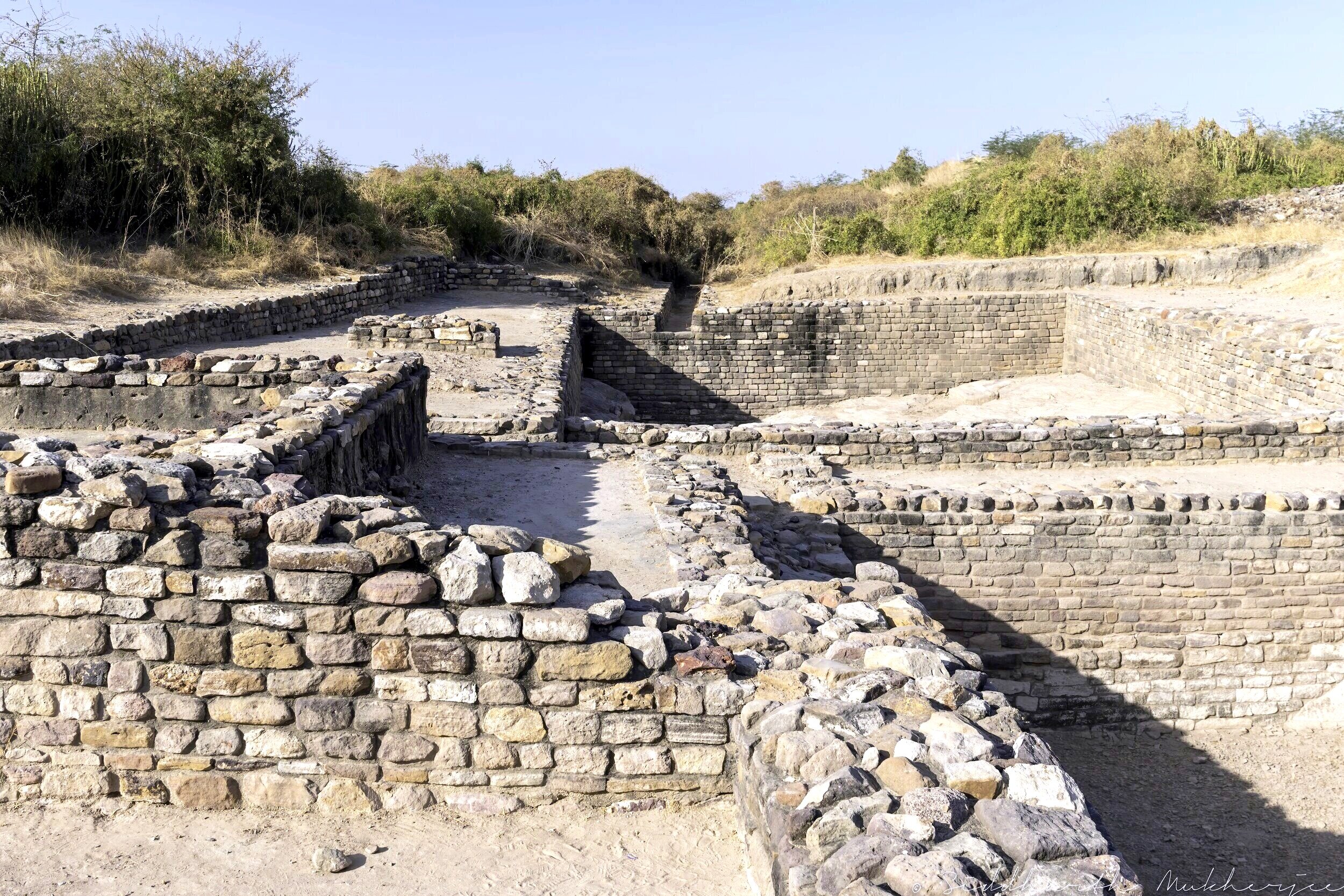
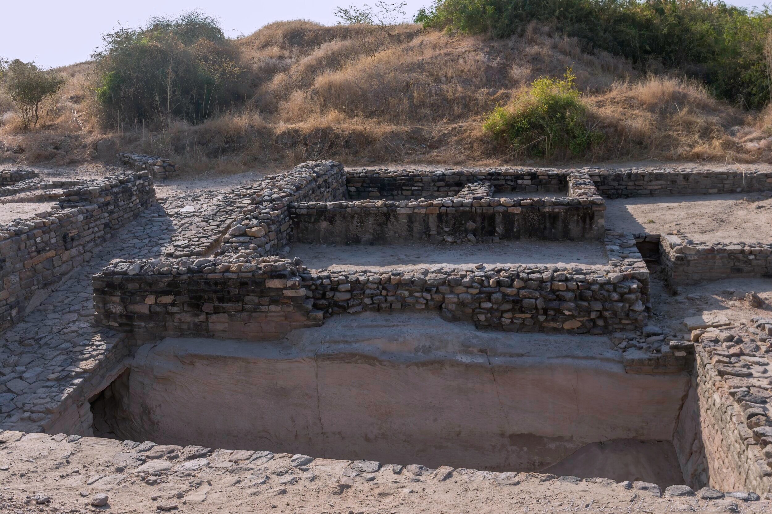
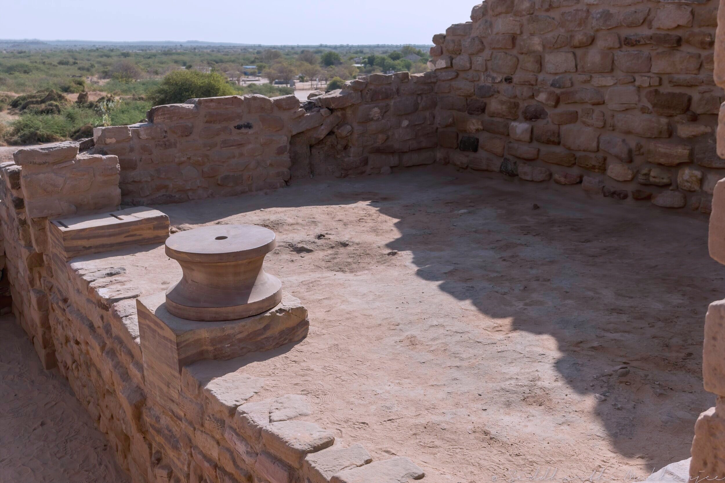
The ruins show an imposing citadel in the center, the highest point of the complex, with a middle and lower town, each fortified separately, built with pleasingly smoothed structures of sun-dried brick and stone masonry and remarkable town planning. Well laid out streets lead outward systematically from the citadel and there is a large stadium with a complex structure and seating arrangement. Dholavira has also one of the world’s earliest water conservation systems ever excavated. Pictures show an underground reservoir, an expertly constructed rainwater harvesting system extending from the walls of the city. Its incredible water management system and hydraulic engineering contains at least 16 reservoirs and an elaborate systems of drains and sewers. In the citadel area there is an intricate network of storm water drains, all connected to an arterial one and furnished with slopes, steps, cascades, manholes (air ducts / water relief ducts), paved flooring and capstones. The main drains were high enough for a tall man to walk through easily. The rainwater collected through these drains was stored in yet another reservoir that was carved out in the western half of the citadel. Altogether the reservoirs have an area of about 10 hectares, or 10 percent of the area within the walls. This fabulous system made it possible for the Dholavirans to thrive in their desert home.
The citadel, unlike its counterparts at Mohenjodaro, Harappa and Kalibangan, but like that at Banawali was laid out in the south of the city area. Like Kalibangan and Sukotada it had two conjoined fortified subdivisions, tentatively christened as “Castle” and “Bailey” located on the east and west respectively. The castle itself was zealously guarded as evidenced by the impregnable defenses and the aesthetically furnished gates and towers.
There are also two large rectangular sunken structures, which appear to be water reservoirs, with multiple flights of stairs leading down into them. I think these were the predecessor to the balolis and vavs (step wells) that dot the northern and western plains of India. One of the recent discoveries was the 5000 year old step-well which is almost three times bigger than the Great Bath of Mohenjodaro.
Professor Vasant Shinde, Vice Chancellor of the Deccan College of Archaeology and one of the authorities on Harappan Civilization, explains that the inhabitants of Dholavira dammed both the Manhar and the Mansar, and they diverted all the water into the settlement. Excavations show that the city was divided into three parts and in each there were subterranean water cisterns connected by an underground channel pictured here on the right. They ensured the water circulation within these cisterns through the seasons of the desert and this enabled them to not just survive but flourish for thousands of years at Dholavira.
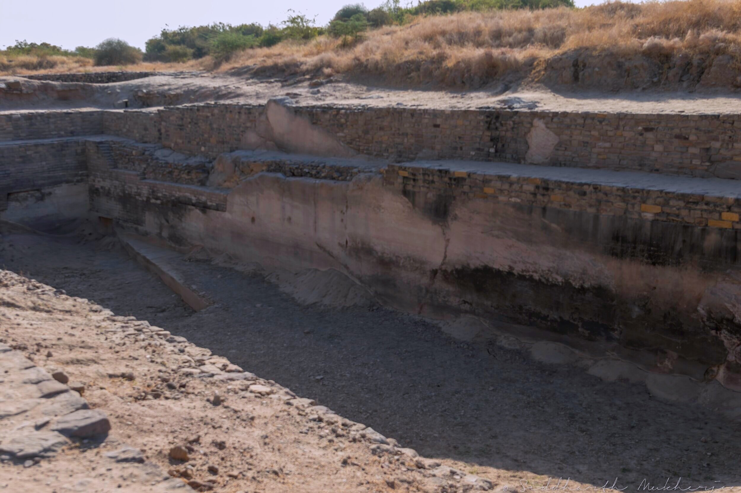
The Reservoirs of Dholavira
"The kind of efficient system of Harappans of Dholavira, developed for conservation, harvesting and storage of water speaks eloquently about their advanced hydraulic engineering, given the state of technology in the third millennium BCE" says R. S. Bist, Joint Director General (Rtd.), Archaeological Survey of India. One of the unique features of Dholavira is the sophisticated water conservation system of channels and reservoirs, the earliest found anywhere in the world, built completely of stone. The city had massive reservoirs, three of which are exposed. They were used for storing fresh water brought by rains or to store water diverted from two nearby rivulets. This clearly came in response to the desert climate and conditions of Kutch, where several years may pass without rainfall. A seasonal stream which runs in a north-south direction near the site was dammed at several points to collect water.
The inhabitants of Dholavira created sixteen or more reservoirs of varying size during Stage III. Some of these took advantage of the slope of the ground within the large settlement, a drop of 13 metres (43 ft) from northeast to northwest. Other reservoirs were excavated, some into living rock. Recent work has revealed two large reservoirs, one to the east of the castle and one to its south, near the Annexe.
The reservoirs are cut through stone vertically, and are about 7 m (23 ft) deep and 79 m (259 ft) long. They skirt the city, while the citadel and bath are centrally located on raised ground. There is also a large well with a stone-cut trough connecting it to a drain meant for conducting water to a storage tank. The bathing tank had steps descending inwards.
In October 2014 excavation began on a rectangular stepwell which measured 73.4 m (241 ft) long, 29.3 m (96 ft) wide, and 10 m (33 ft) deep, making it three times bigger than the Great Bath of Mohenjedaro.
Some of the key structures:
1. Water reservoirs and waterways
2. Workshops for seal making – Dholavira was famous for these and some workshops have been identified with the construction of specific seals.
3. Granaries
4. Burial grounds
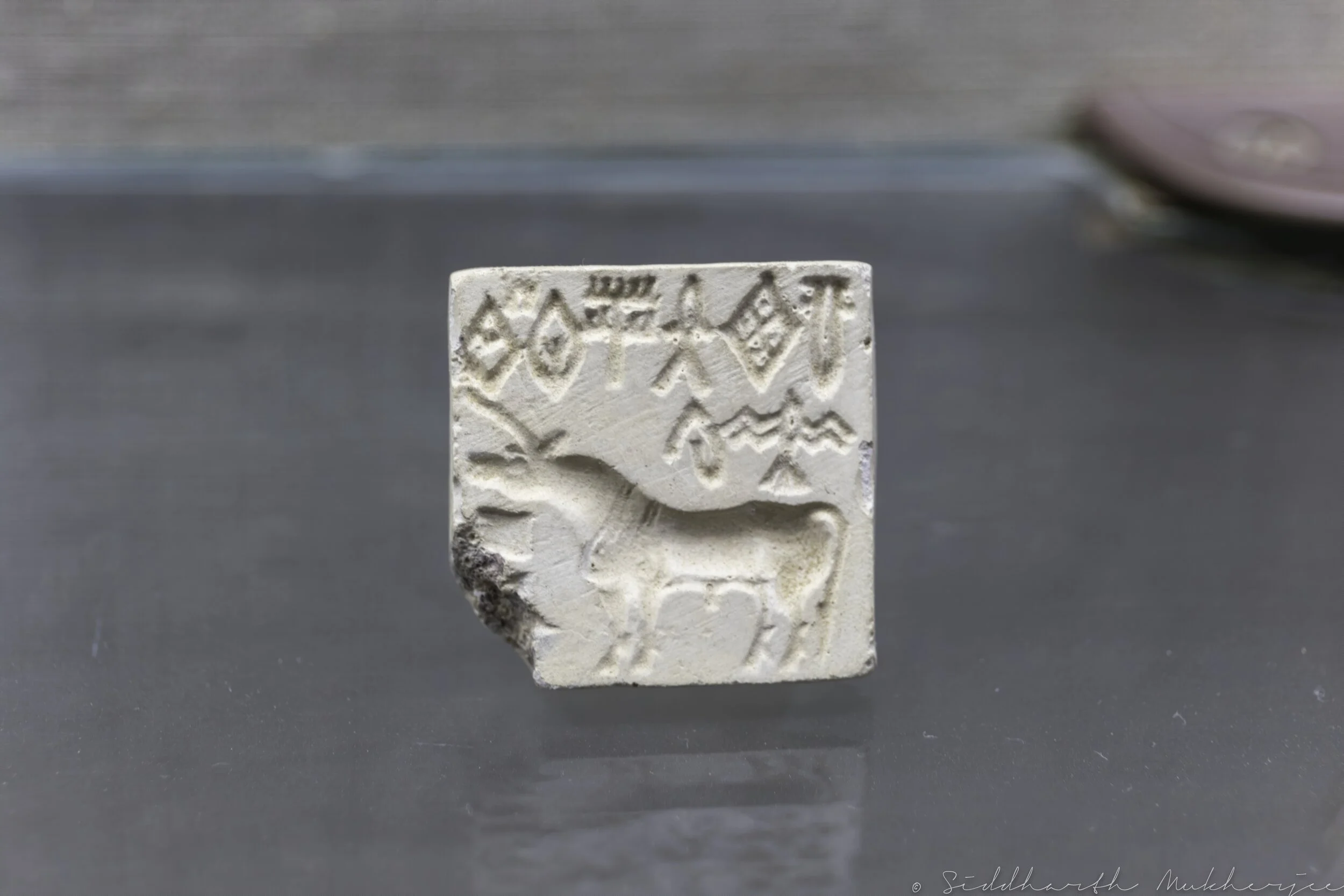
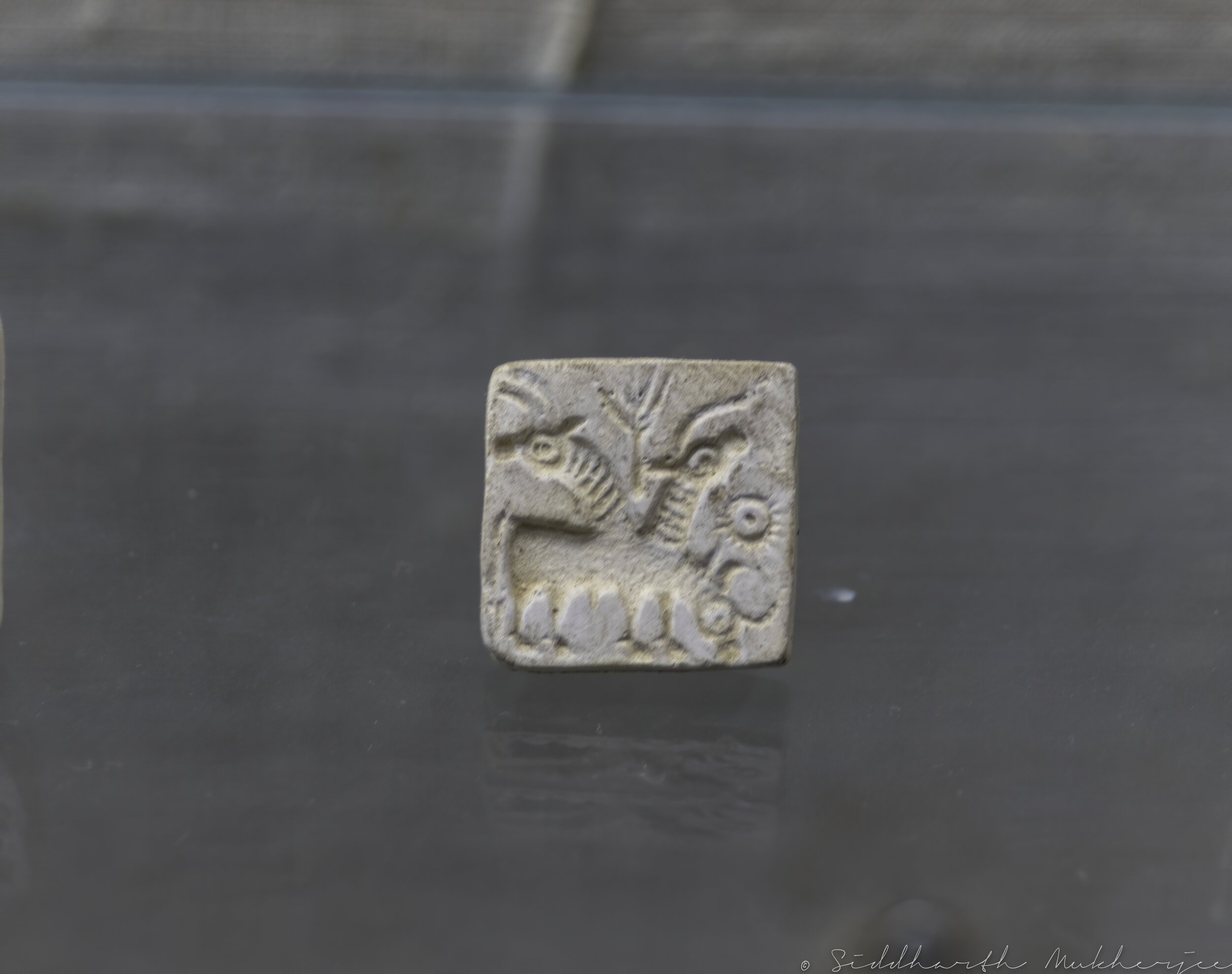
5. Sign Board
The Dholavira Sign Board is the most significant discovery at the site – found in one of the side rooms of the northern gateway of the city and is acclaimed to be the oldest signboard. The Harappans arranged and set pieces of gypsum to form ten large symbols or letters on a big wooden board. At some point, the board fell flat on its face and the wood decayed, but the arrangement of the letters survived. The letters of the signboard are comparable to large bricks that were used in the nearby walls. Each sign is about 37cm (15in) high and the board on which the letters were inscribed was about 3m (9.8ft) long. The inscription is one of the longest in the Indus script, with one symbol appearing four times, and this and its large size and public nature make it a key piece of evidence cited by scholars arguing that the Indus script represents full literacy. A four-sign inscription with large letters on sandstone is also found at this site, considered first of such inscription on sandstone at any of the Harappan sites.

Dholavira Sign Board

This deciphered reading translated to “I was a thousand times victorious over avaricious raiders desirous of my wealth of horses“.
A later interpretation became “maitradhaa -raaghava-deza-saadha” translating to “Success to the country of Raghava which promotes friendship“
This refers to Lord Krishna’s realm and his capital, Dwaraka, situated just over the Rann of Kutch, where it was recently dredged up from the depths of the Arabian gulf.
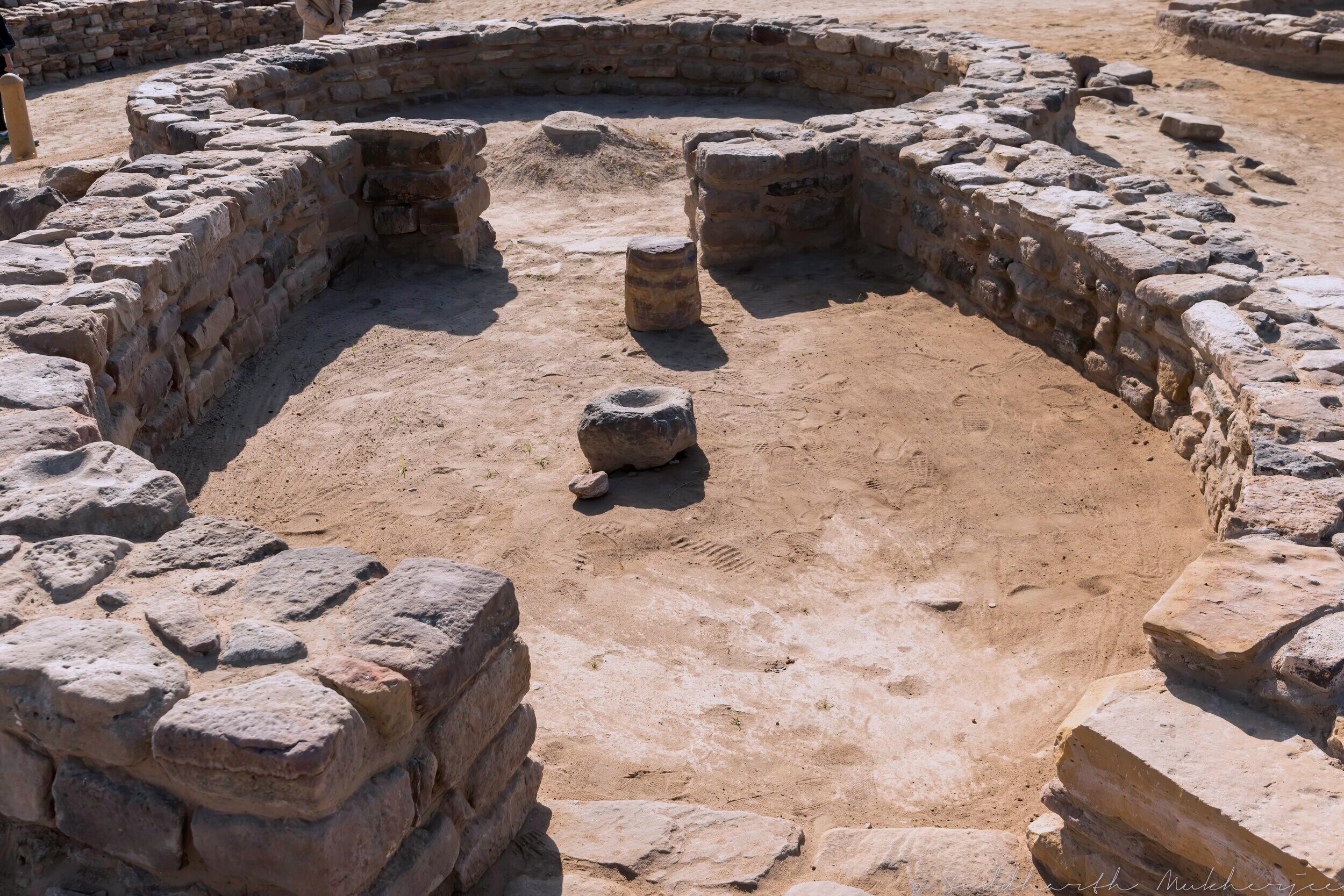
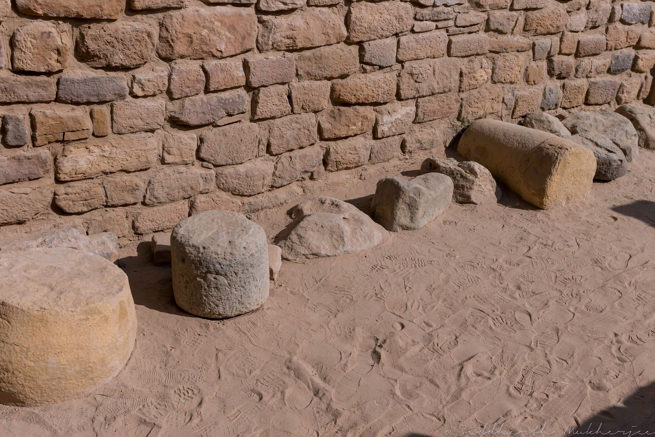
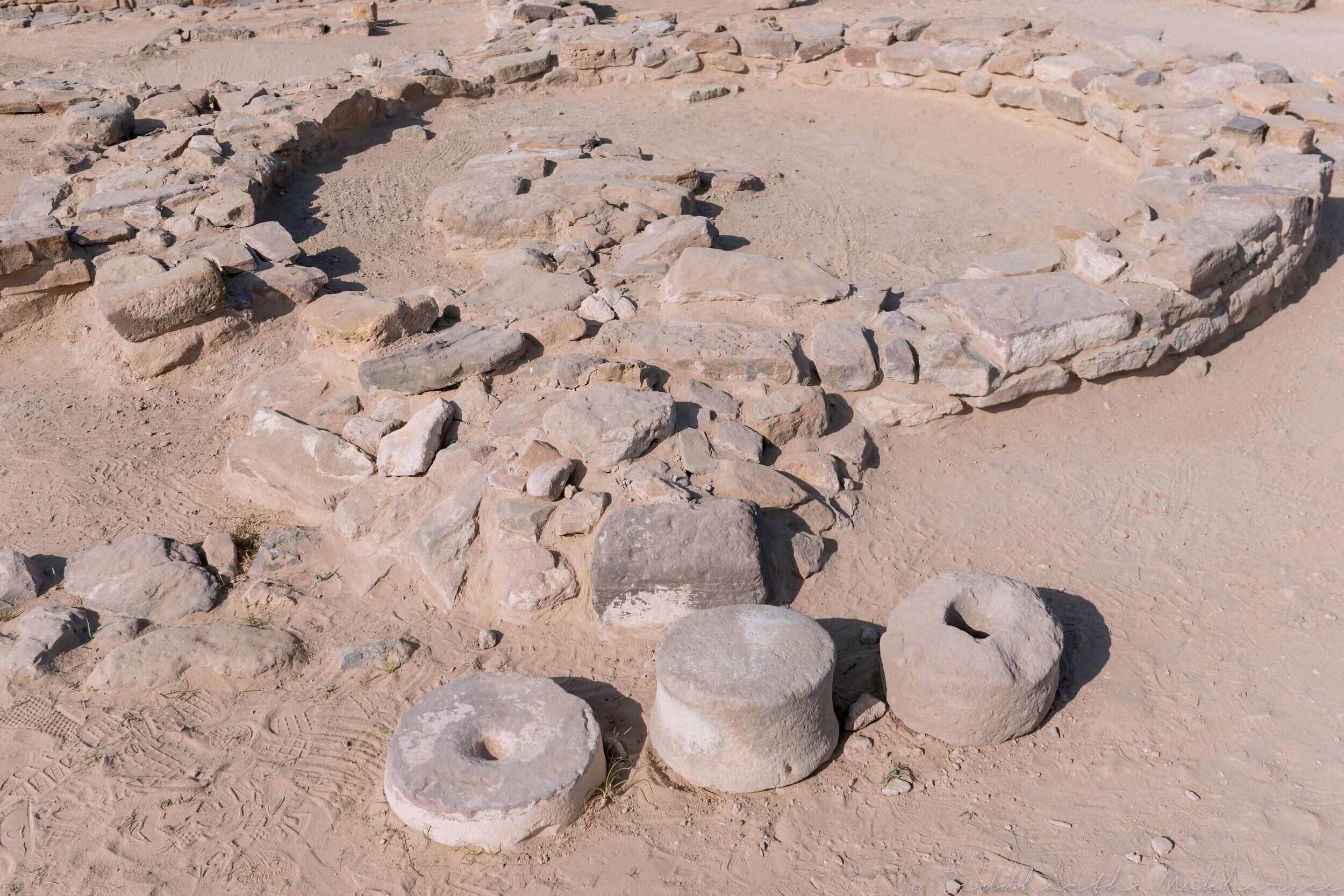
Across the entire complex were found painted Indus black-on-red-ware pottery, square stamp seals, seals without Indus script, one poorly preserved seated male figure made of stone. A giant bronze hammer, a big chisel, a bronze hand-held mirror, a gold wire, gold ear stud, gold globules with holes, copper bangles, shell bangles, phallus-like symbols of stone, humped animals, terracotta tumblers, grinding stones, mortars etc. Stone weights of different measures were also found.
Some of the seals found at Dholavira, belonging to Stage III (2500–2200 BCE: Mature Harappan A), contained animal only figures, without any type of script. It is suggested that these type of seals represent early conventions of Indus seal making. The guide mentioned Unicorns and there was a profusion of seals bearing the Unicorn. So does that imply the Unicorn was real and not mythical? After all this is the Saraswati Era we are talking about, the cradle of civilization.
Some of the seals and weights excavated from the site and displayed at the museum and as described by our guide.


Dholavira, reminds us of how amazingly intelligent and resourceful our ancestors were to design a town at a location where the natural source of water was scarce. All other Harappan cities are built near rivers but not Dholavira. Here we see huge water reservoirs with built-in filtration systems, the craftsmanship and engineering used to build a geometric and well-planned town containing a citadel, an immense auditorium, a middle and a lower town, an extensive underground sewage system, well laid out streets. It is also suggested that a coastal route existed linking Lothal and Dholavira to Sutkagan Dor on the Makran coast.
All of this begs the question: have we truly progressed from what we could do 5000 years back?
Dholavira Citadel from beyond the large reservoir. The two men standing across from me help to provide a sense of scale to these reservoirs and the overall magnitude of Dholavira.
Leaving the metropoly of Dholavira and heading downhill the vast expanse of the Great Rann can be seen stretching out as far as the eye can see. In the area controlled and patrolled by the Border Security Force (BSF) after the "India Bridge" several hundred square kilometers of Rann is pure white like snow with heavy deposit of salt crystals. The marshy Rann here becomes pure white and flat till the eye can see, till the horizon after the rain water has dried up, in the winters every year. This photo was taken enroute to the Kutch Fossil Park at the edge of the Great White Desert and on the other side lies Pakistan about 30 kilometers away if I recall correctly.

Related Posts


