Birds on the Doi
Doi Inthanon | Doi Angkhang | Doi Luang | Doi SanJu
Chiang Mai, Thailand
About 685 kilometers to the north of Bangkok lies the former seat of the ancient Lanna Kingdom and is considered one of the most scenic provinces in the country given its mountain ranges, valleys, flora and fauna. A land of misty mountains and colourful hill tribes, a playground for seasoned travellers, and a delight for adventurers. Despite its relatively small size and blissful calm, Chiang Mai truly has it all, a city that is still firmly Thai in its atmosphere and attitude. It is the second-largest changwat (province) of Thailand. Bordered by Chiang Rai to the northeast, Lampang and Lamphun to the south, Tak to the southwest, Mae Hong Son to the west and the Shan State of Myanmar to the north. Located in a verdant valley on the banks of the Ping River, Chiang Mai was founded in 1296 as the capital of the ancient Lanna Kingdom. Today it is a place where past and the present seamlessly merge with modern buildings standing side by side with venerable temples. Of all the places I have visited in Thailand, Chiang Mai with its forests and mountains and the historic city of Ayutthaya are by far my favourites.

Most famous for its beautiful ancient temples, the historical city of Chiang Mai is quite a diverse place, with different neighbourhoods having very distinct personalities. At its heart is the beautiful Old City. Outside its almost perfectly square moat and ancient city walls is the bustling Night Bazaar, the peaceful Riverside and the modern Nimman Road. The striking mountainous landscape around the city provides a lot of wonderful natural attractions and is home to two tribal villages. We however saw very little of the city itself and spent most of our time in the mountains and forests surrounding the city.

I would like to give my heartfelt thanks to our wonderful guide and host - Atiwich Kwaechum Ball (inset). Affectionately called Ball, he took phenomenal care and ensured that we got the species we targeted. Another crucial aspect he handled with aplomb was the food. Chiang Mai’s dining scene is outstanding with excellent choices, ranging from first-class fine-dining restaurants with international menus to little local joints specialising in the area’s unique and tasty cuisine. The food is especially remarkable, with an emphasis on small shared dishes. With Ball showing the way we had THE best culinary experience ever considering our penchant for staying away from civilization more or less on these trips.
With its more Northern latitude and higher elevation, Chiang Mai enjoys a cooler climate than the stifling central plains near Bangkok. During the hot season, however, the temperature rises quite a bit and perhaps the rising mercury is the reason why Songkran (the water festival) is celebrated so enthusiastically here. Due to the more tropical location of Chiang Mai, the normal seasons of spring, summer, fall and winter don’t apply. Instead, there are three seasons: Hot, Cool and Rainy.
The cool season lasts from early December to February and is the most popular time to visit Chiang Mai, weather-wise. During the day the temperatures max out at a pleasant 30°C (86°F) and drops rapidly after sunset, sometimes to as low as 10°C (50°F). On the upside, rain in the cool season is rare and more than one shower in a month is uncommon. And therefore our trips were in the winter and we spent almost all our time on 4 mountains or Dois. Look up Chiang Mai province in a guide or on a map and you’ll see the same Thai place names cropping up over and over again: Doi this, Mae that and so on. So what do they all mean? The word Chiang itself is from North Thai, or Lanna, meaning town or city and Mai means new making Chiang Mai the New City as it was founded later than Chiang Rai, the earlier capital of King Meng Rai. The districts in the province are called amphoe, and sub-districts are called tambon. Another twist is the use of Nakhon (or Nakorn or Nakhorn), derived from the Sanskrit word Nagara, also means city, though strictly speaking it refers to a capital city such as Nakorn Sri Ayutthaya (more on Ayutthaya later). Indeed to emphasise its former status you may sometimes see Chiang Mai referred to as Nakhon Ping. Other common names of geographical features include mae (river) and doi which is north Thai for mountain - for example Doi Inthanon and Mae Ping.
The four Dois we spent our time on were Doi Inthanon, Doi Ang Khang, Doi Luang and Doi SanJu
Enroute to Doi Ang Khang
Doi Ang Khang is a mountain in Fang District, Chiang Mai Province, Thailand. It is part of the Daen Lao Range that straddles both sides of the Burmese-Thai border. It is the site of an agricultural station, the first research station set up by King Bhumibol Adulyadej in 1969. The peak of Doi Ang Khang is 1,928 metres (6,325 ft) above sea level, and the agricultural station covers an area of 1,989 rai (318 ha).
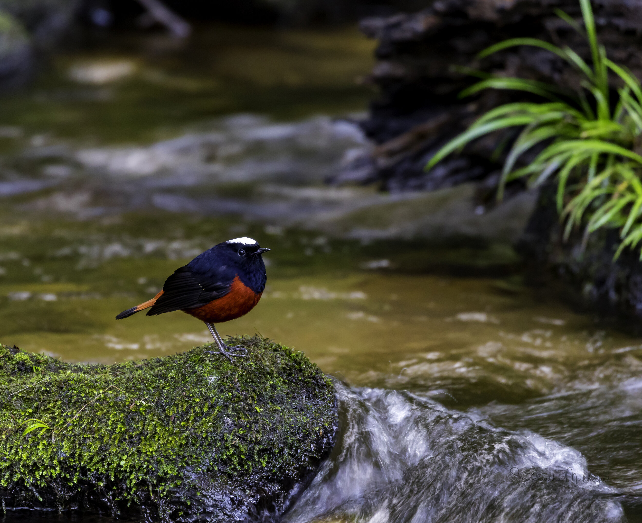
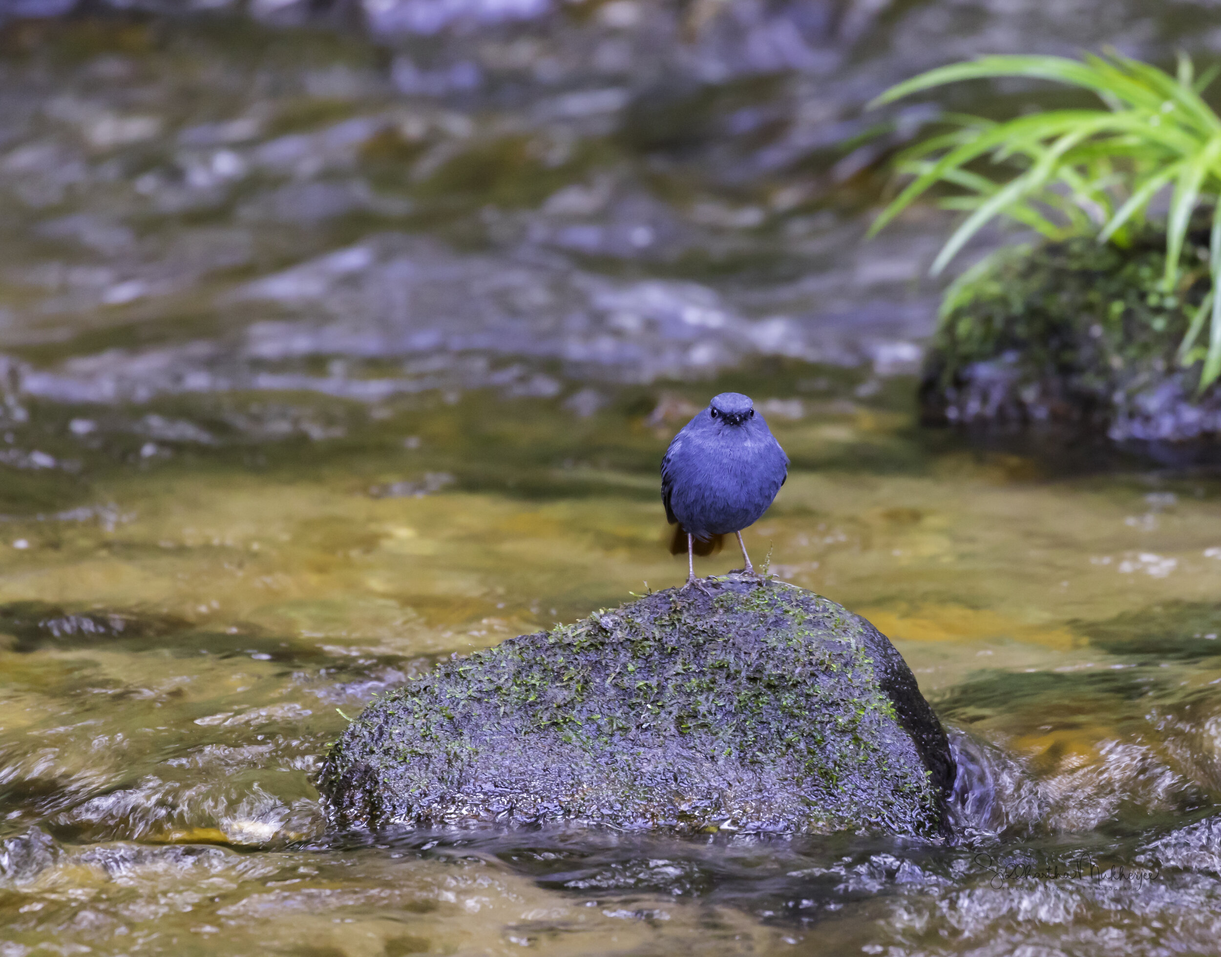
Doi Inthanon is Thailand’s highest mountain is a site of unique biological interest and supports a fascinating variety of vegetation and a higher bird species total than any other protected area. Of the total of 382 species of birds so far known from Doi Inthanon, at least 266 species are residents or were formerly residents on the mountain. Doi Inthanon is of particular conservation importance for those species which inhabit the moist hill evergreen forests of the upper slopes. Some, such as the Chestnut-tailed Minla and White-browed Shortwing, which are around the summit, occur in Thailand only on those few higher mountain summits which have considerable areas of hill evergreen forest above 1800 m. Doi Inthanon contains the only significant protected populations of such species in Thailand. The Ashy-throated Leaf-Warbler is found nowhere else in Thailand while an endemic race of the Green-tailed Sunbird (Aethopyga nipalensis angkanensis) is also completely confined to the summit. The Wachirathan Waterfall is one of the best sites for observing birds of fast-flowing streams. The Plumbeous Redstart and the River Chat often perch on boulders in mid-stream. The Slaty-backed Forktail can sometimes be seen. Among the many scarce arboreal birds to look out for are the Long-tailed Broadbill, Brown-throated Treecreeper, Green Cochoa and Purple Cochoa and Black – tailed Crake.
Doi Ankhang is a mountain belonging to the Himalayan foot hill range, located at the Myanmar (Burmese) border. The highest point is 1,928 metres. Although chiefly deforested, this is still one of Northern Thailand’s most prominent birdwatching areas, due to more and rarer bird species being in residence, as well as being a popular resting point for numerous migratory birds. Examples of rare and beautiful birds inhabiting this area include the Spot-breasted Parrotbill and the Red-faced Liocichla. A highly recommend site to find the rarest bird species is the picturesque area named Heavenly Valley. It is not so uncommon to spot the Red-tailed Laughing Thrush here. Around The Royal Agricultural Project Station you can find Brown, Burmese and Long-tailed Shrike and also Fire-capped Tits and Silver-eared Mesia, White – tailed Robin & Maroon Oriole.
Doi Luang & Doi SanJu in close proximity to the Doi Pha Hom Pok National Park, it is the second highest mountain in Thailand and a part of the Dan Lao Mountain range, northwest of Chiang Mai, sharing the border with Myanmar. Doi SanJu, can be easily accessed from Fang town. The mountain forest and no traffic make it easy to view birds. The entire area is very quiet, secluded and home to rare species like Mrs. Humes Pheasant, Long–tailed Sibia, Himalayan Cutia, Black–throated Tit, Black–eared Shrike Babbler, Whiskered Yuhina, Crimson–breasted Woodpecker, Fire–tailed Sunbird to name a few.
We didn’t have the good fortune to see all the species on all the mountains, that would have been impossible, but we did rack up quite a number of species - about 95 of them. Here are some of them with a sprinkling of the amazing landscapes.


Waterfall level 3 ~ Pha Tak
Waterfall level 5 ~ Wang Thao Promma.
Mae Sa - Wang Thao Promma
The roar of a small waterfall
The two photos above are from the Mae Sa Waterfall (Nam tok Mae Sa) in Doi Suthep-Pui National Park, Chiang Mai. This waterfall is an impressive series of 9 or 10 small waterfalls and cascades spaced anywhere between 100m to 500m apart from each other. Mae Sa waterfall covers a large area as it tumbles down its various levels and each of the levels is named. Pictured here are levels 3 and 5 - Waterfall #3 is named Pha Tak and Waterfall #5 (the video on the right) is named Wang Thao Promma. The falls are located about 30 minutes away from Chiang Mai by car, in an area also called Mae Sa. While the waterfall is not visible from the road, there are lots of signs that point the way. Mae Sa is made up mostly of rainforest and set in a valley, where there are a range of adventure activities, elephant camps as well as the Mae Sa waterfall.
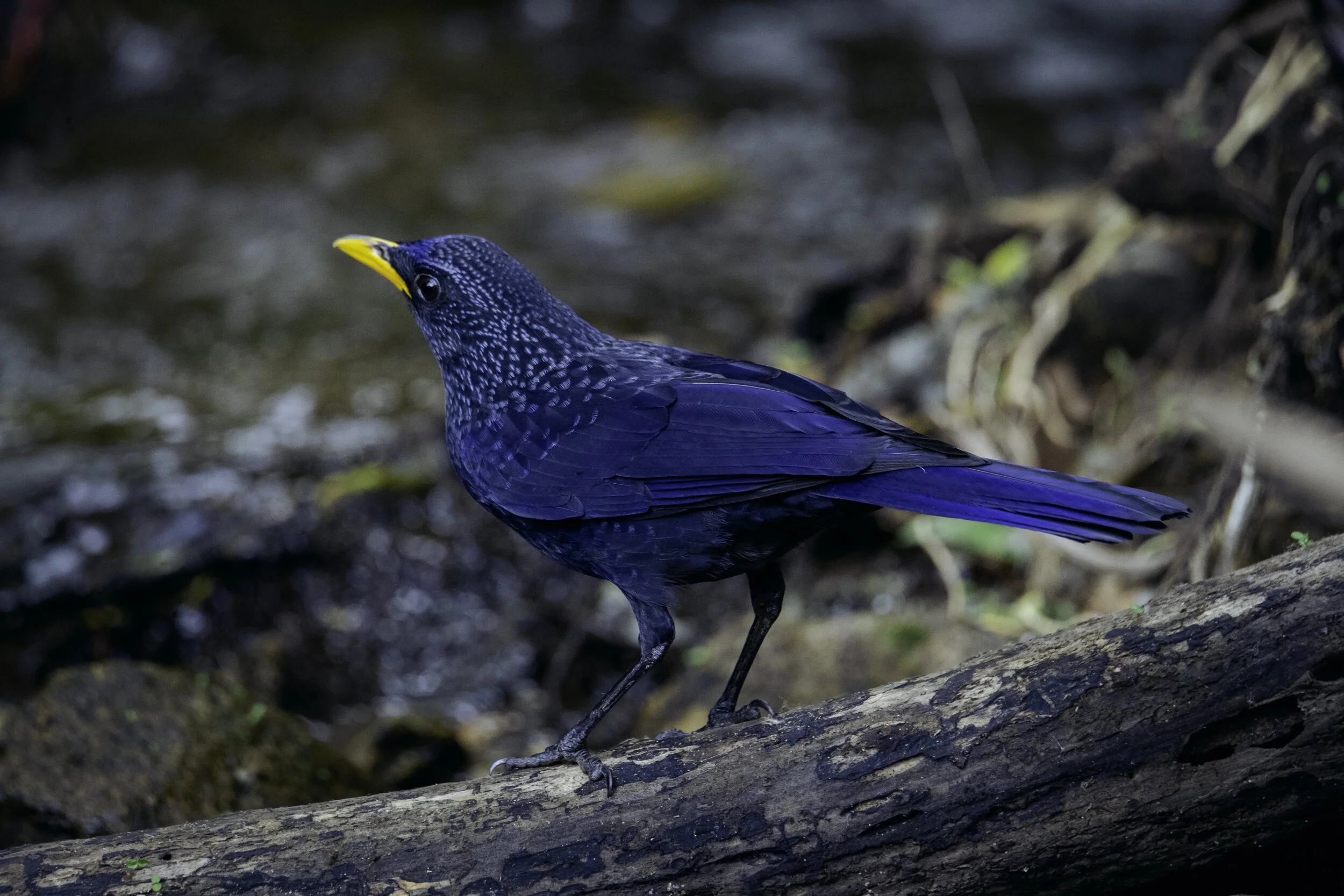
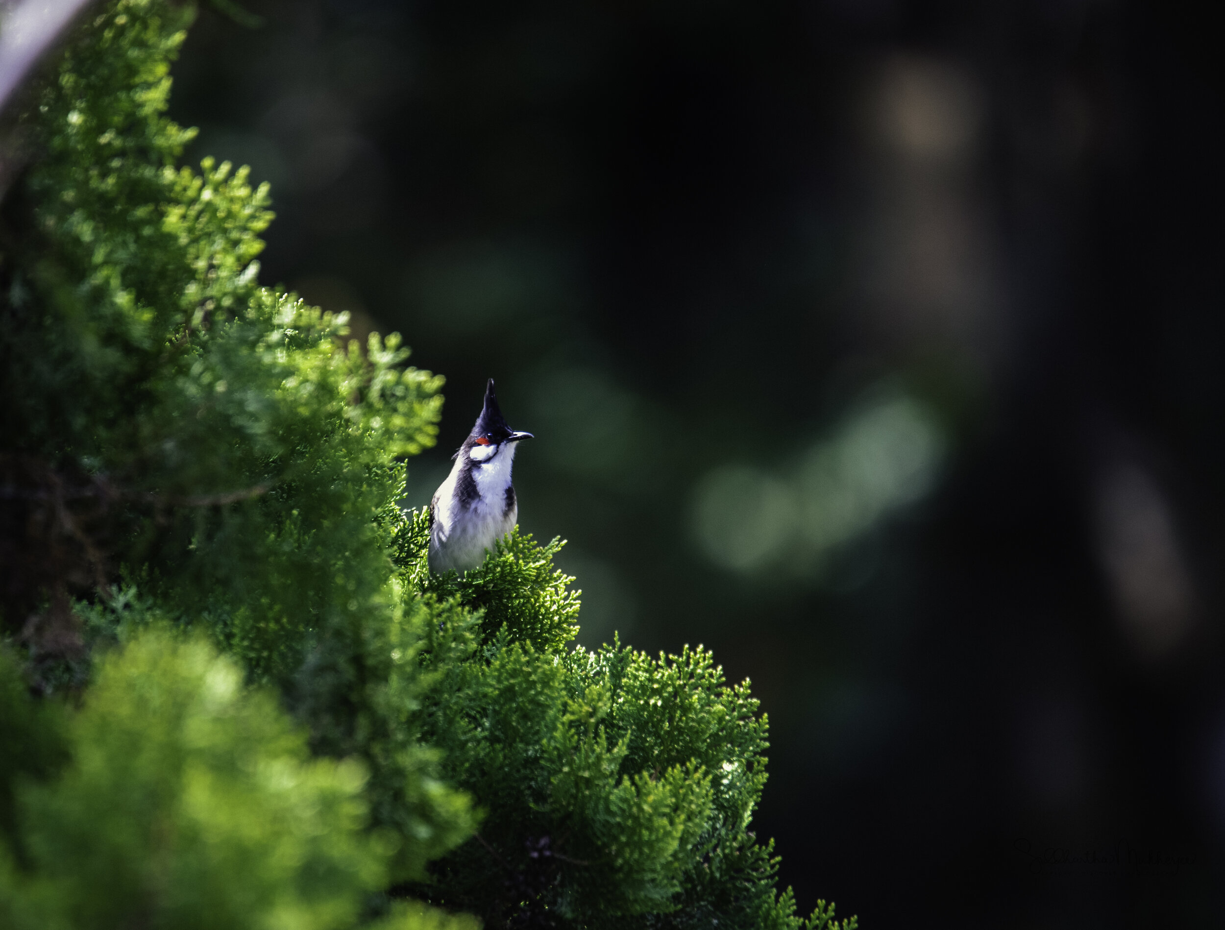
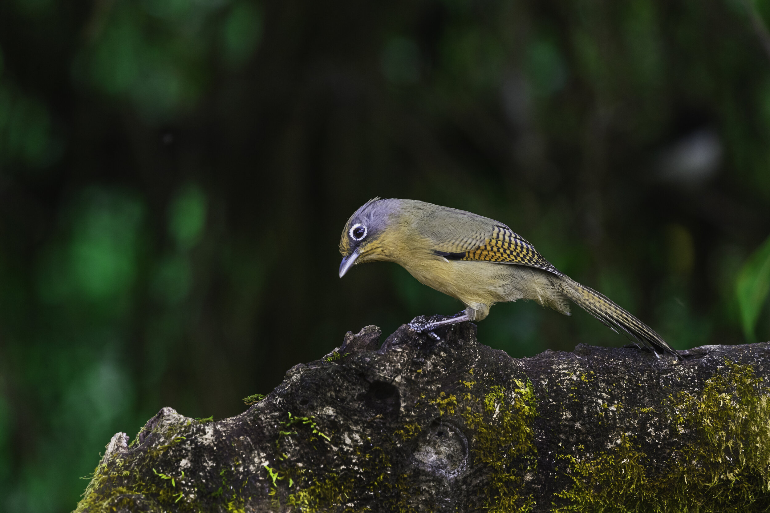
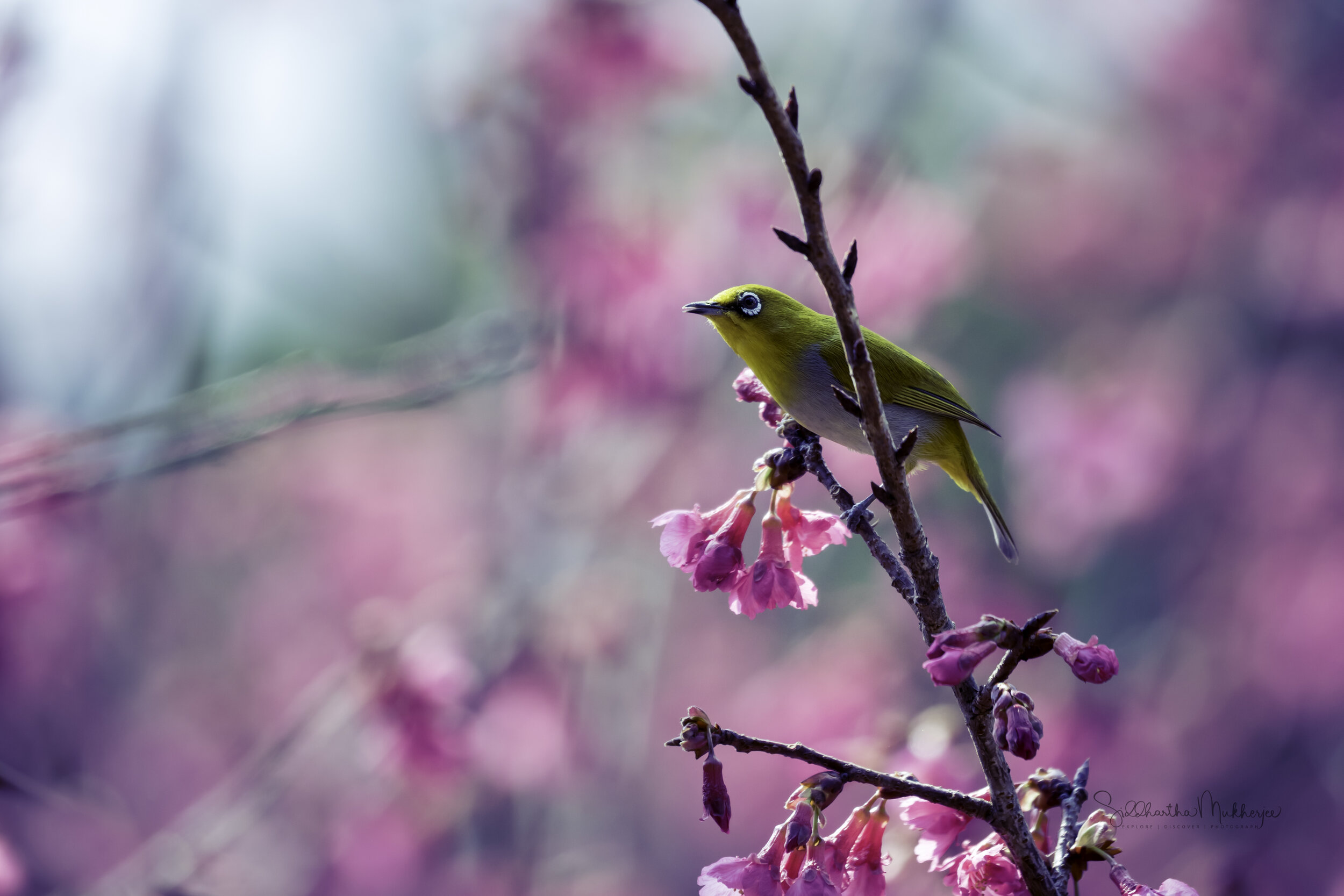
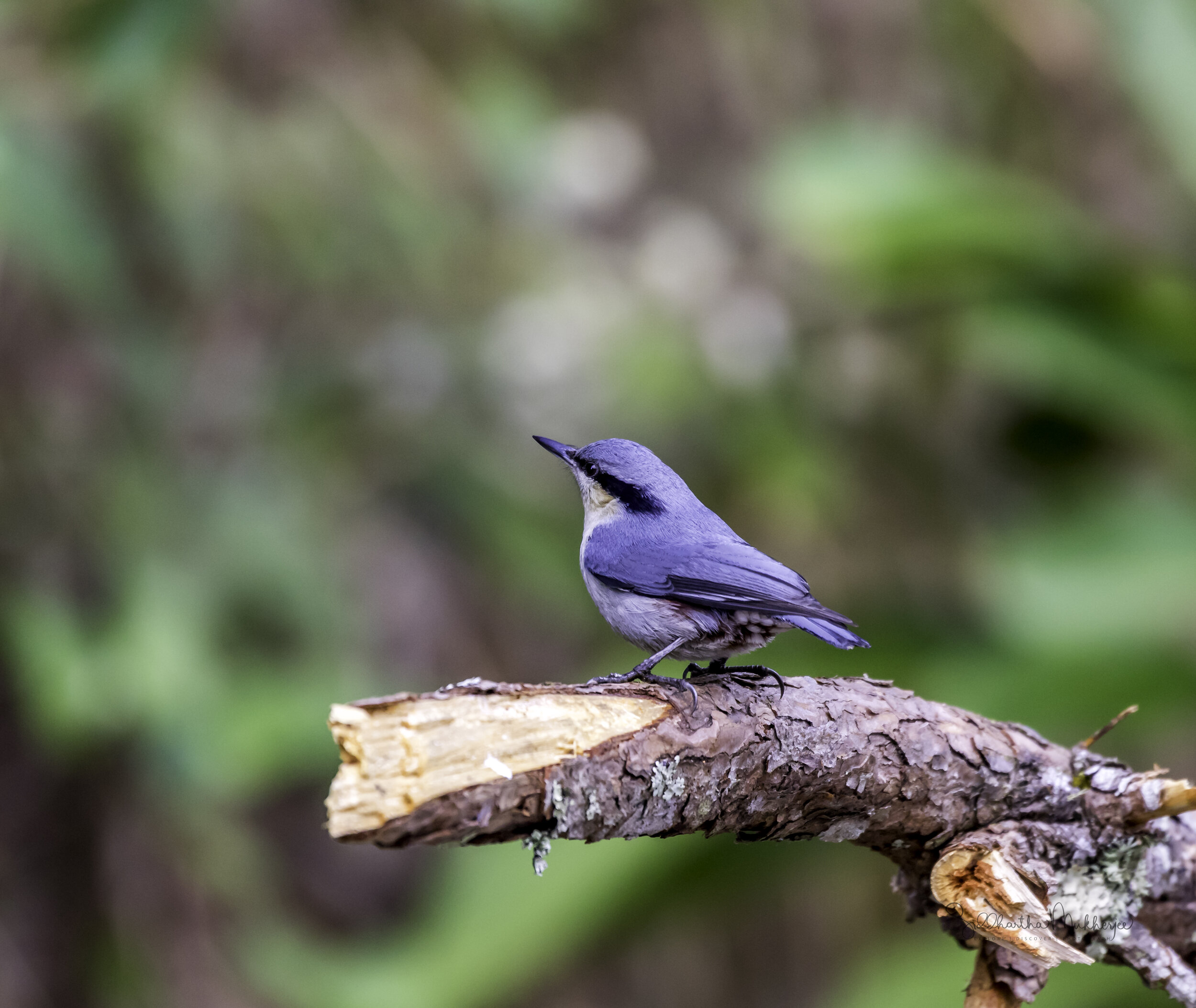
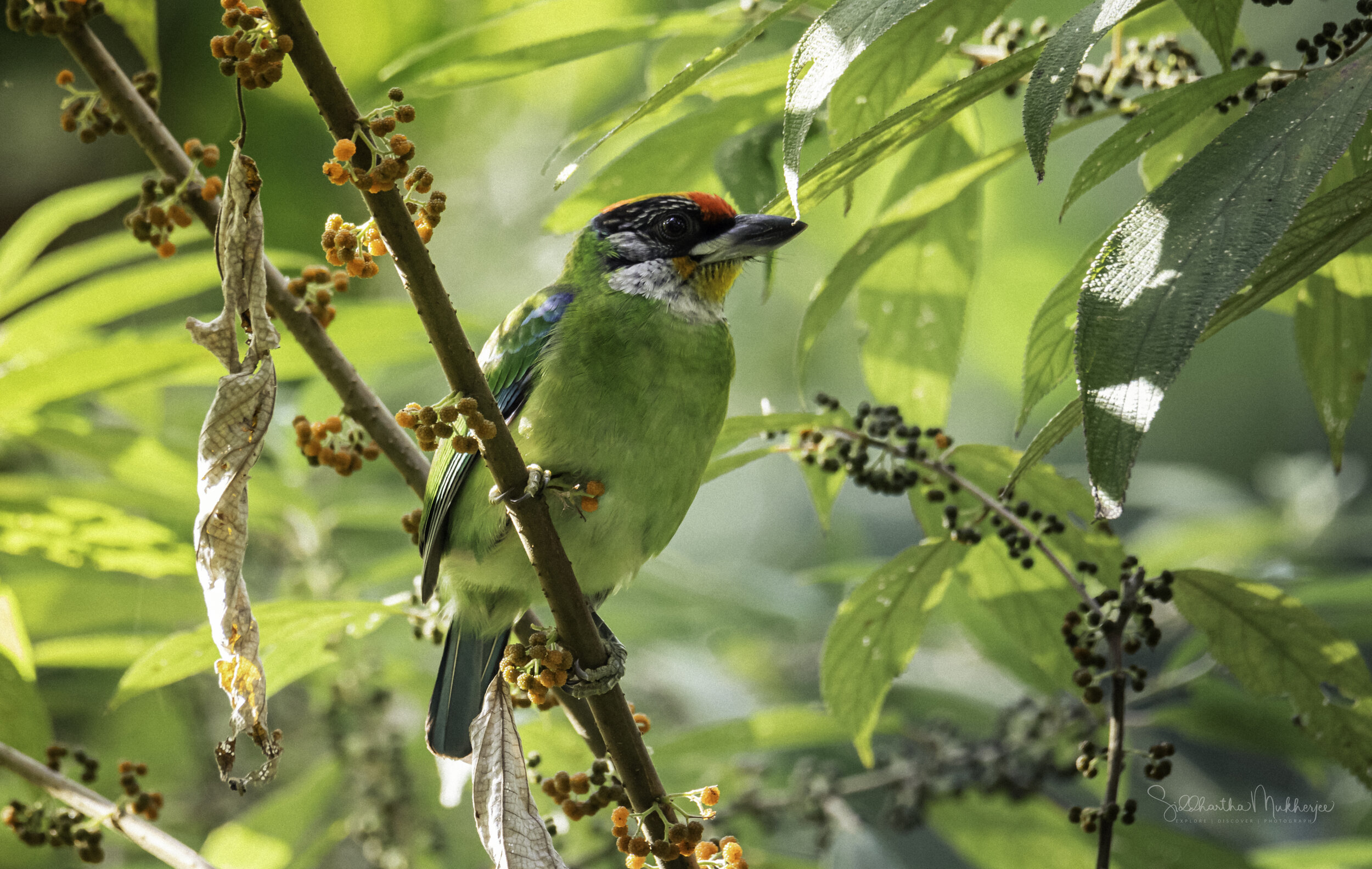
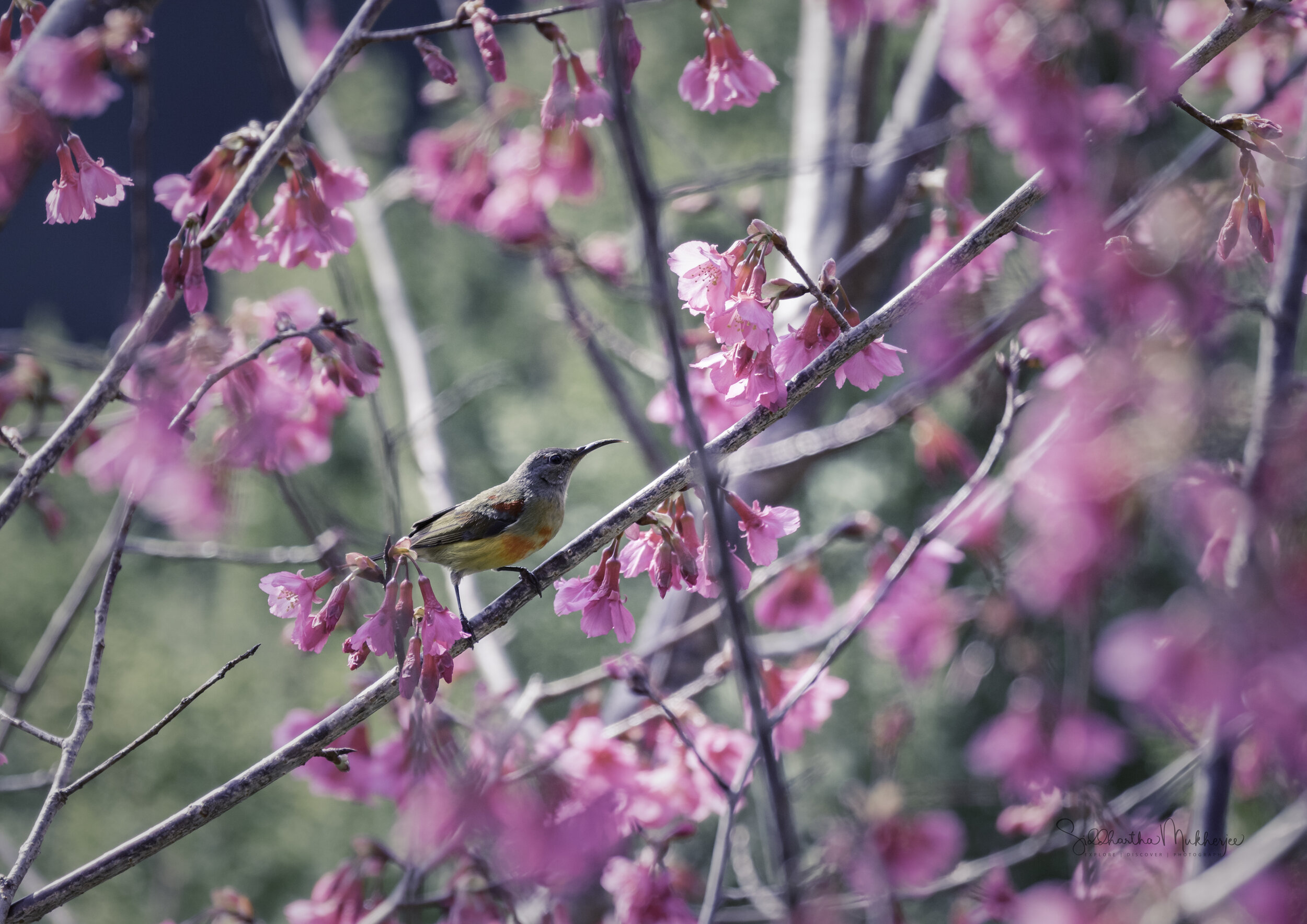
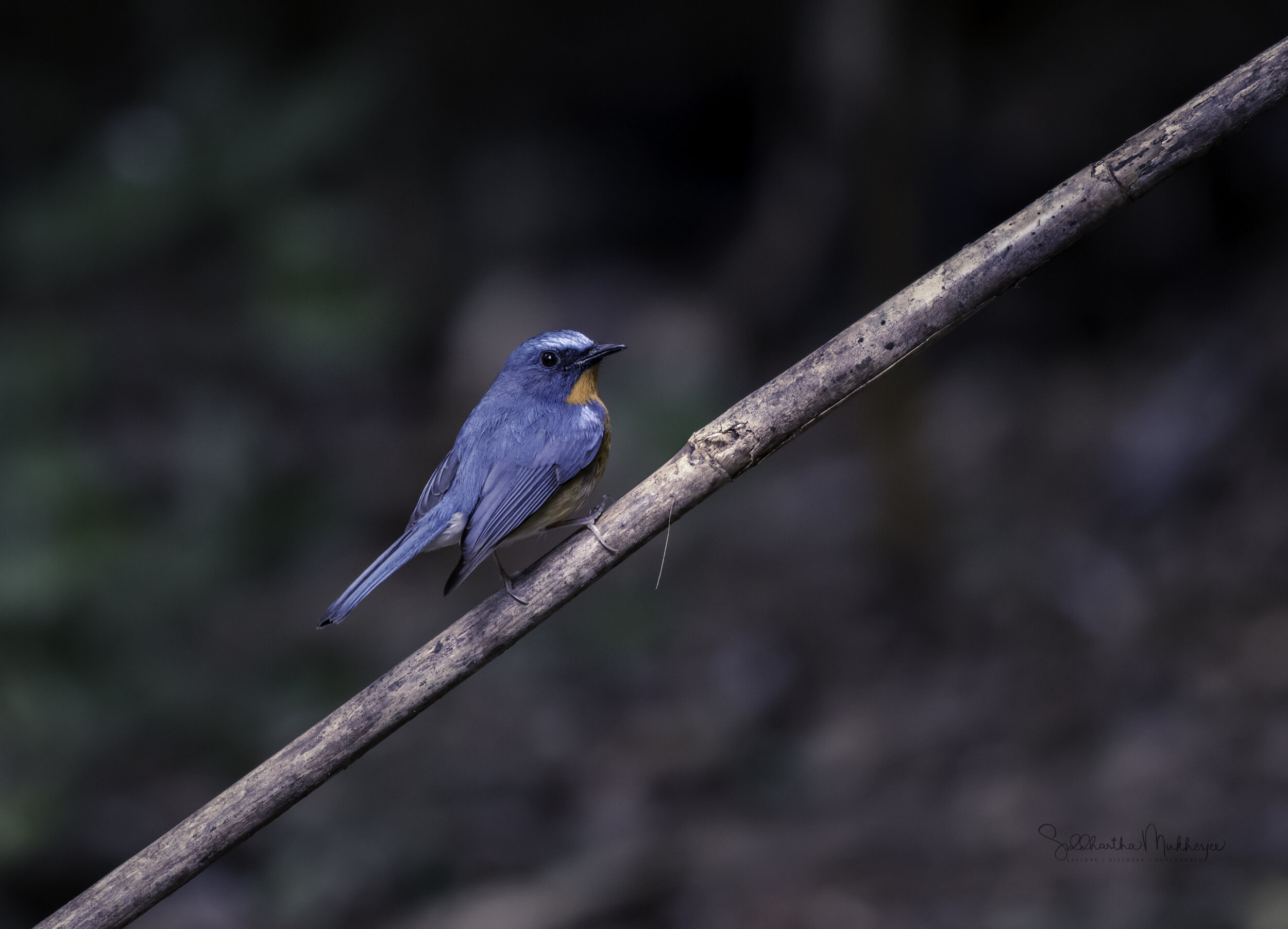
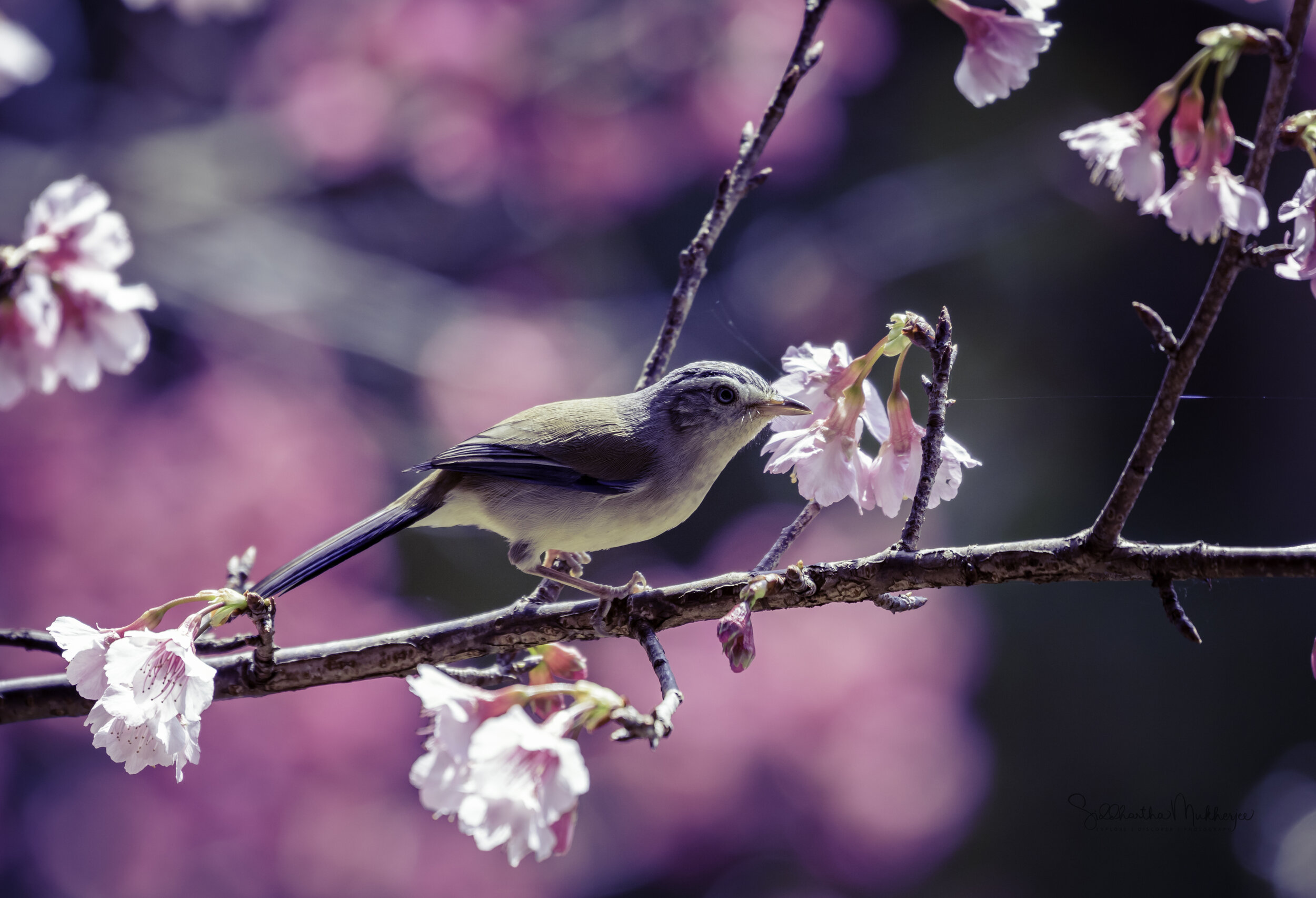
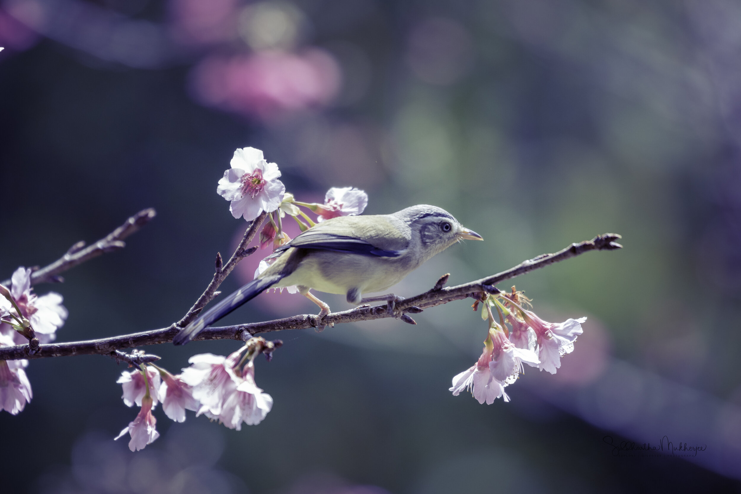
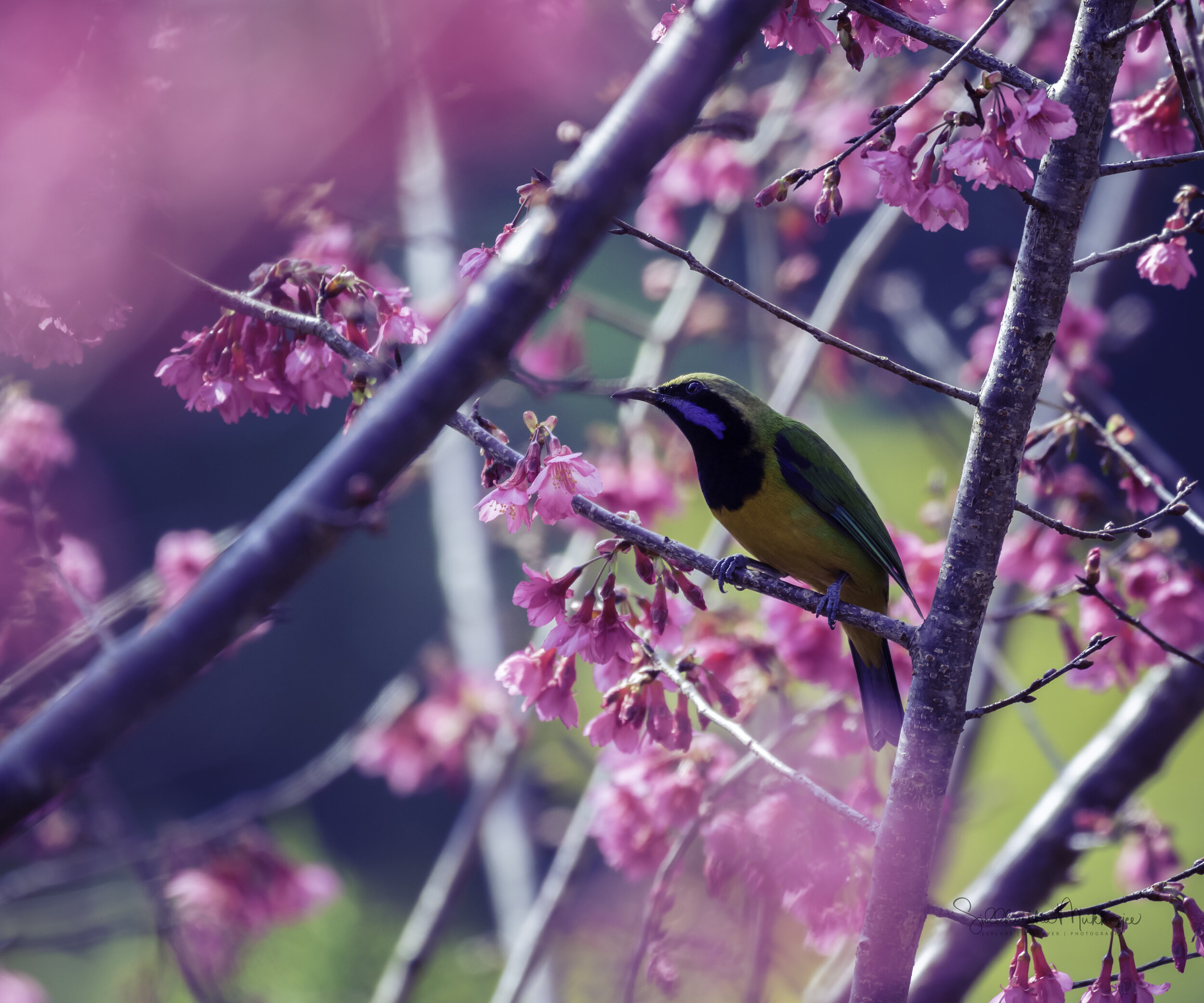
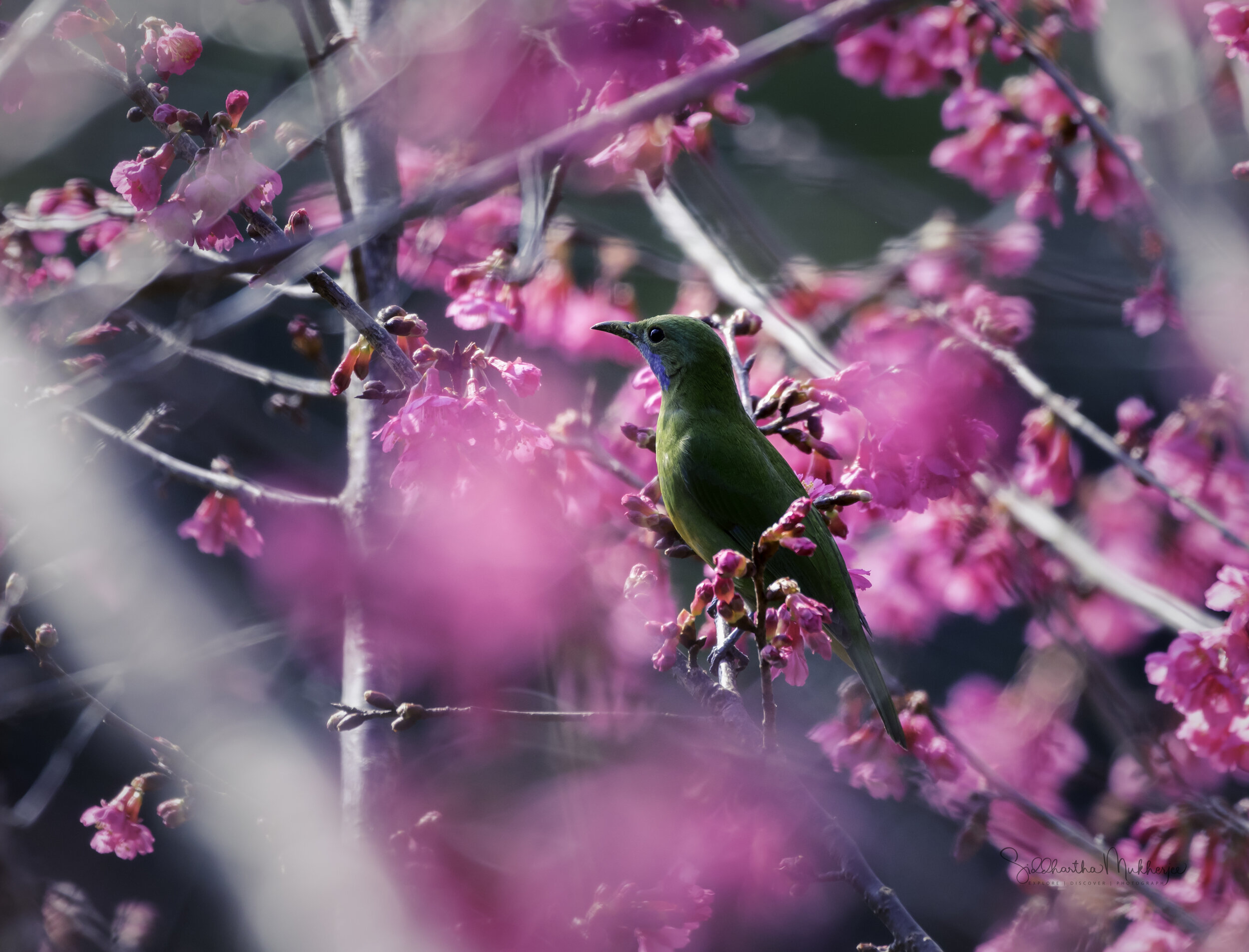
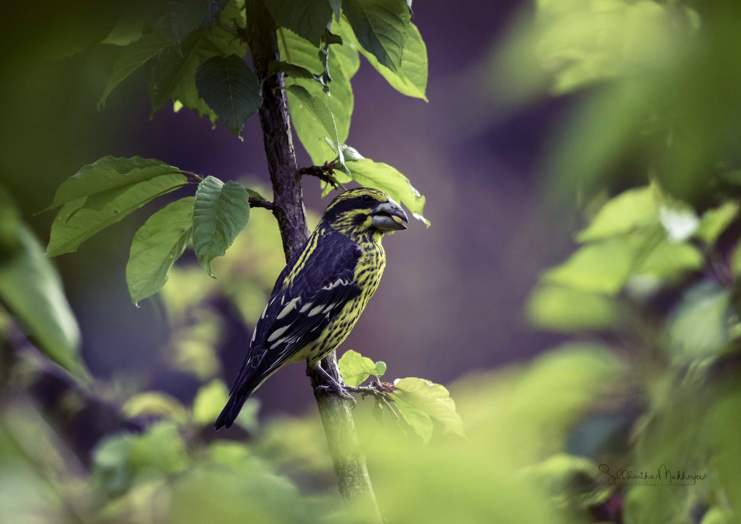
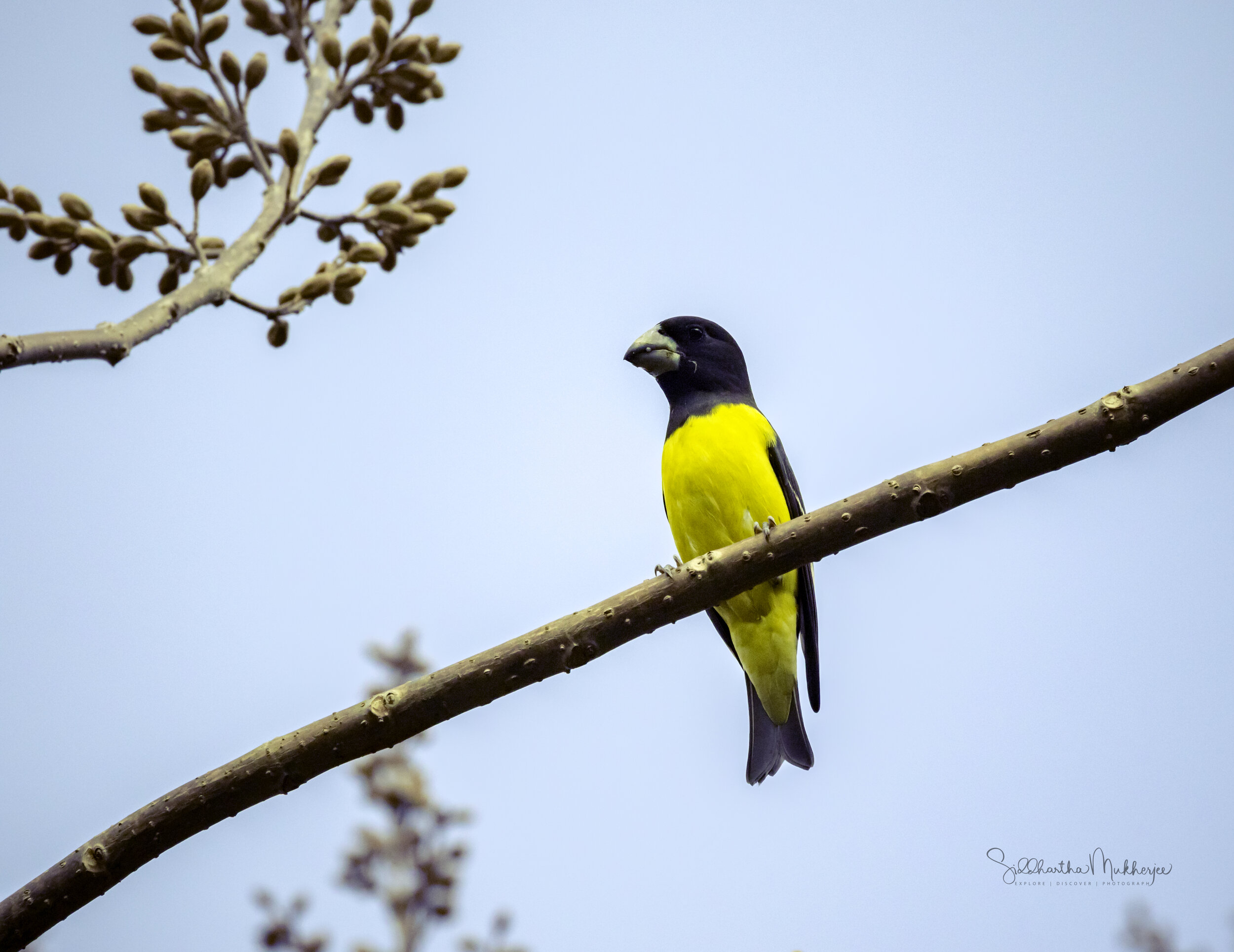
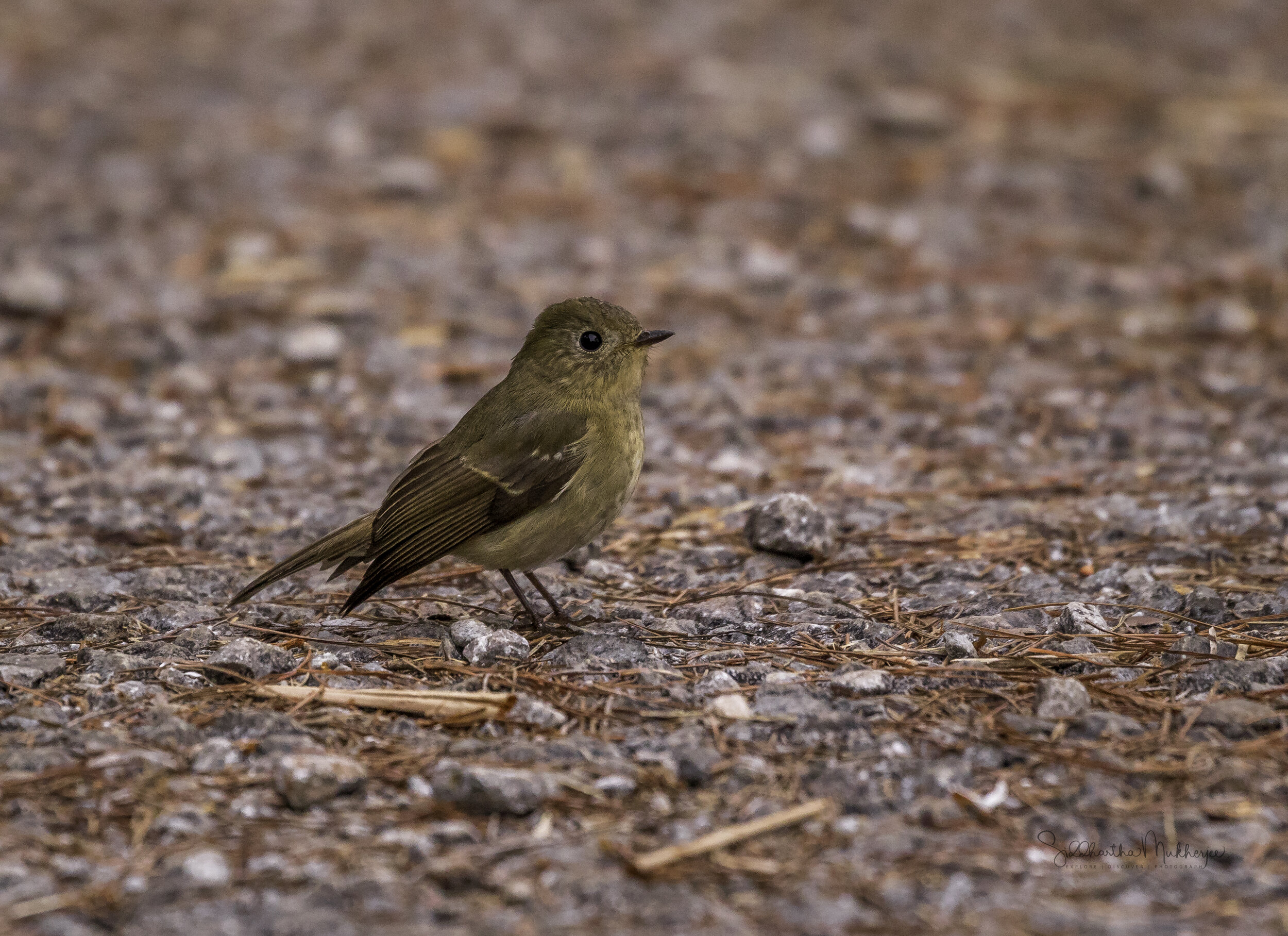
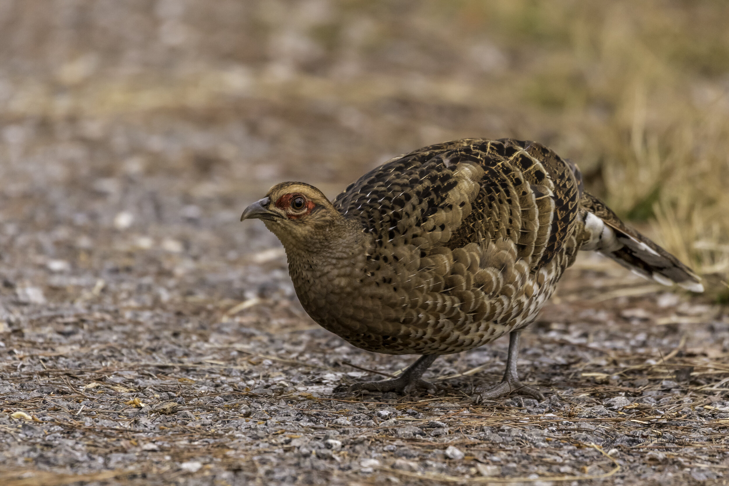
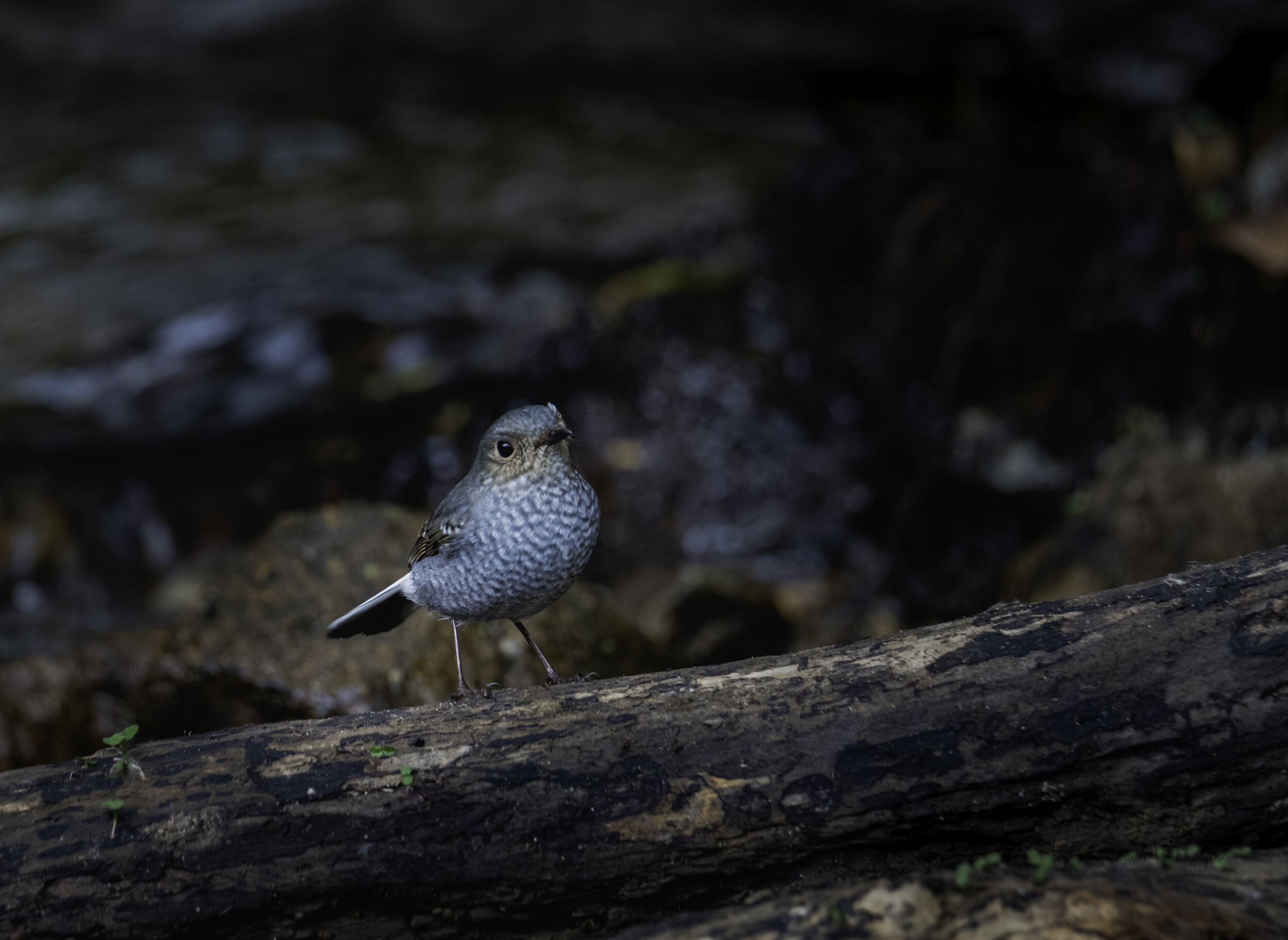
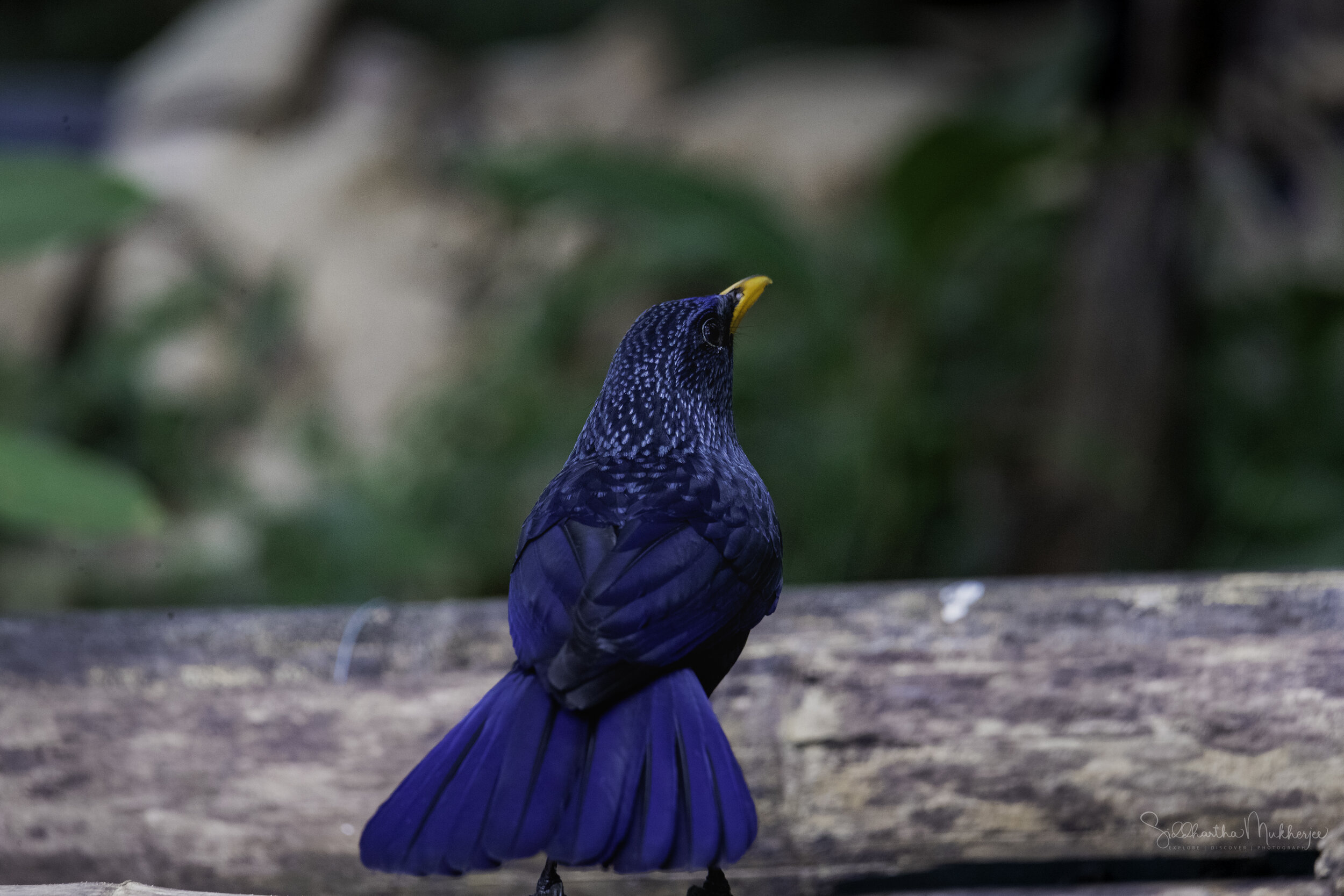
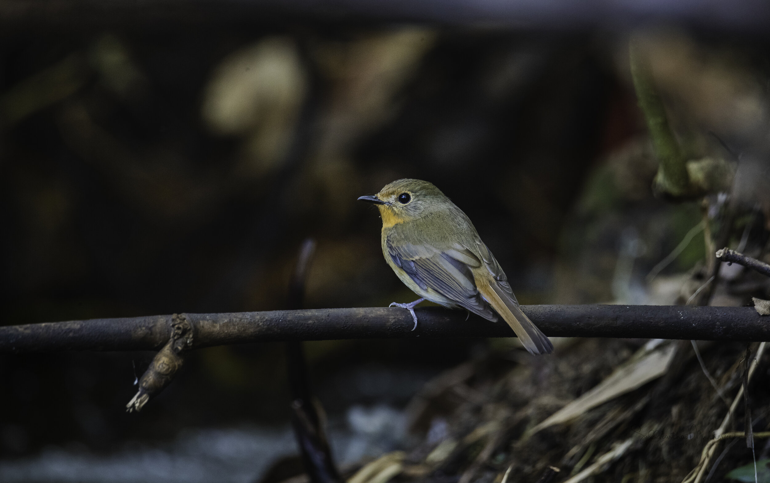
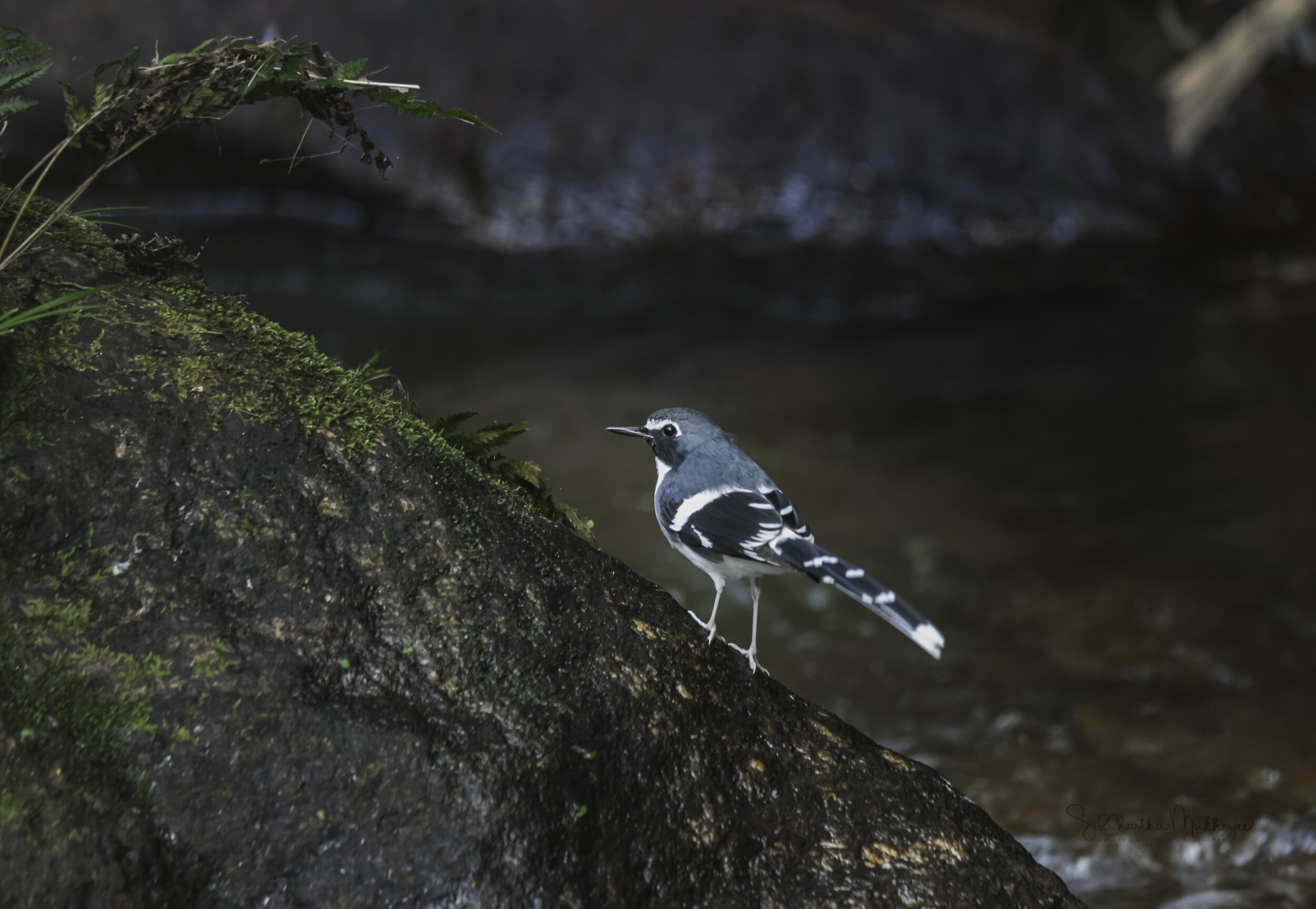
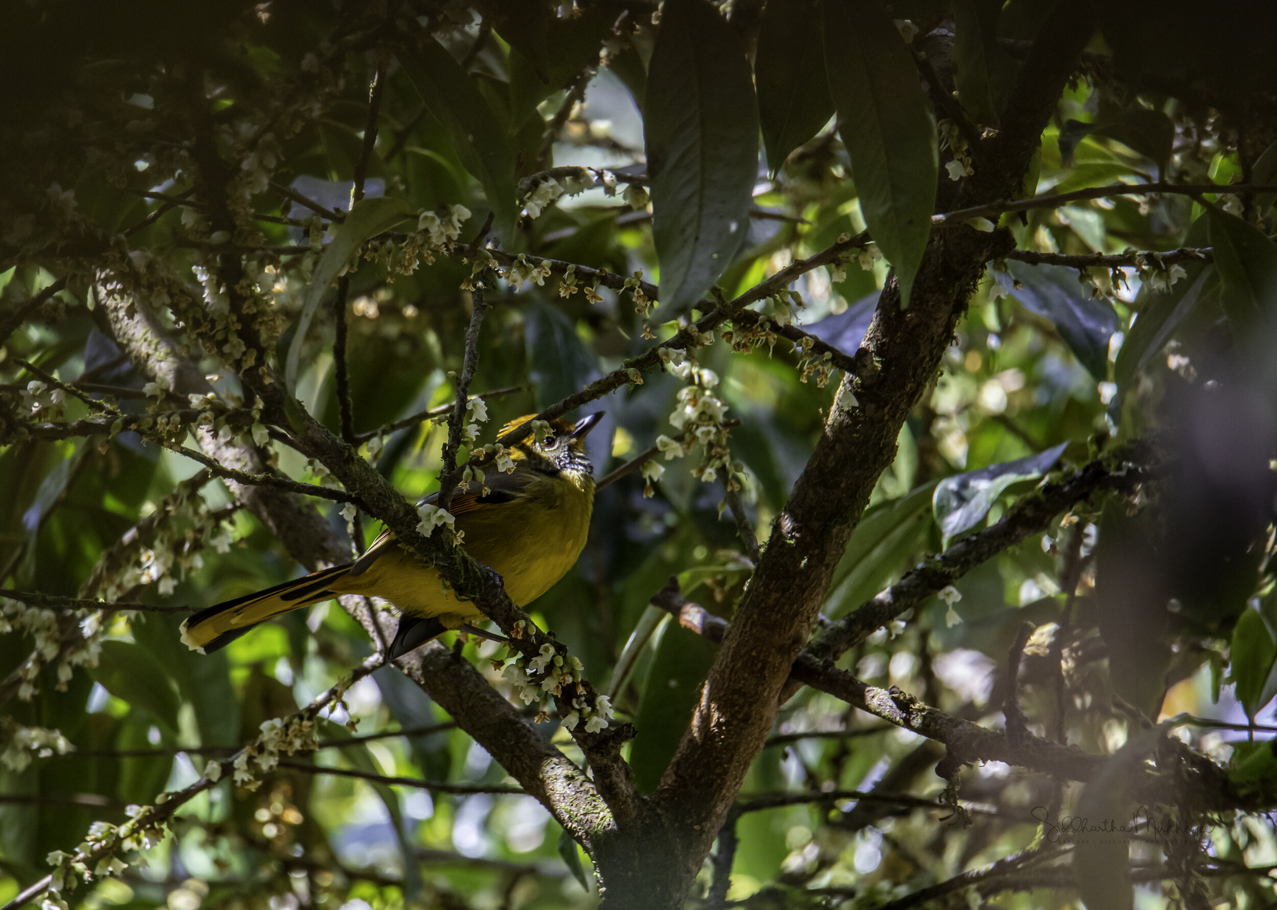
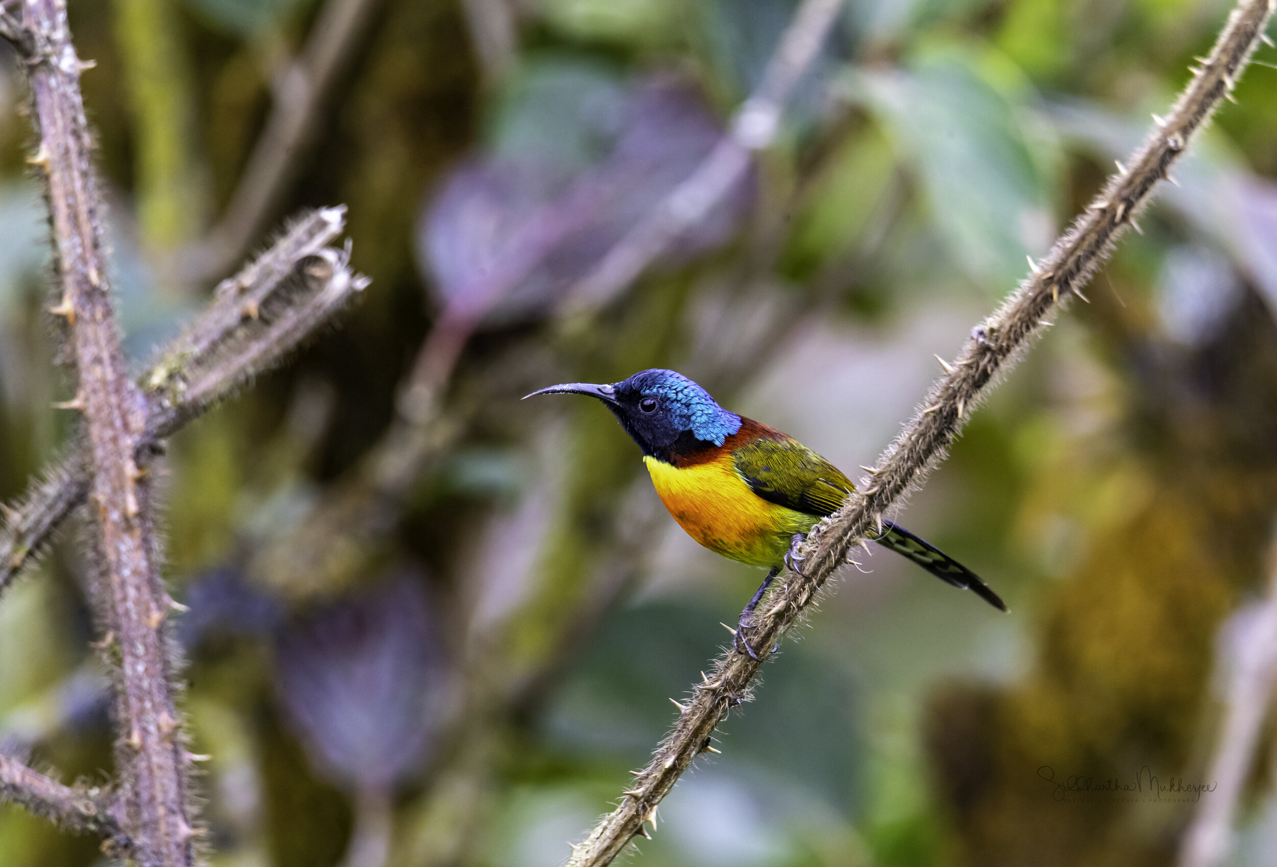
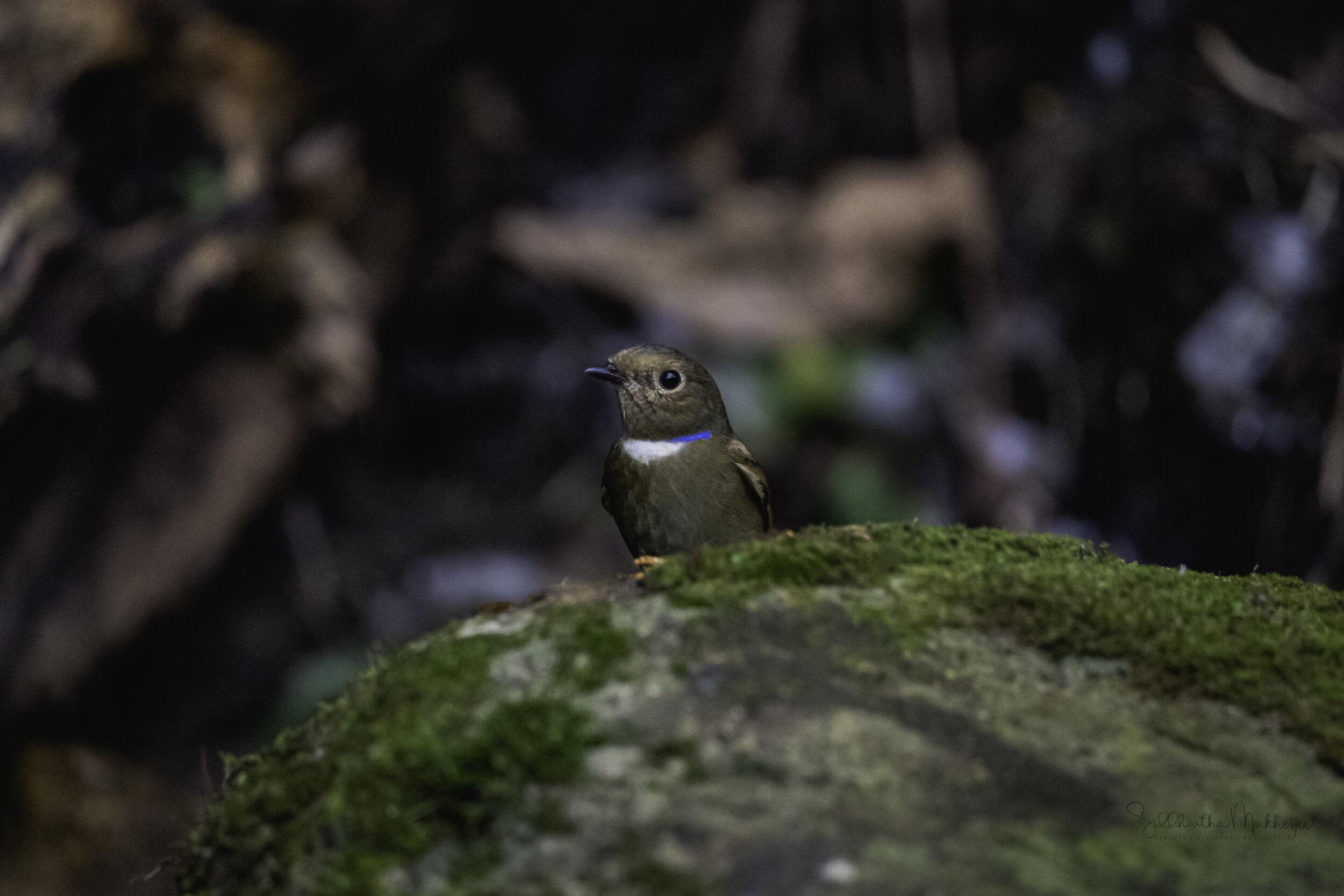
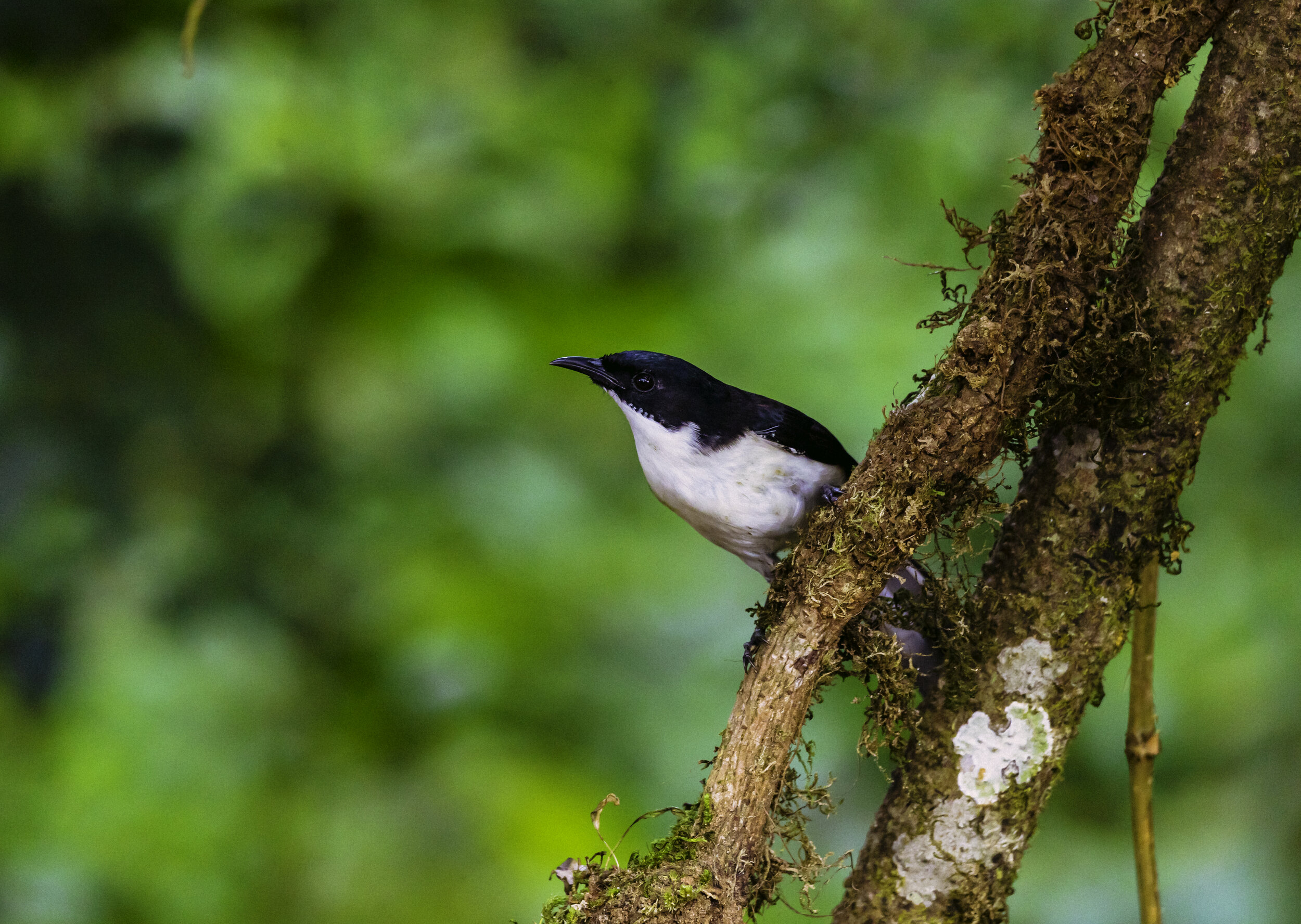
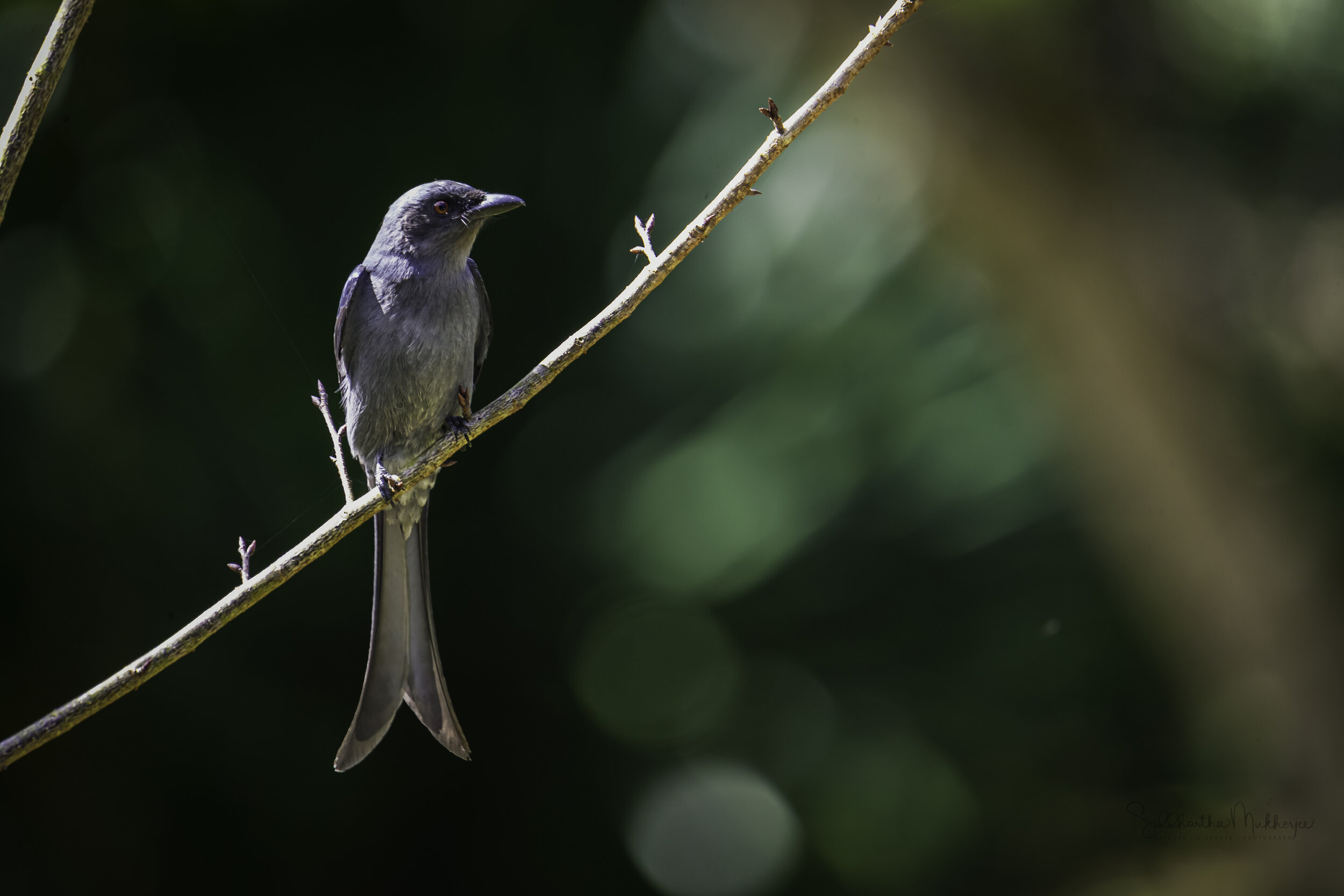
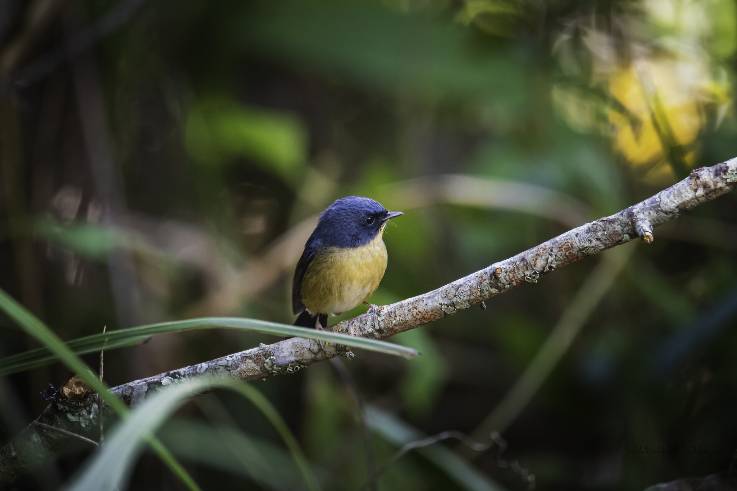
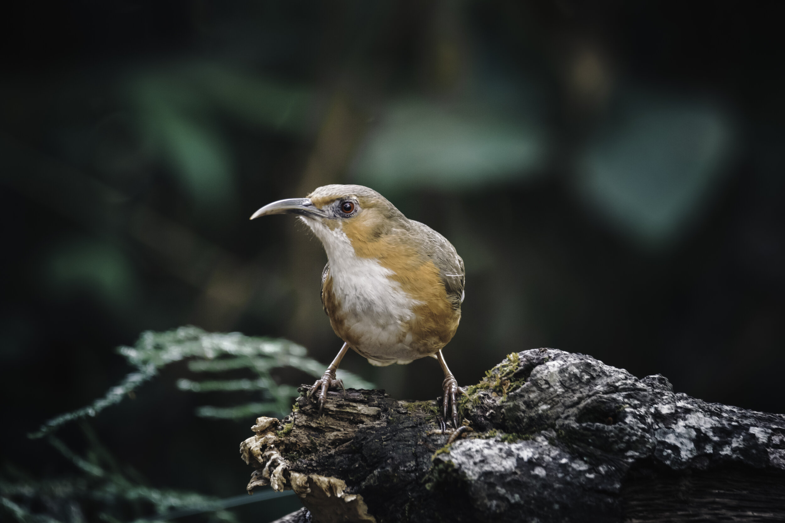
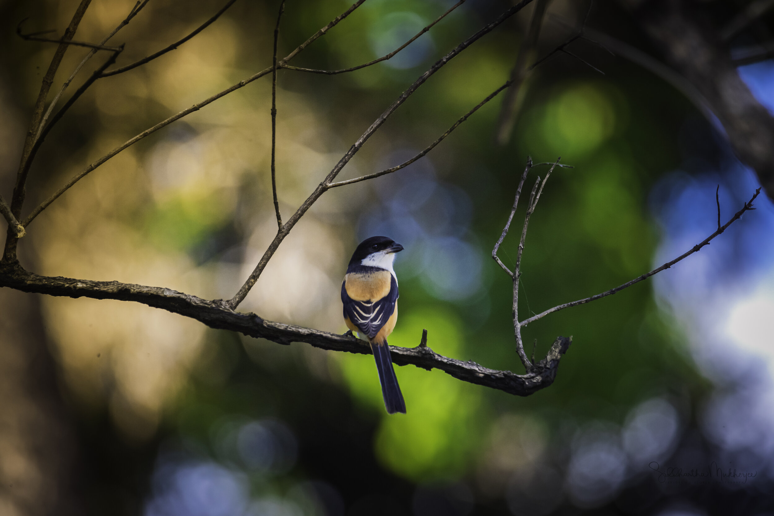
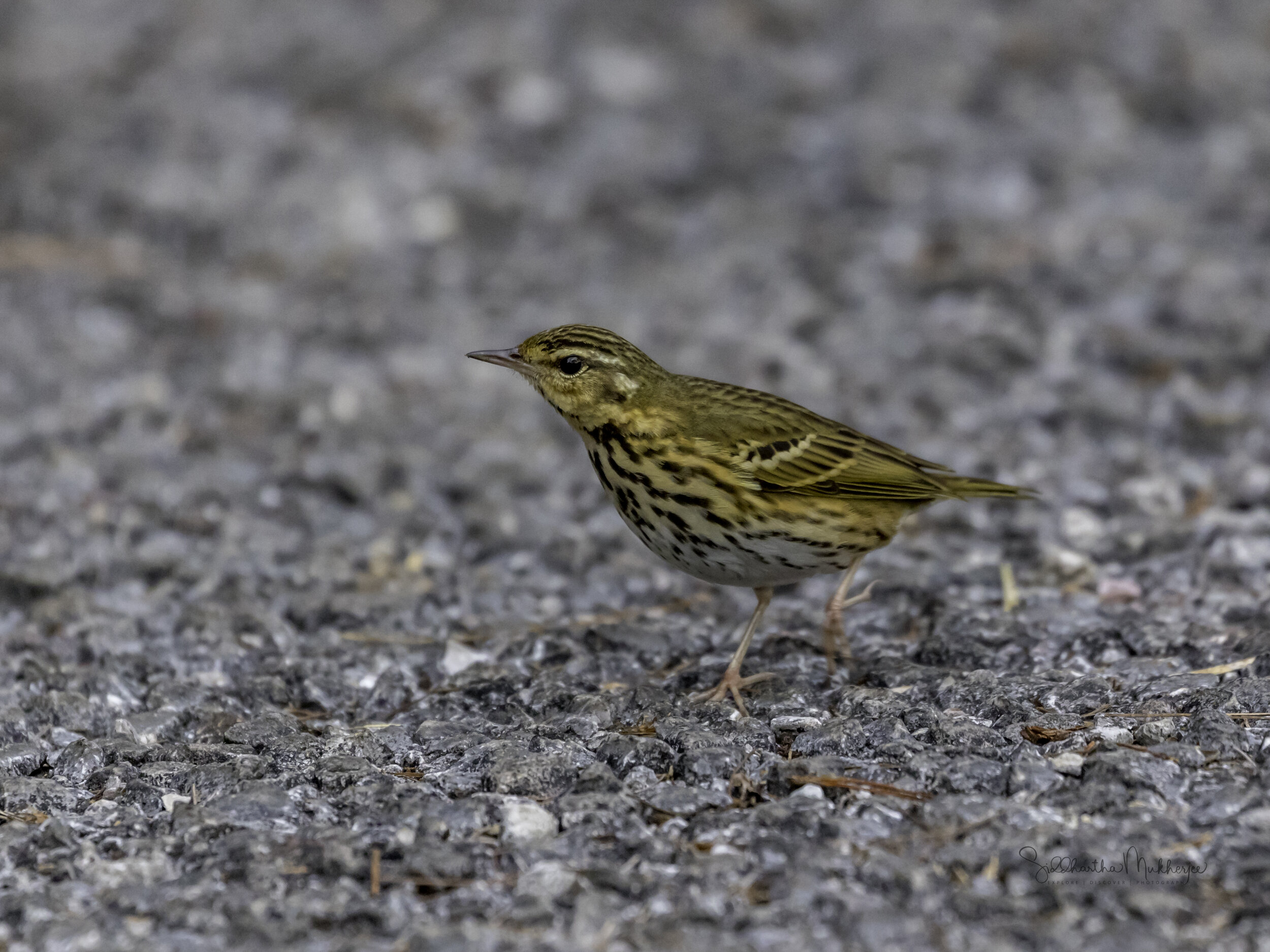
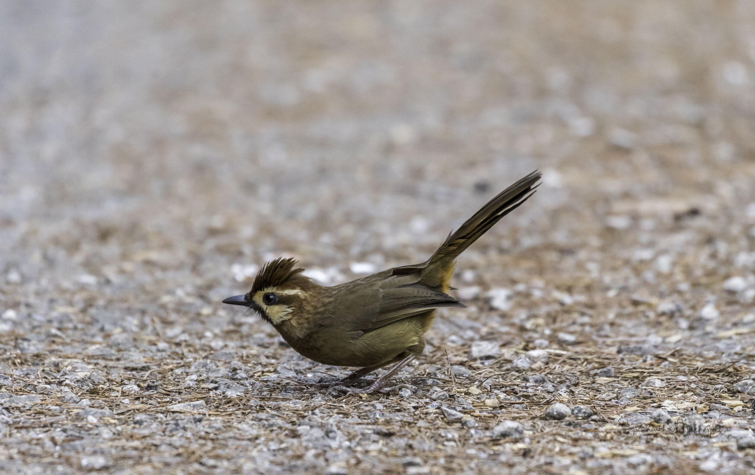
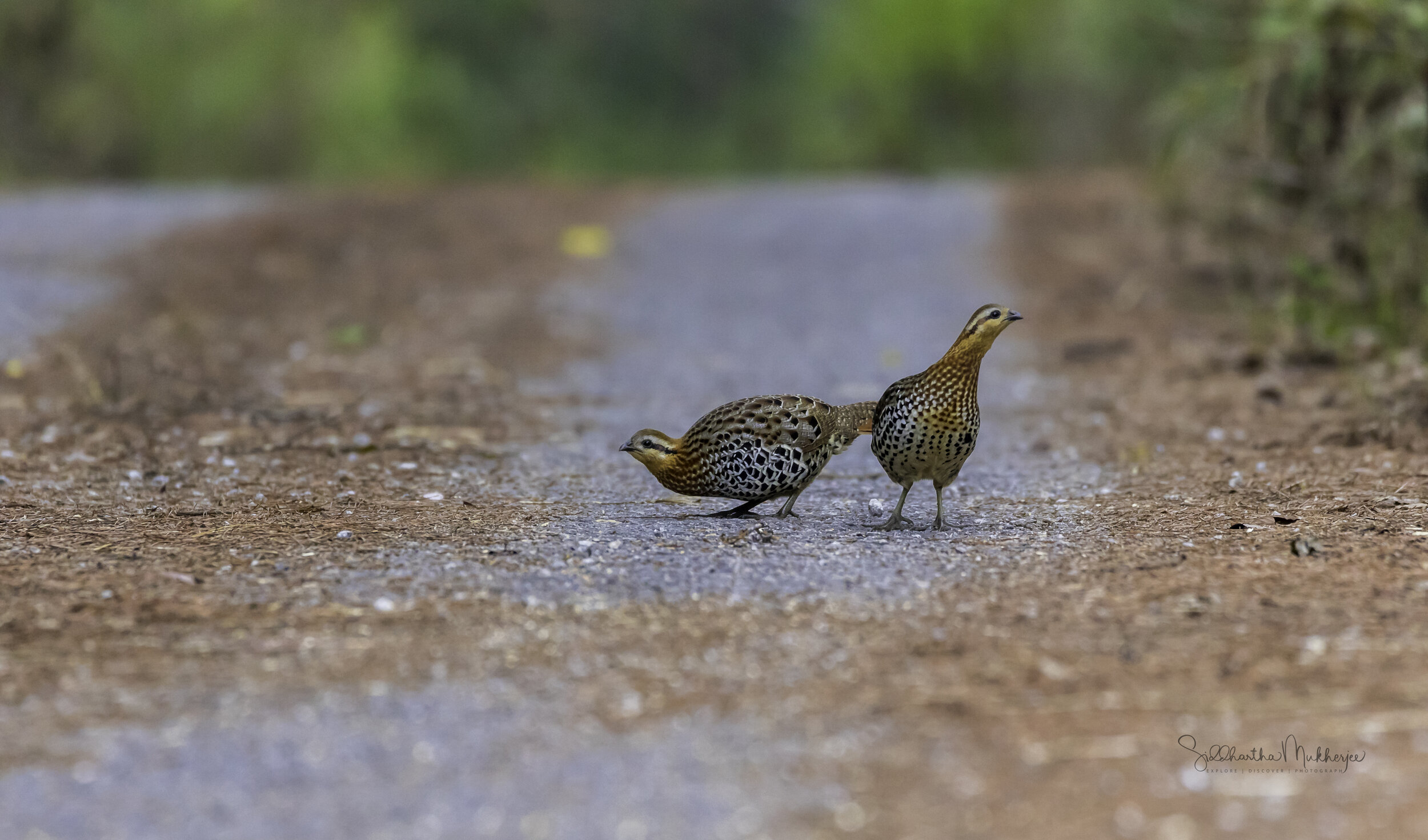
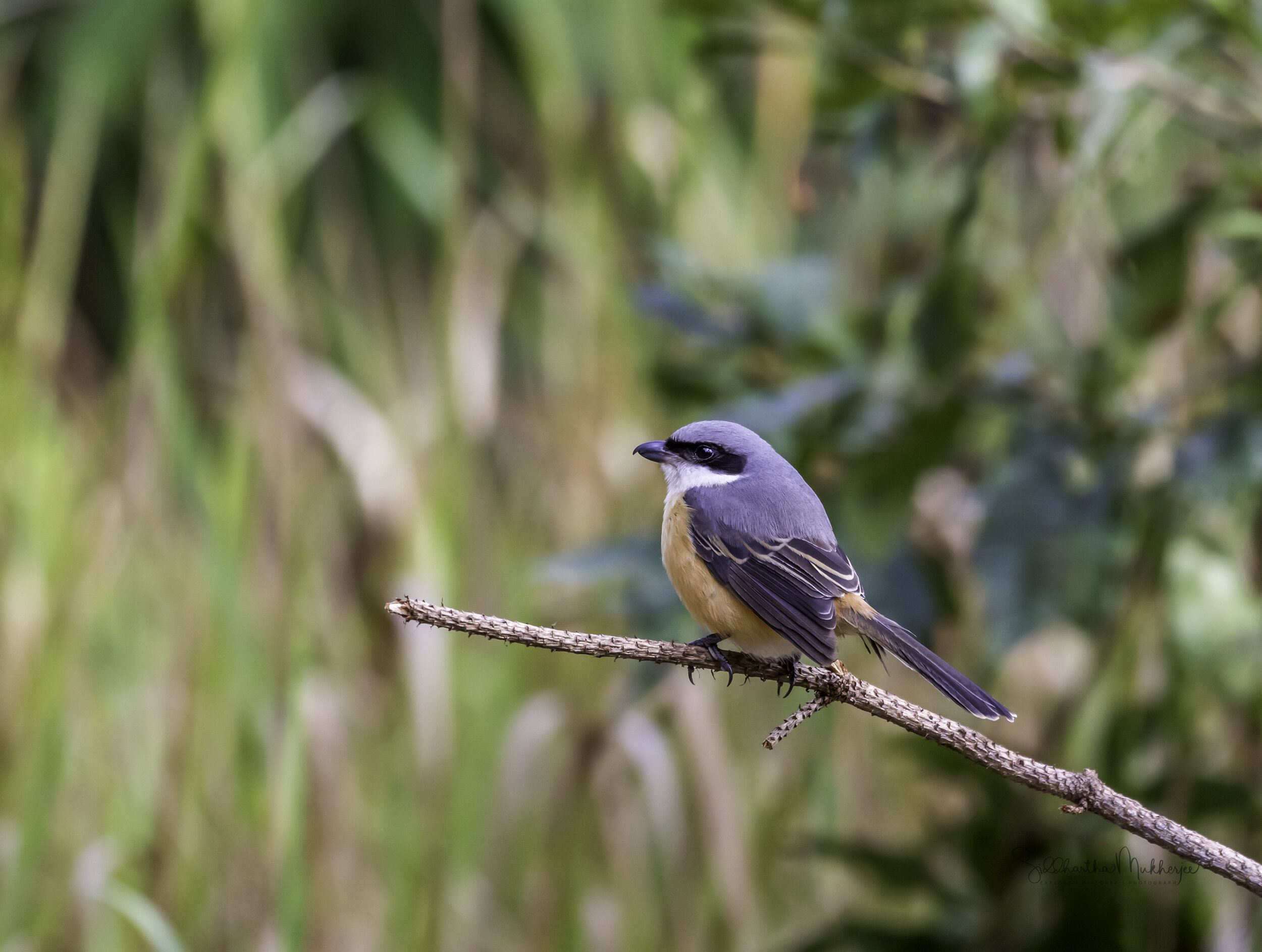
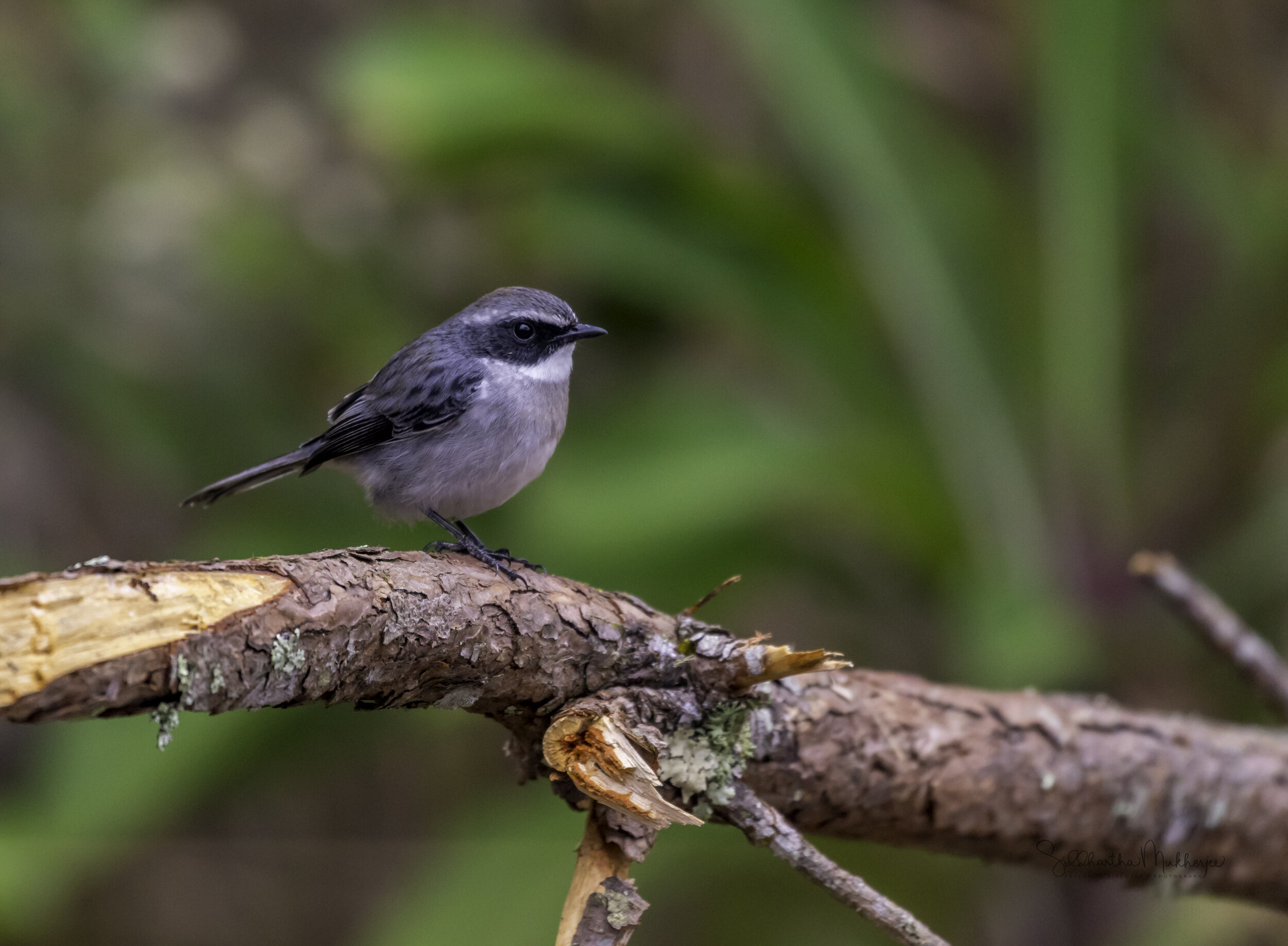
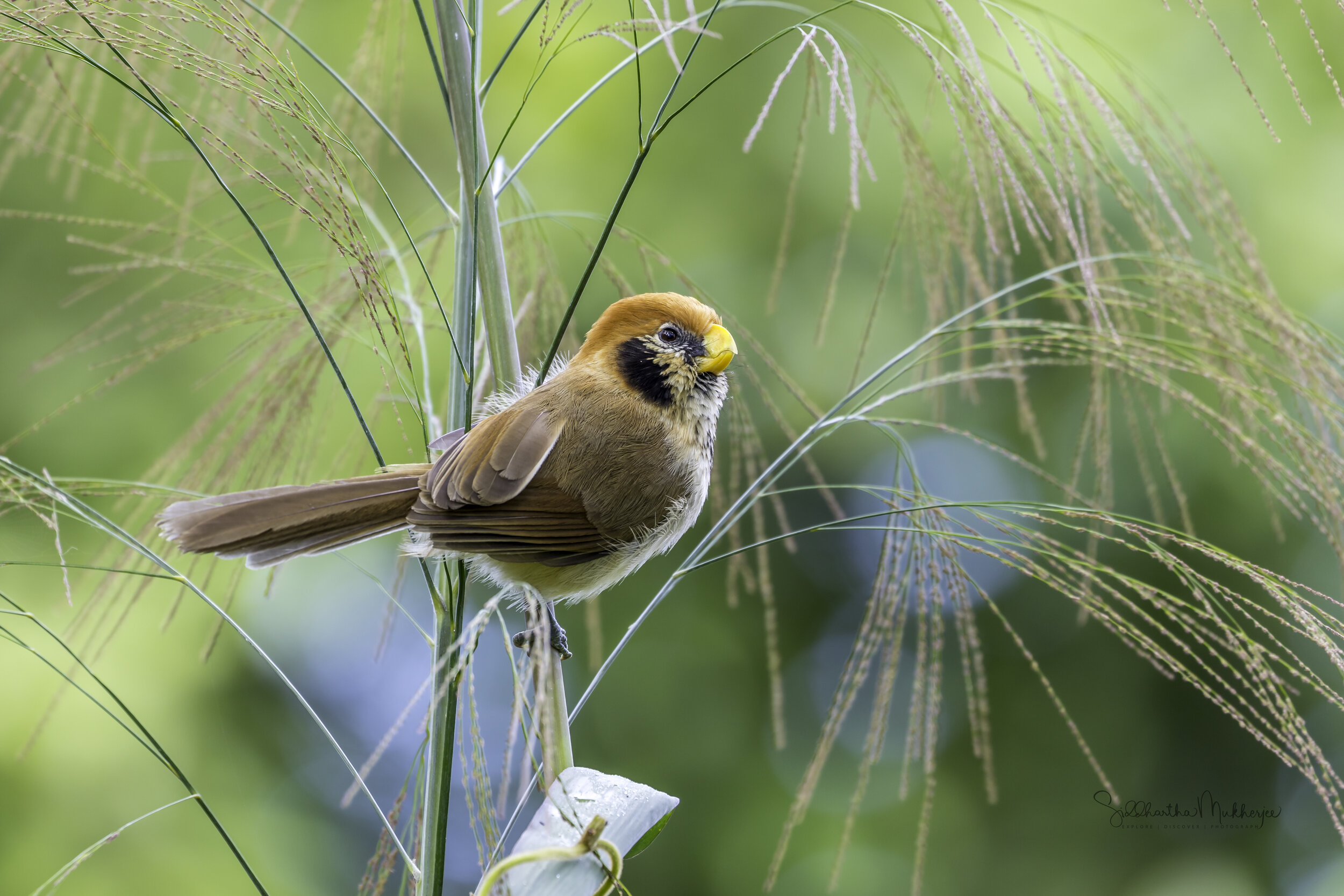
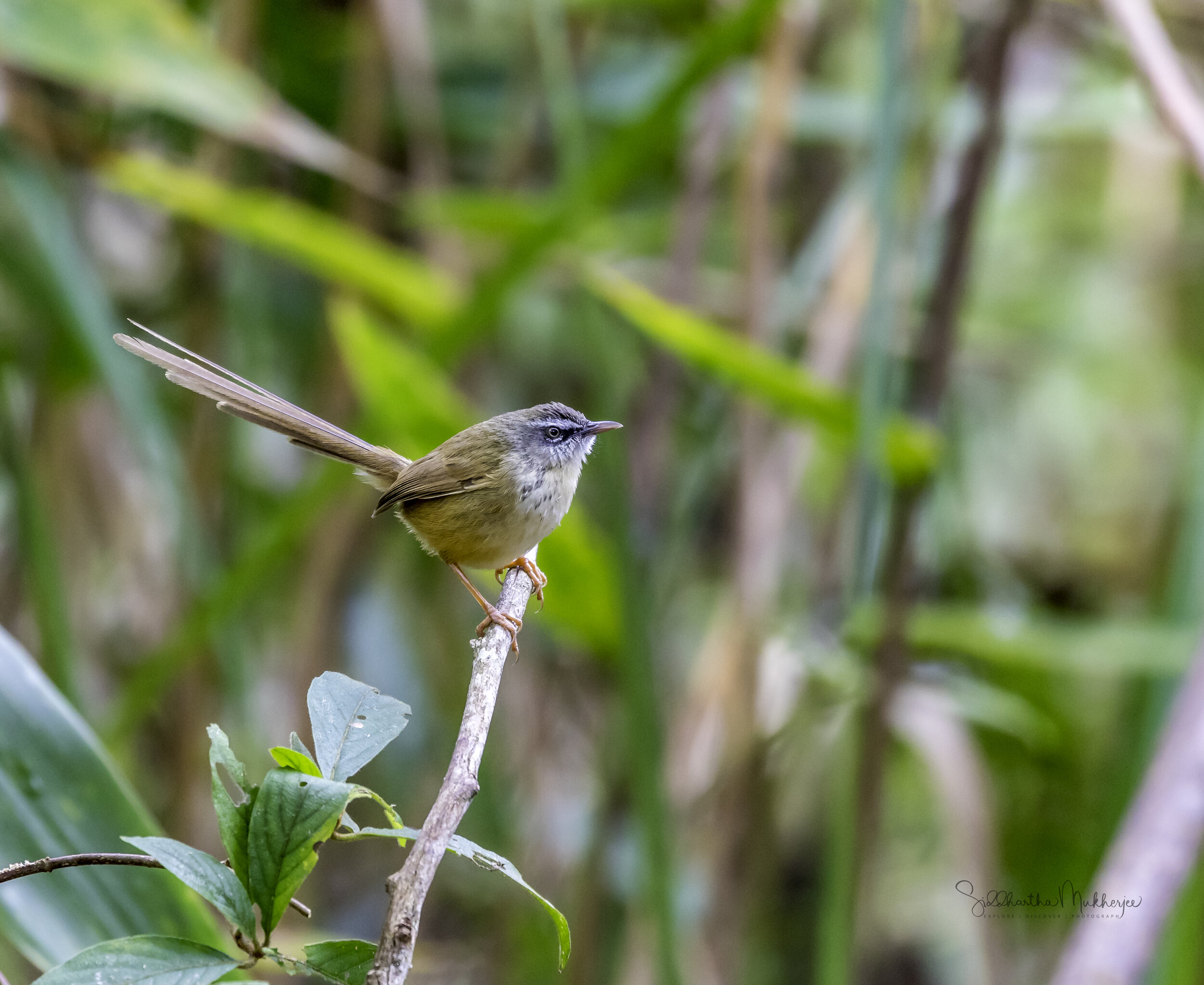
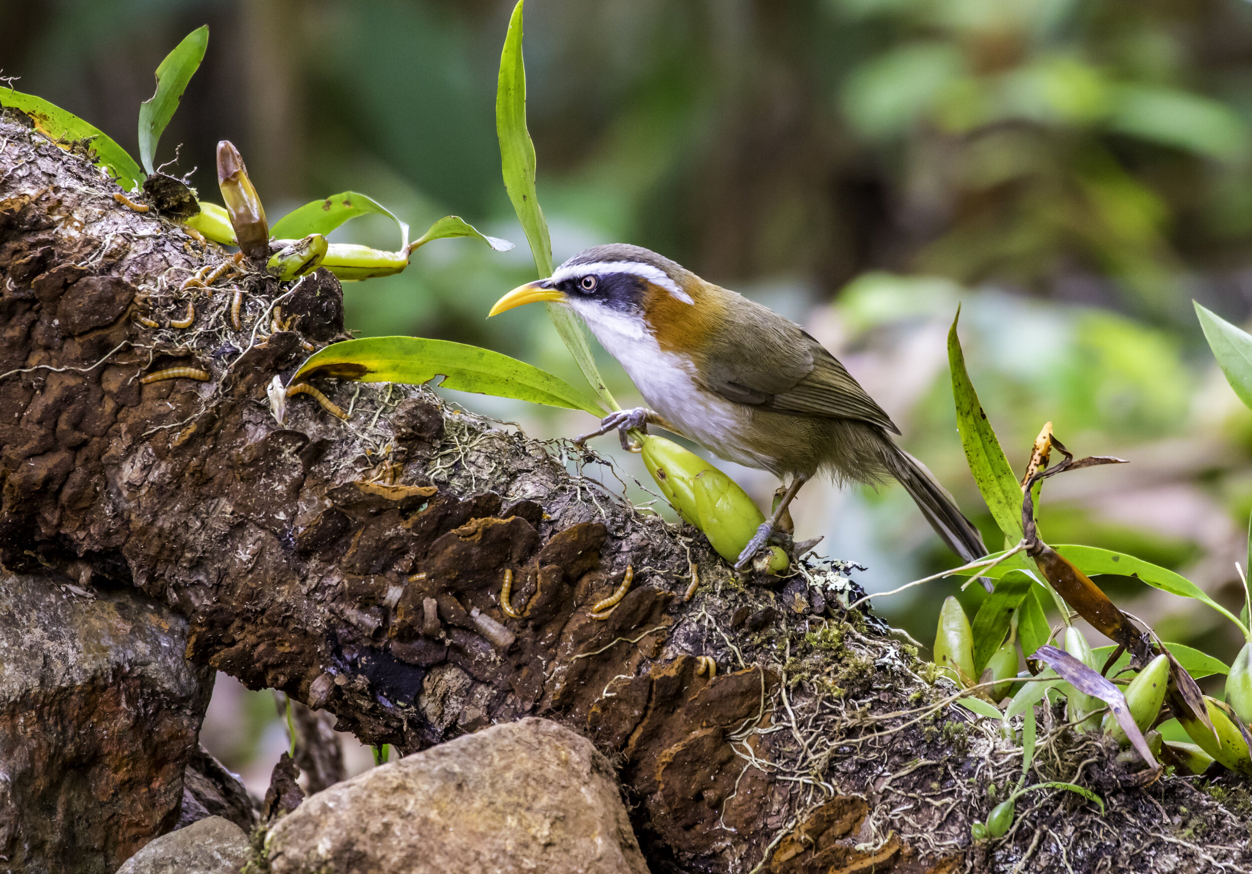
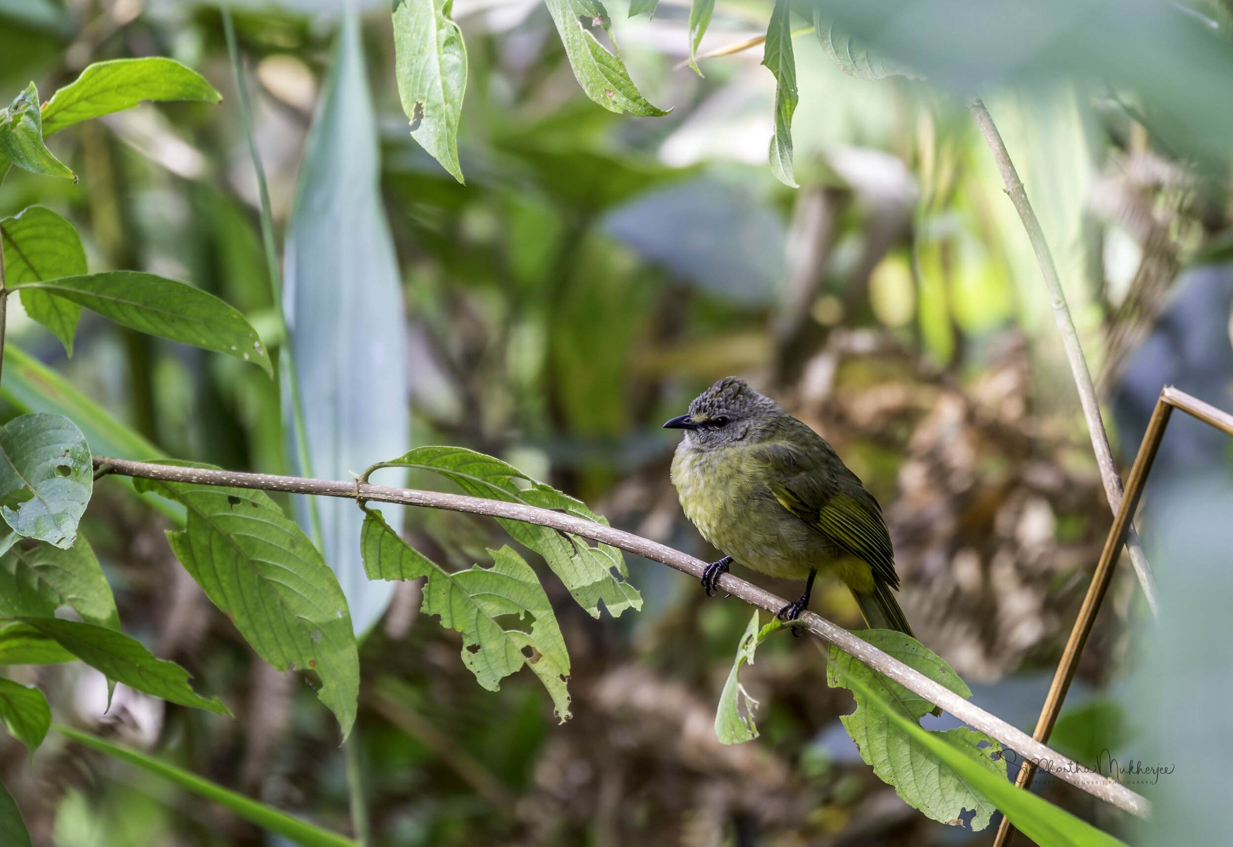
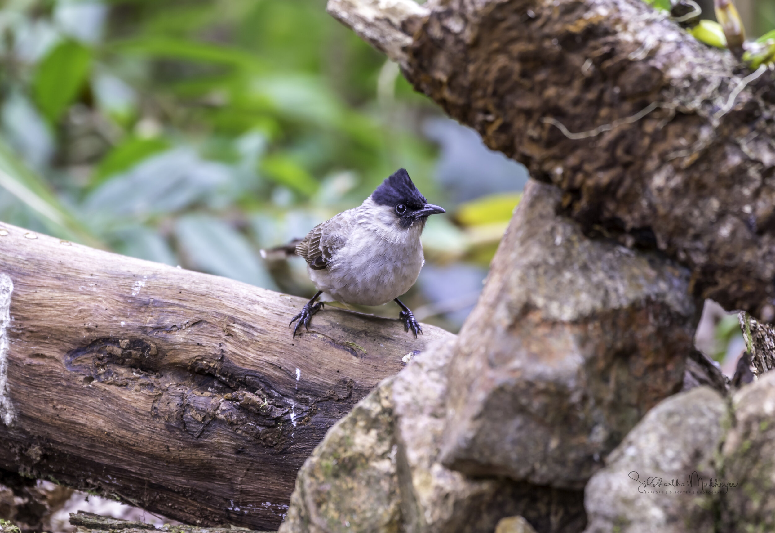
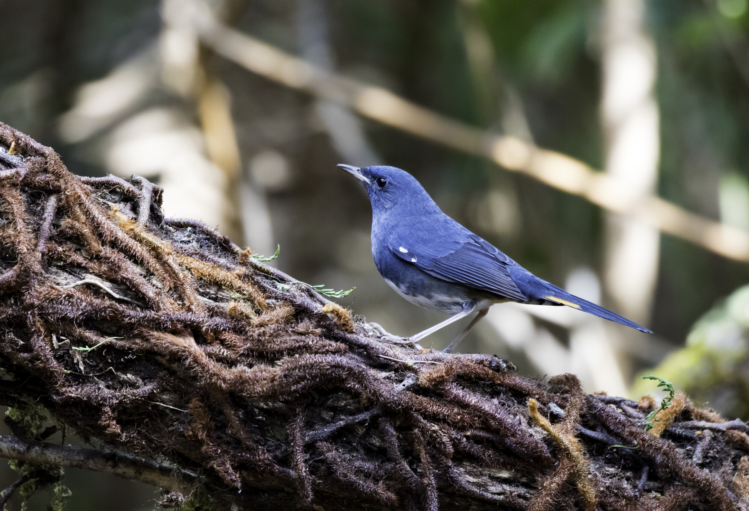
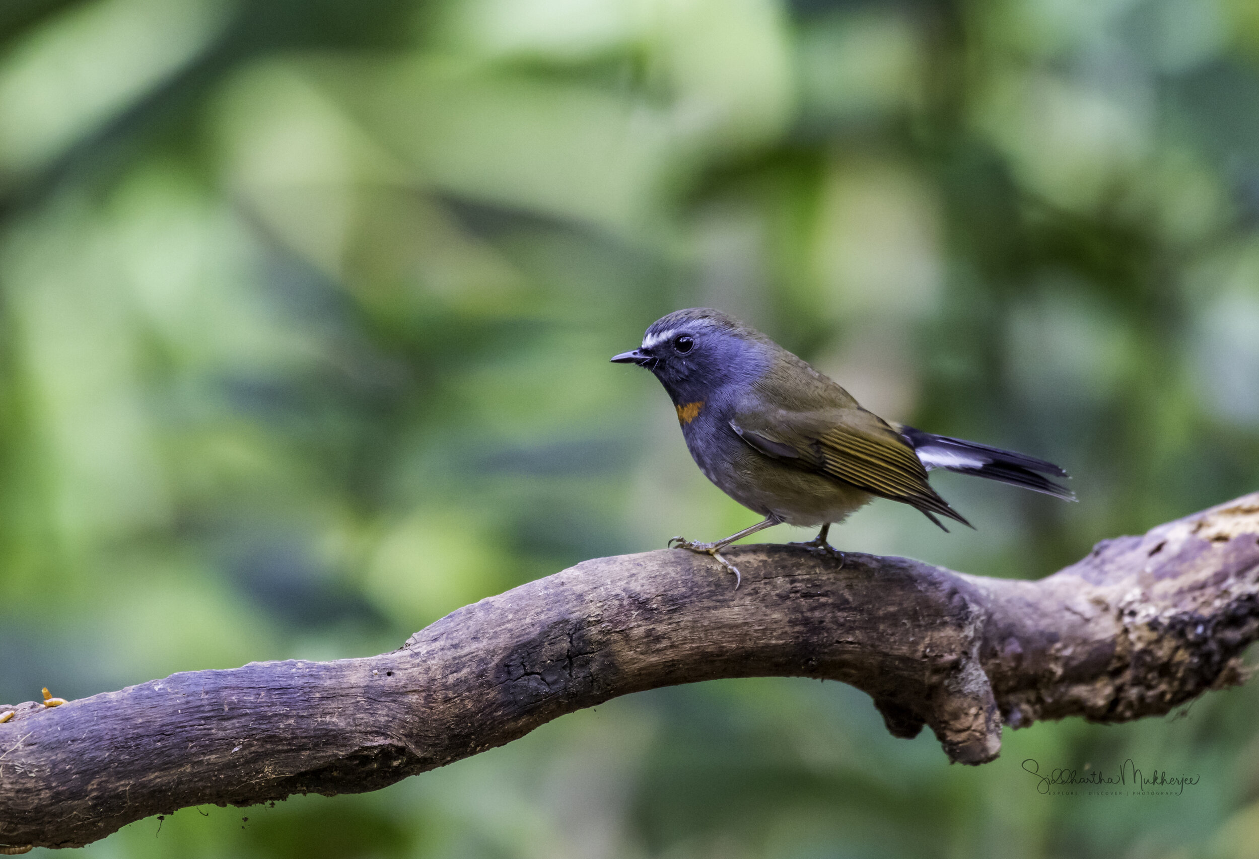
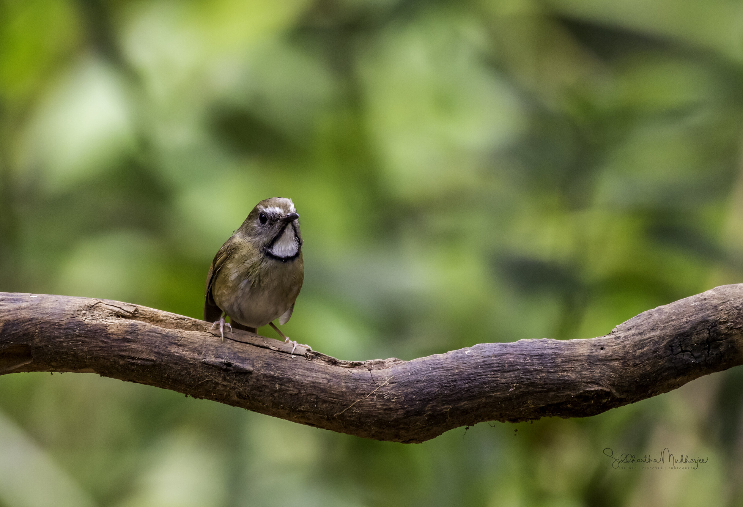
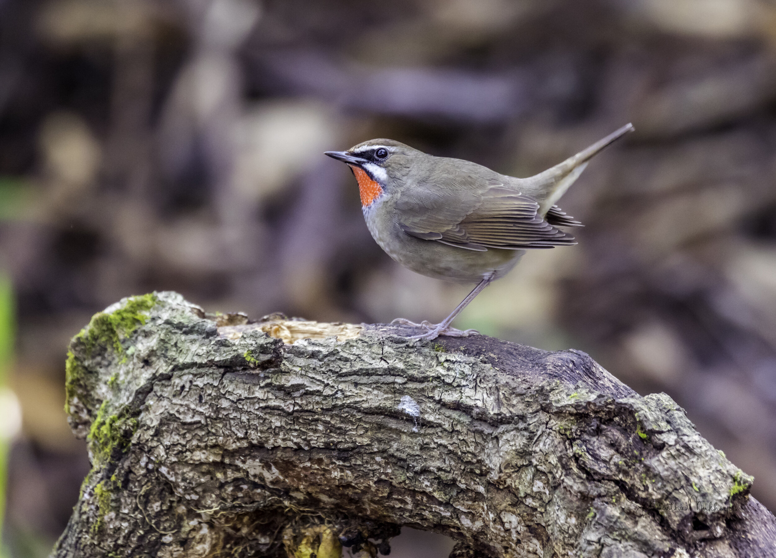
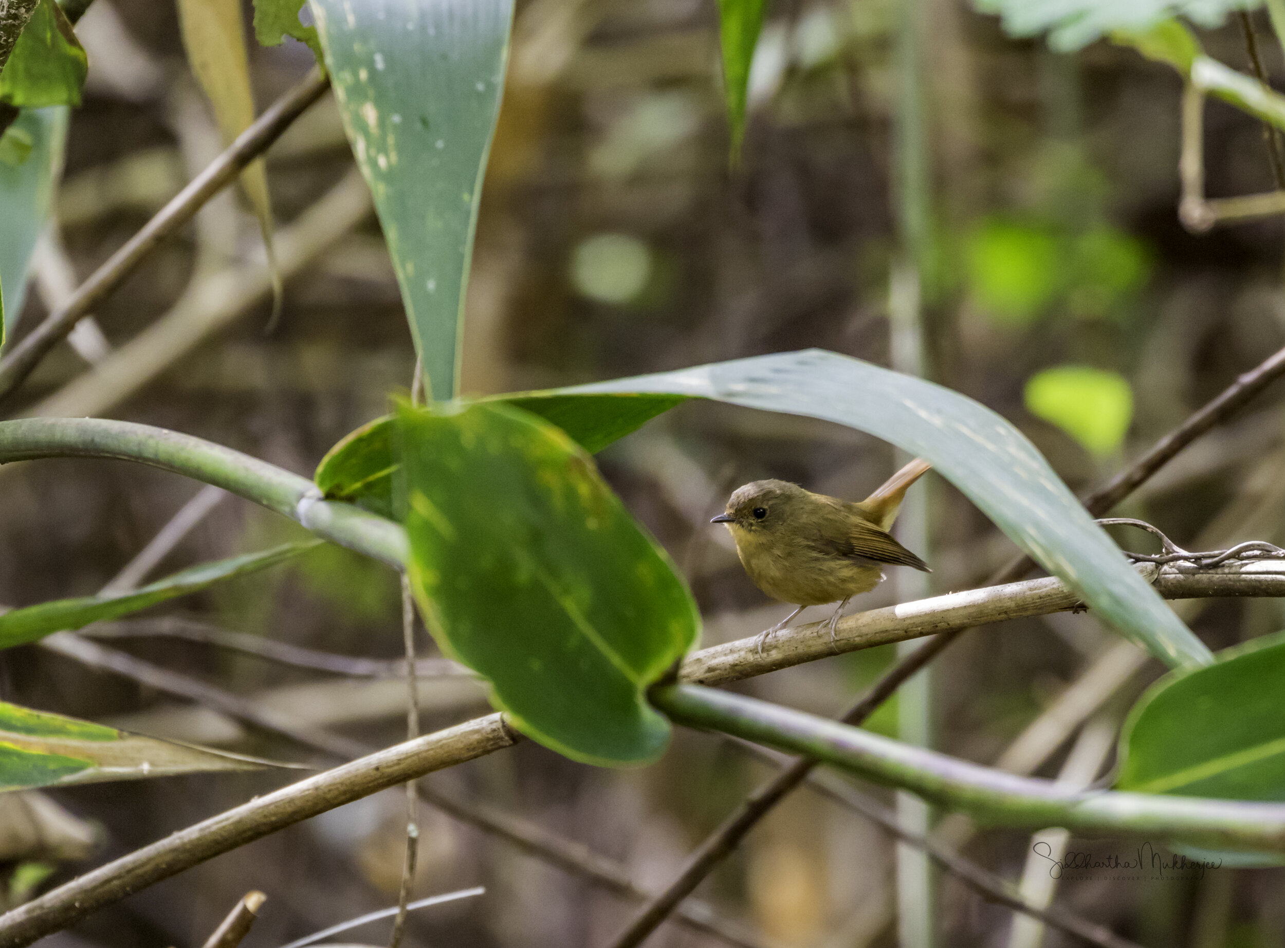
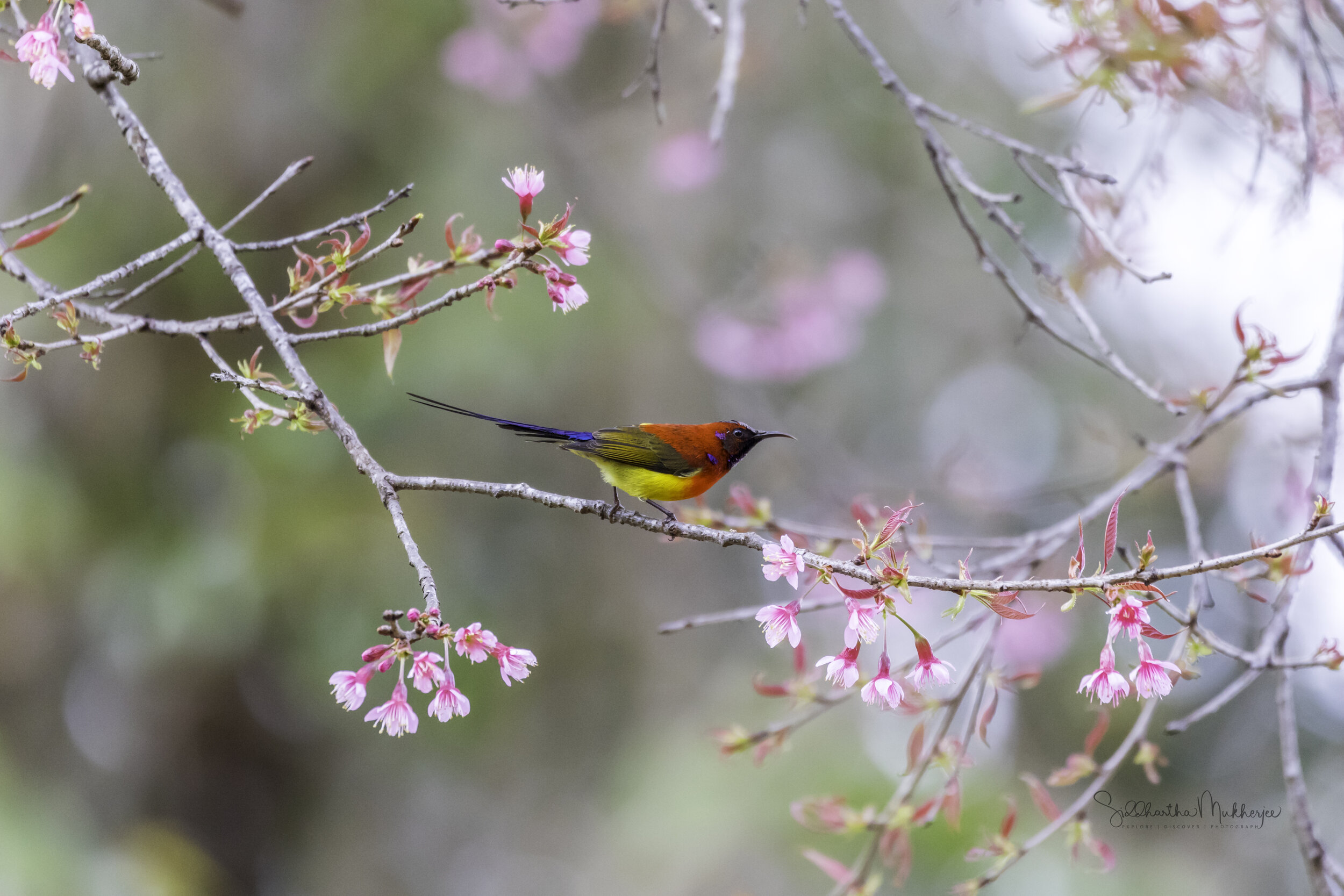
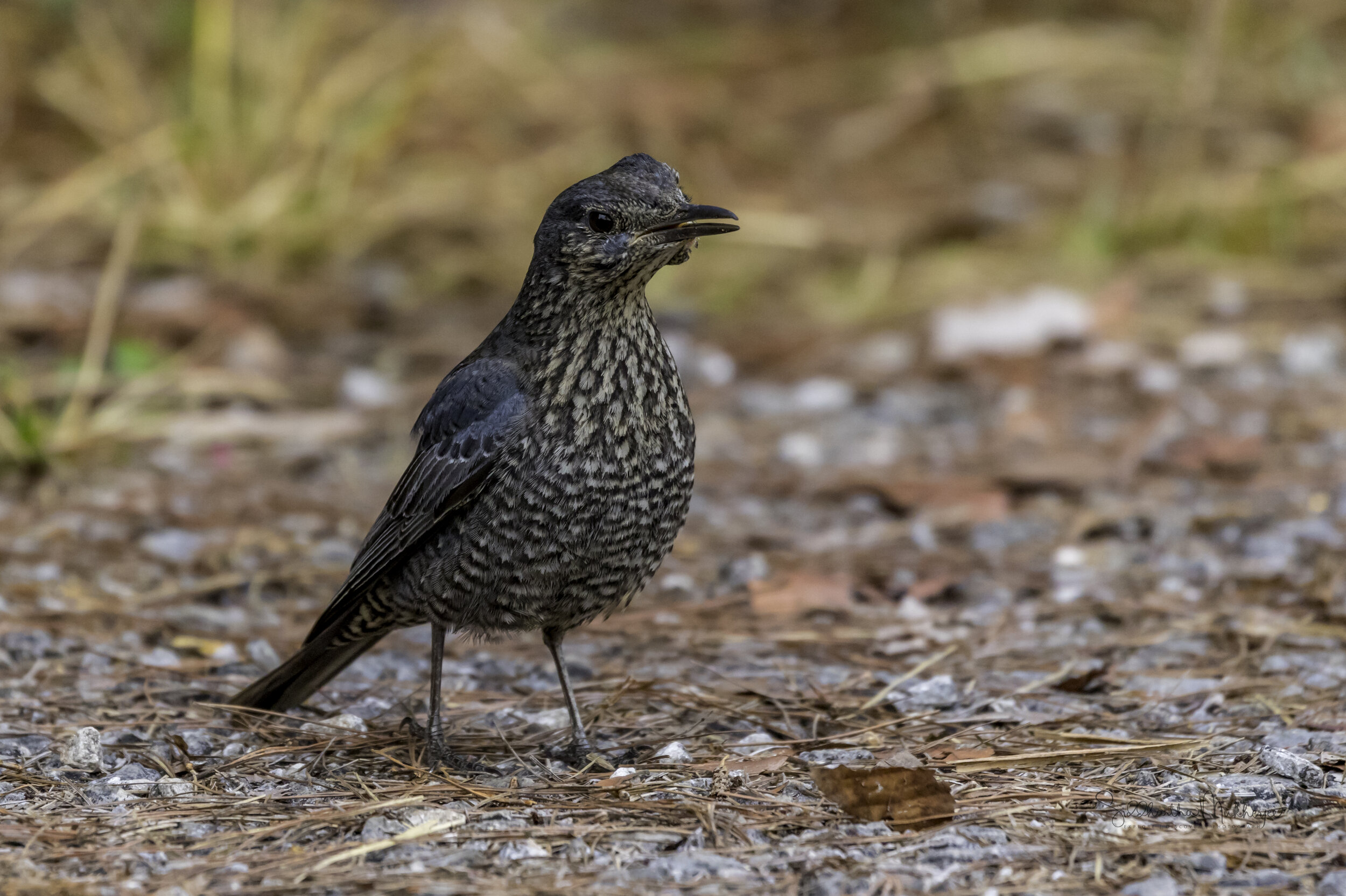
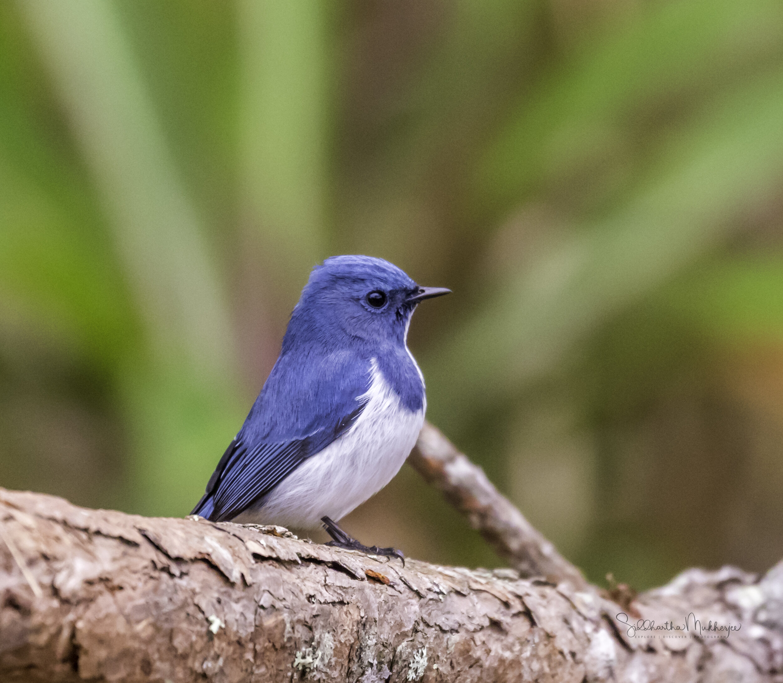
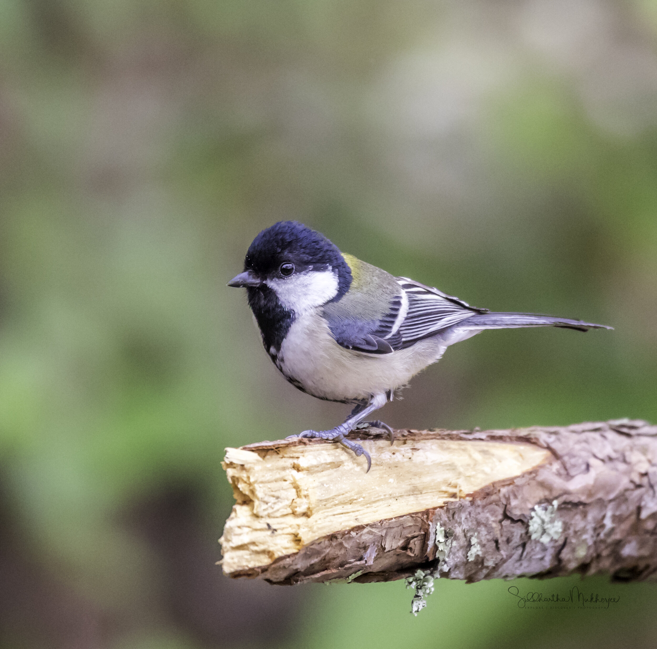
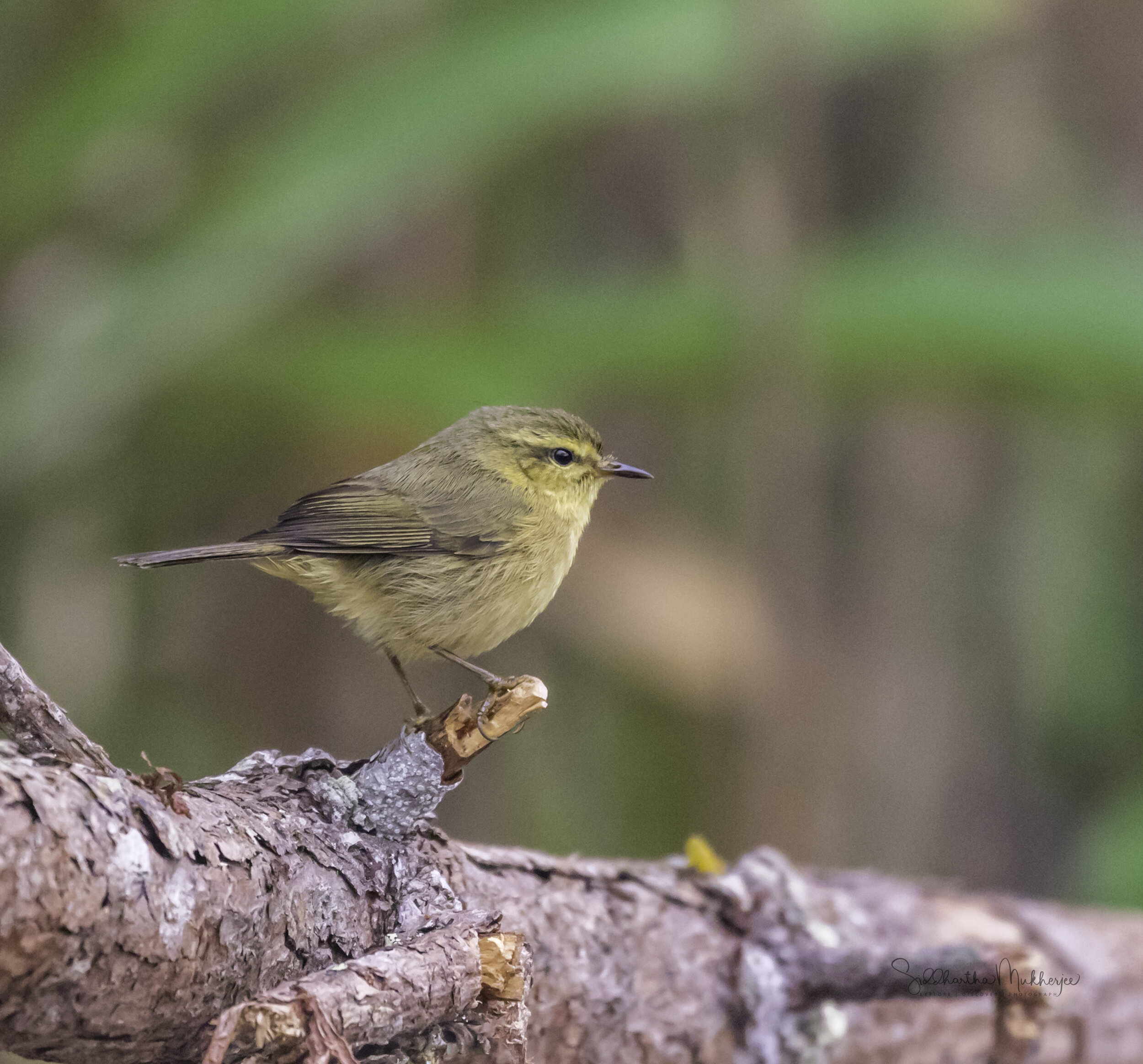
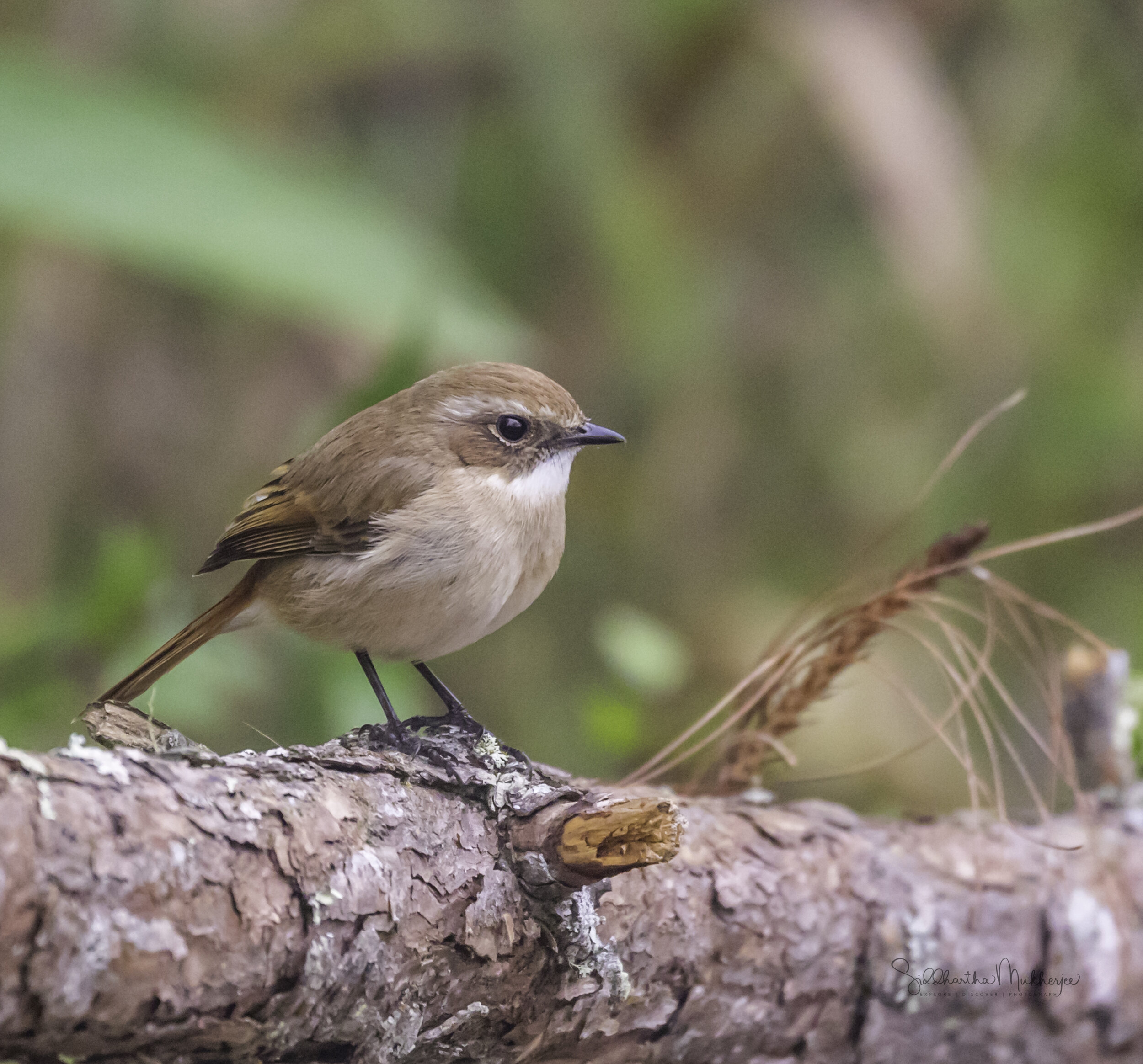
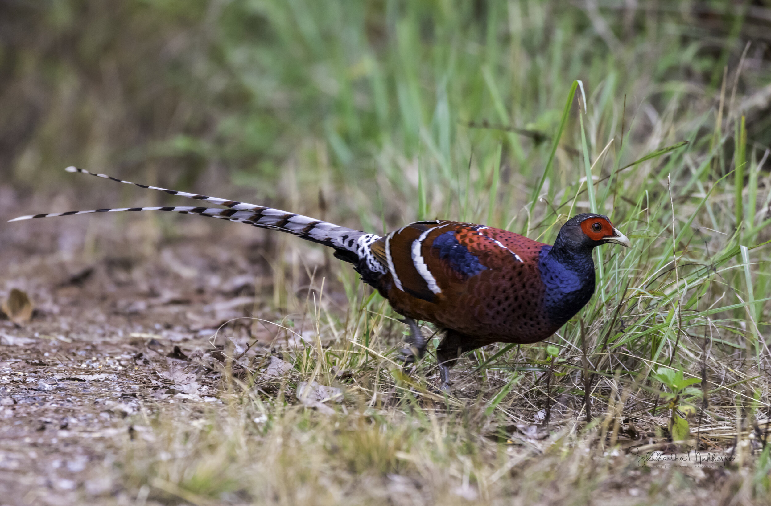
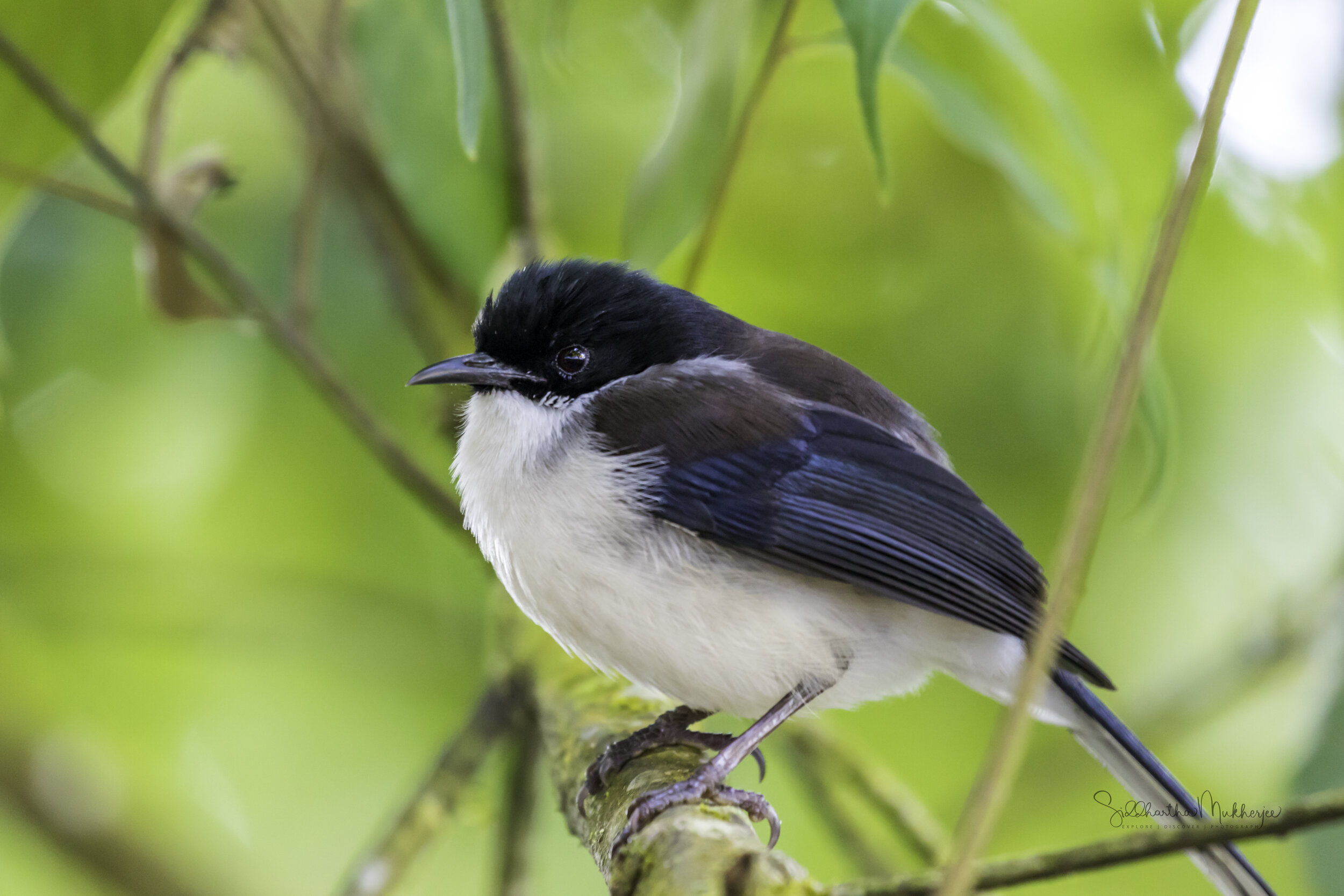
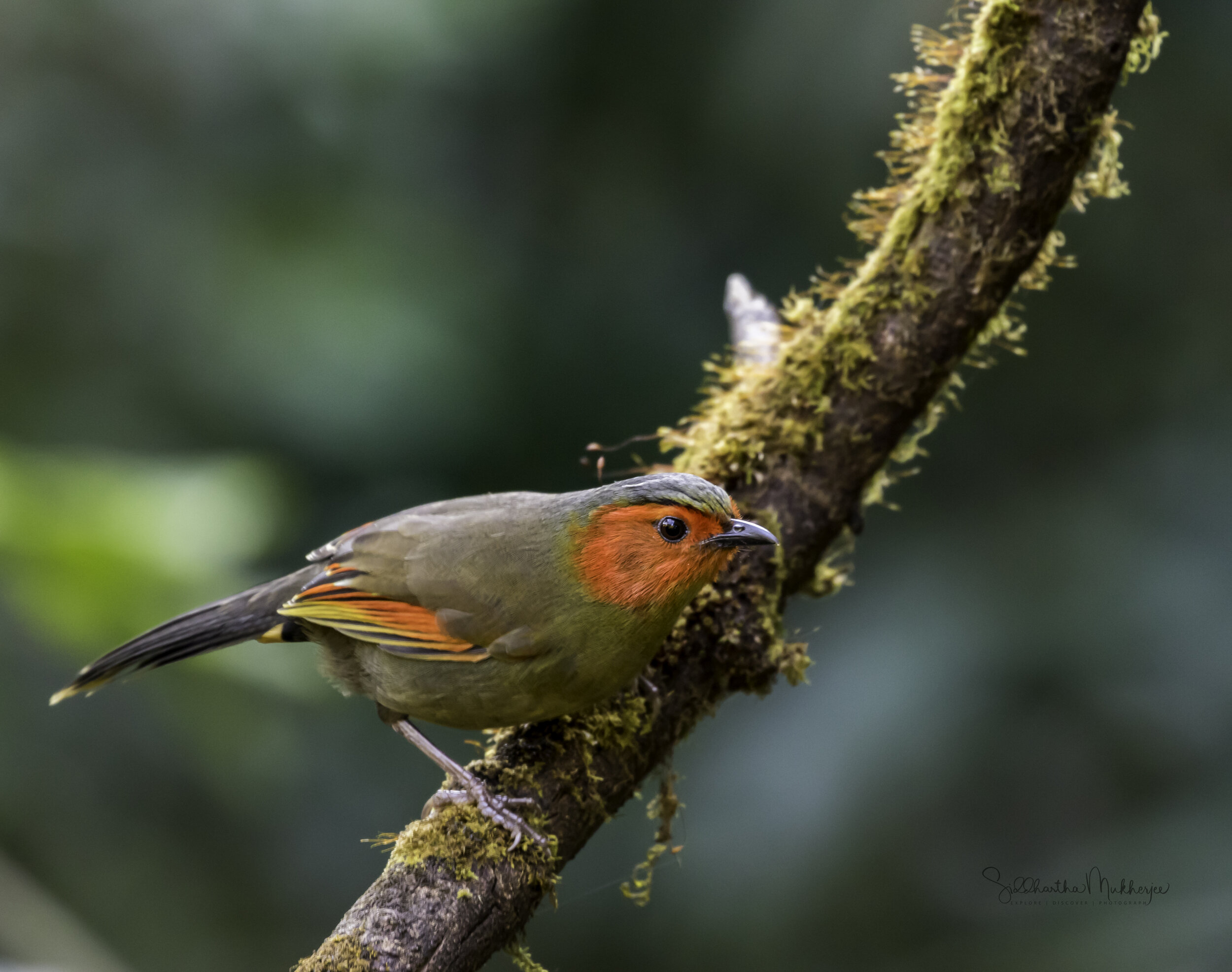
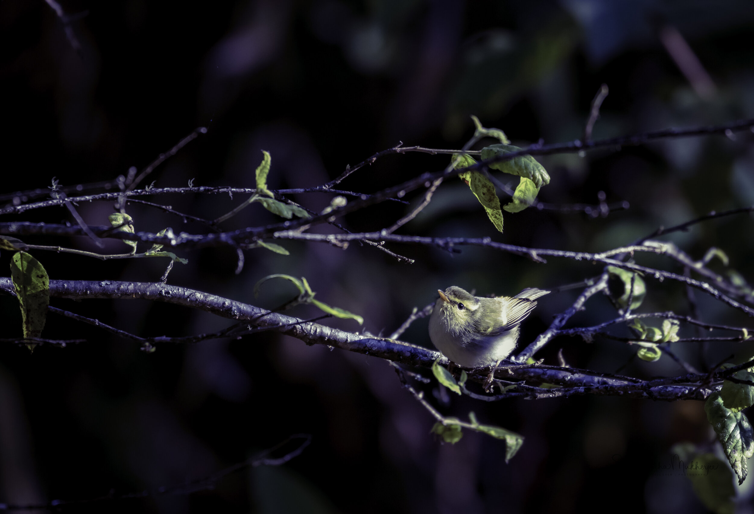
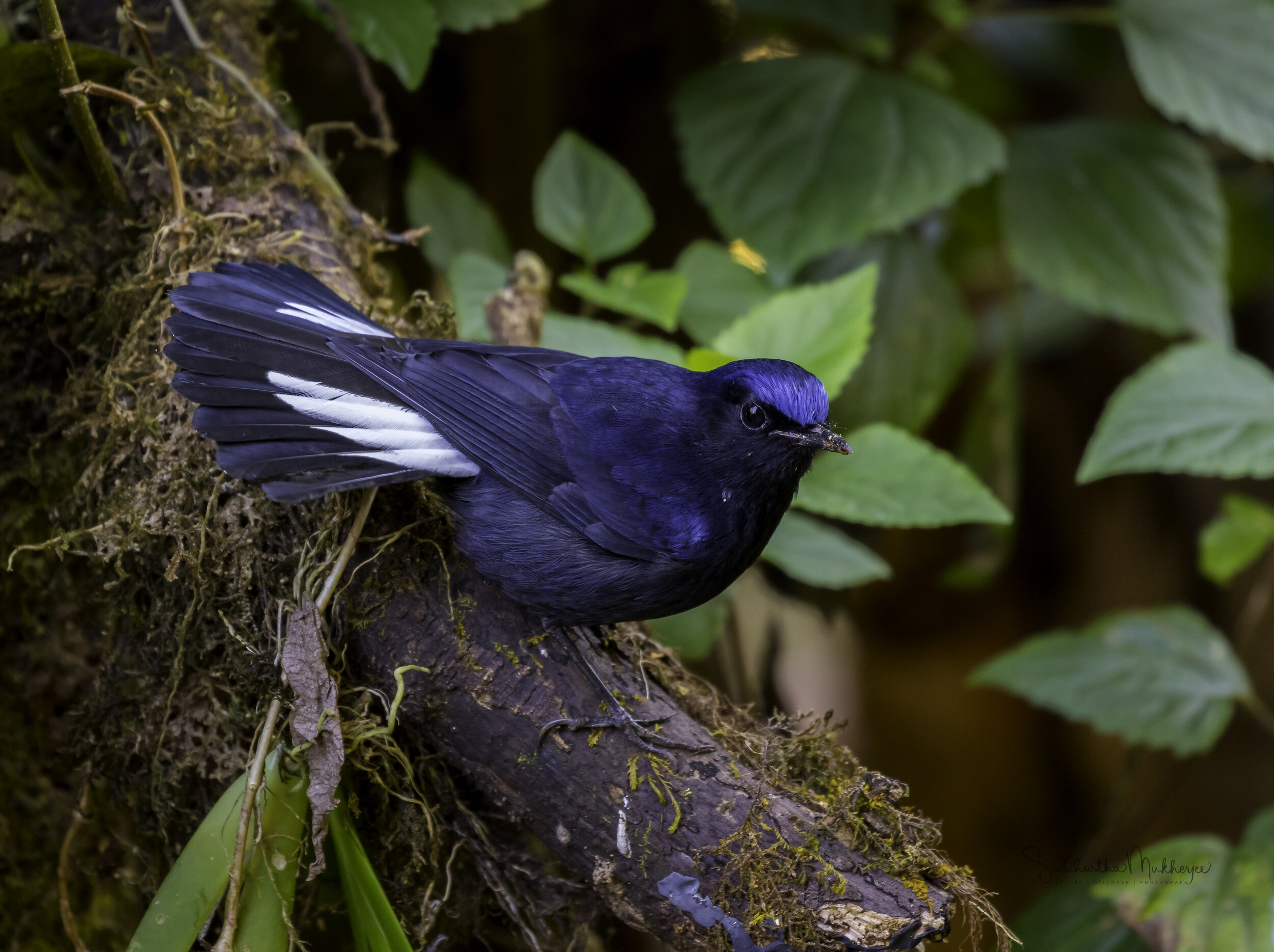
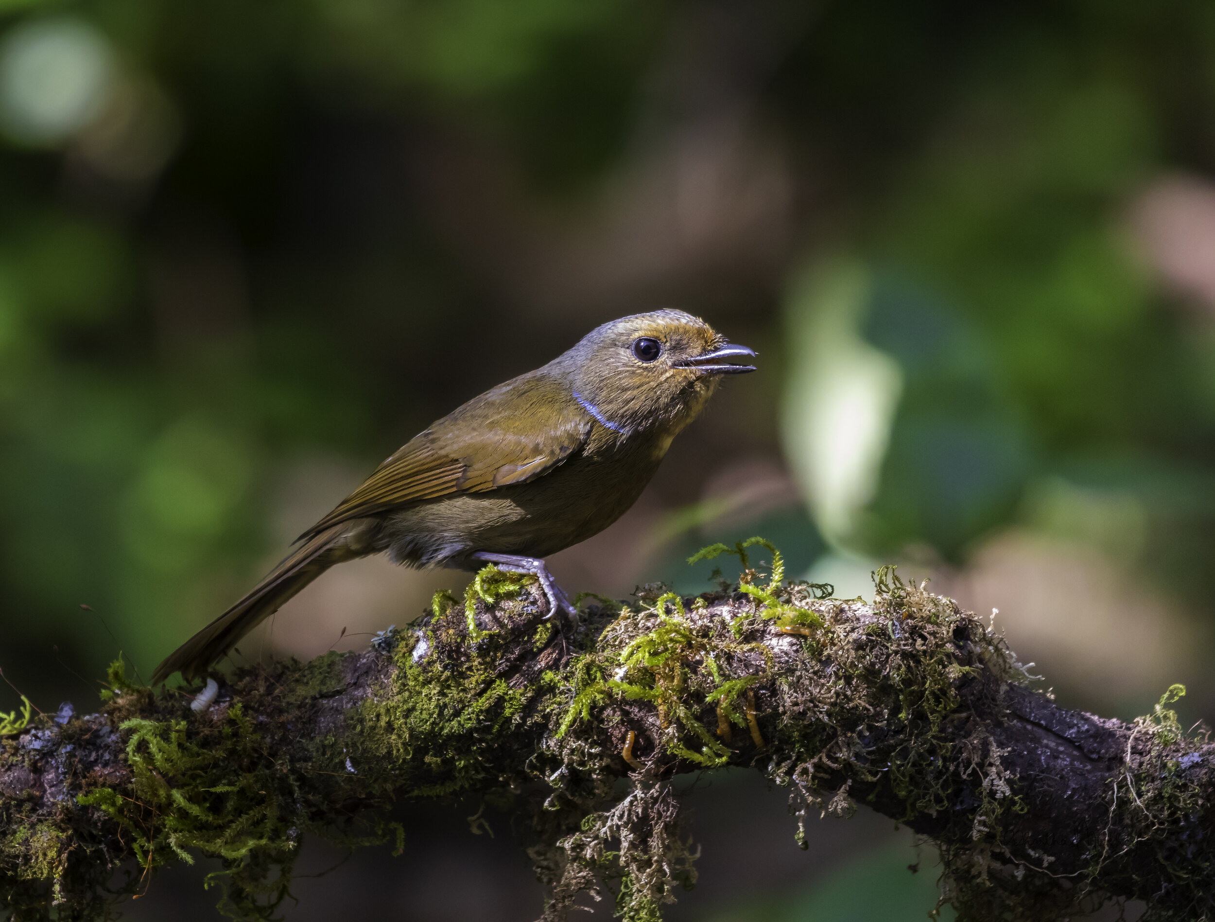
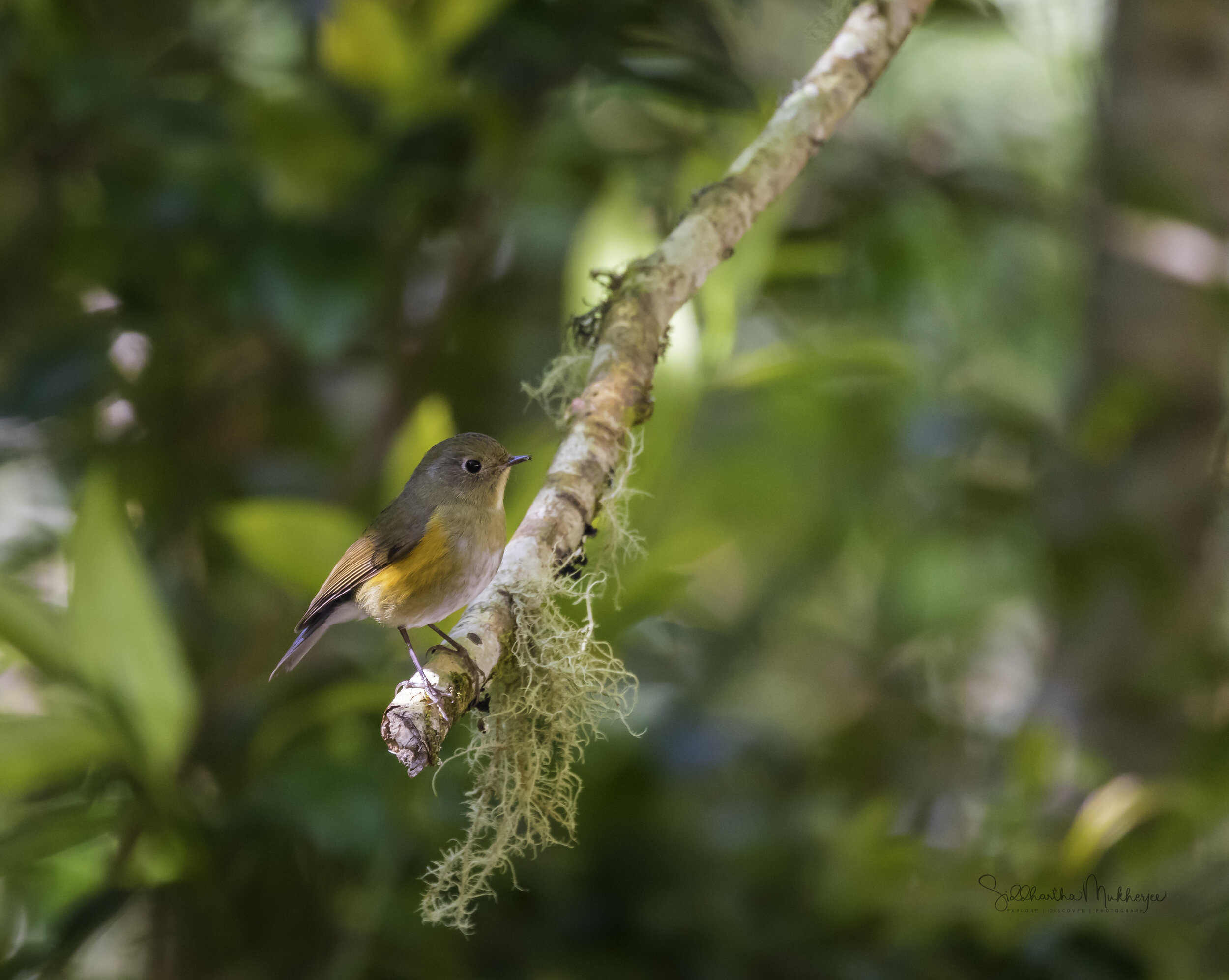
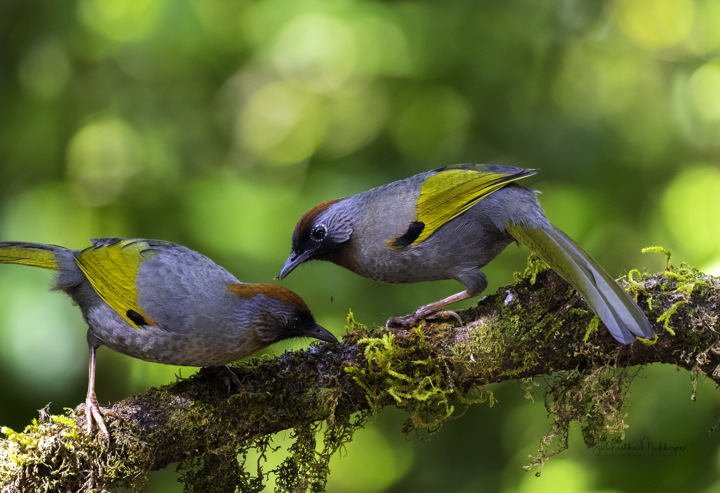
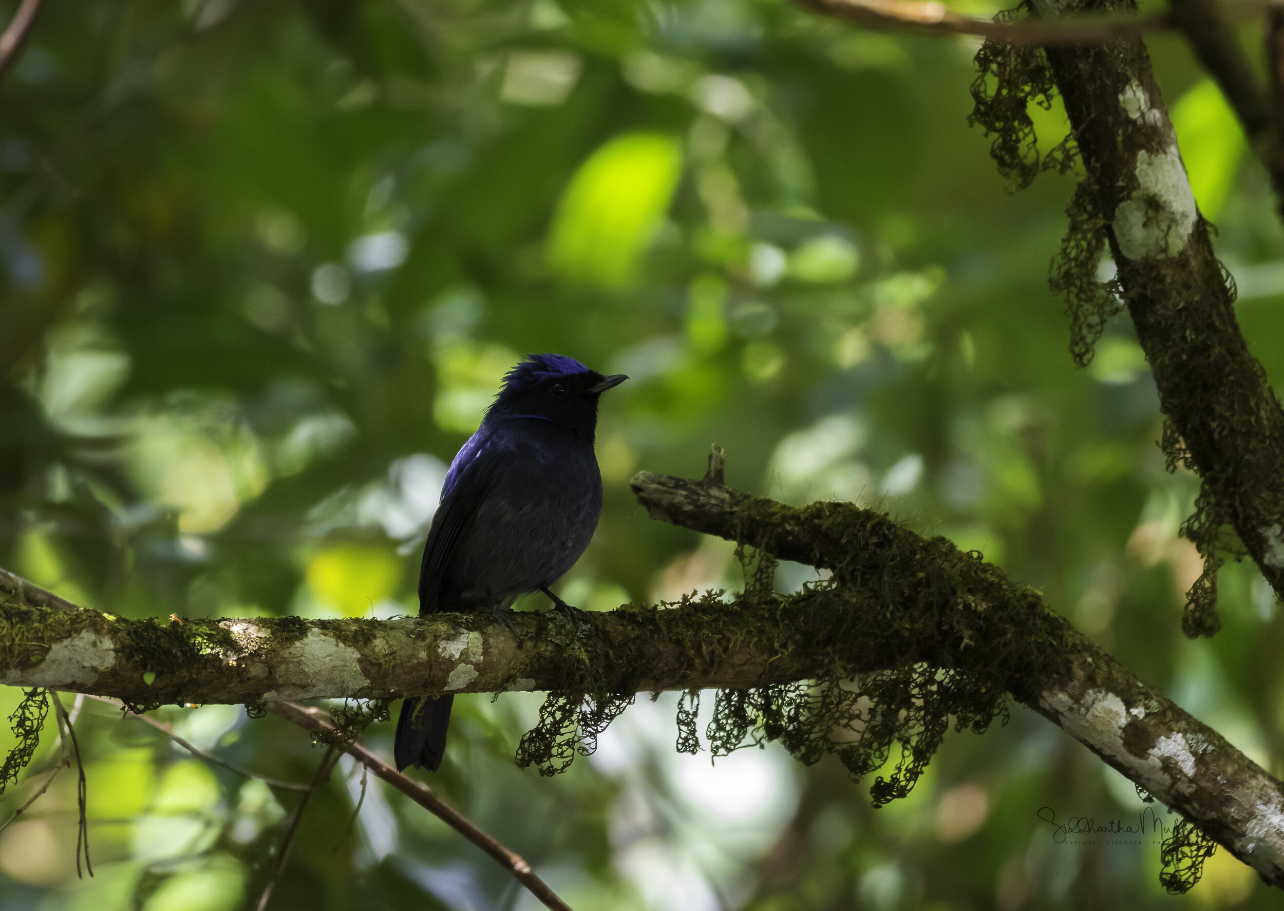
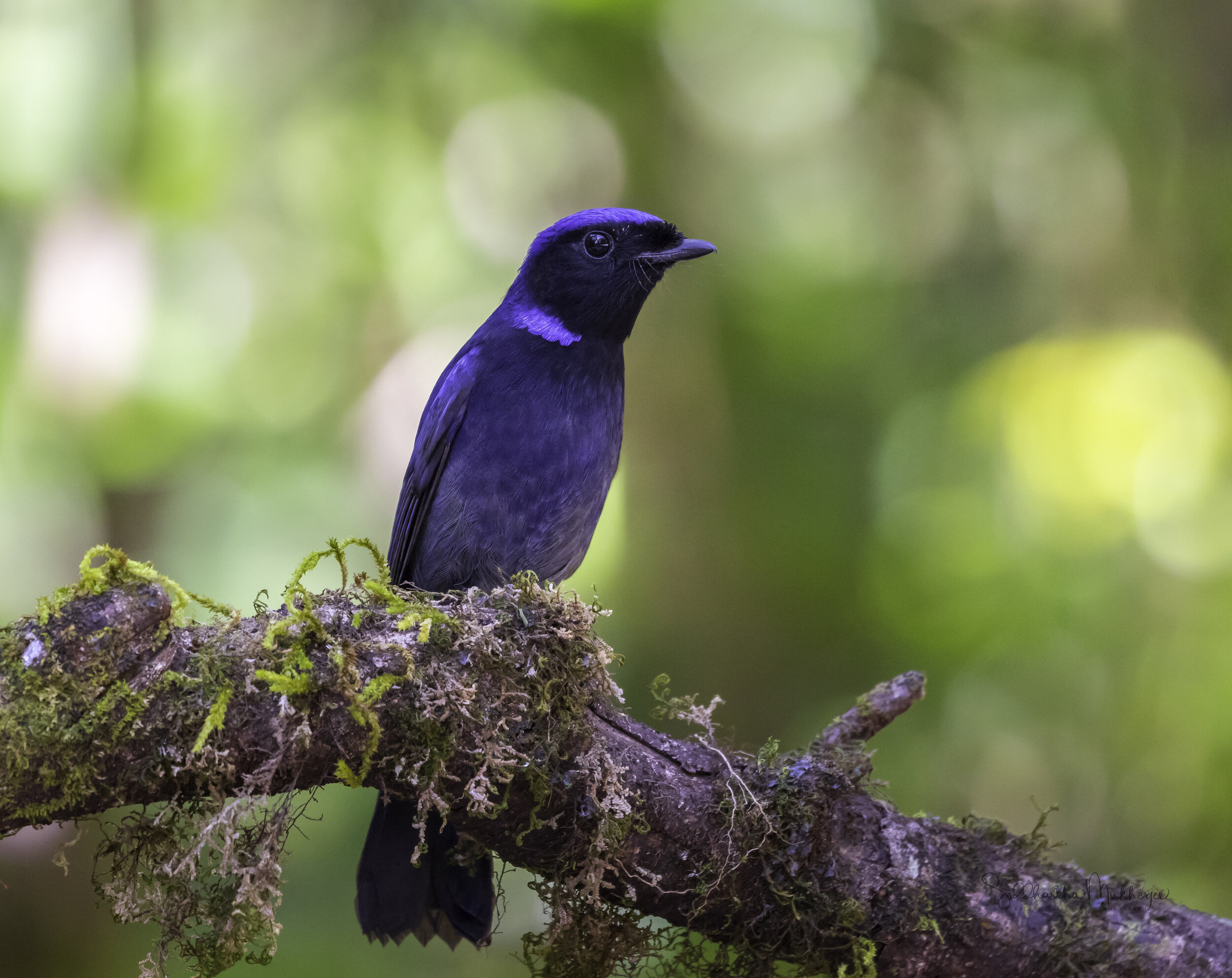
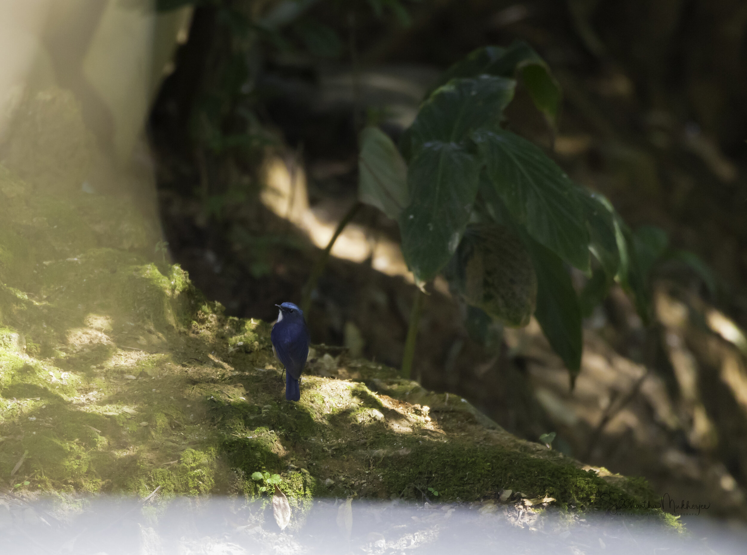
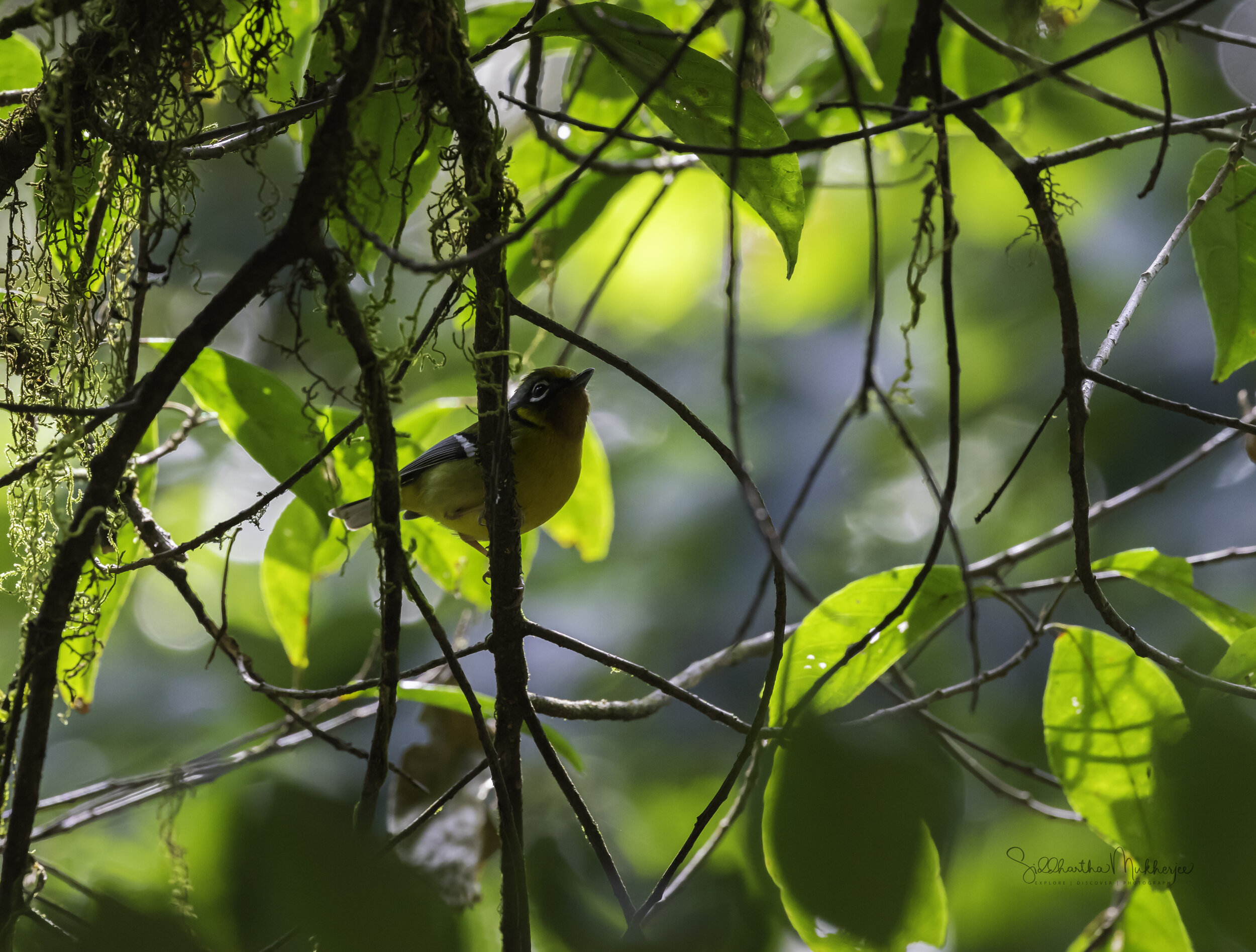
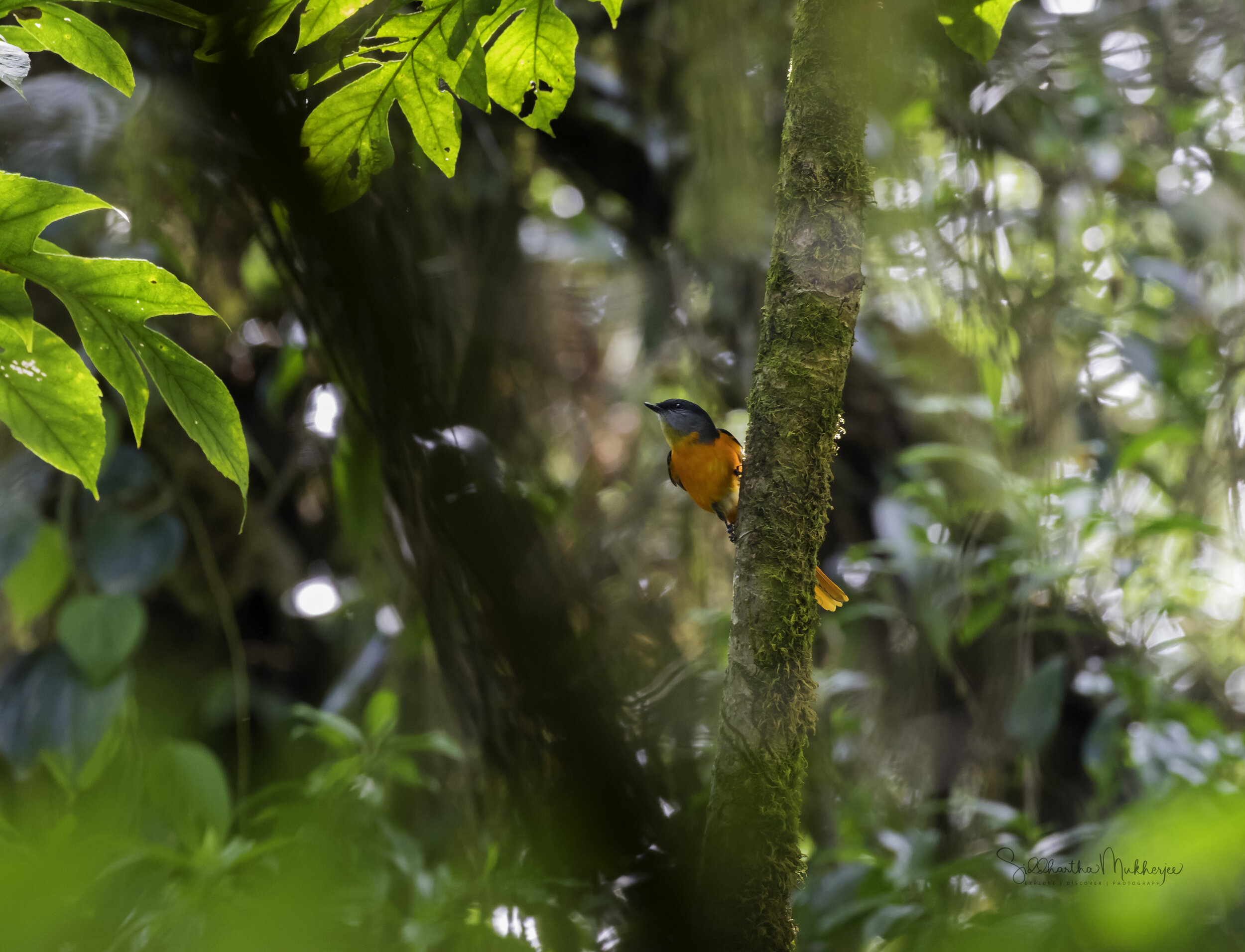
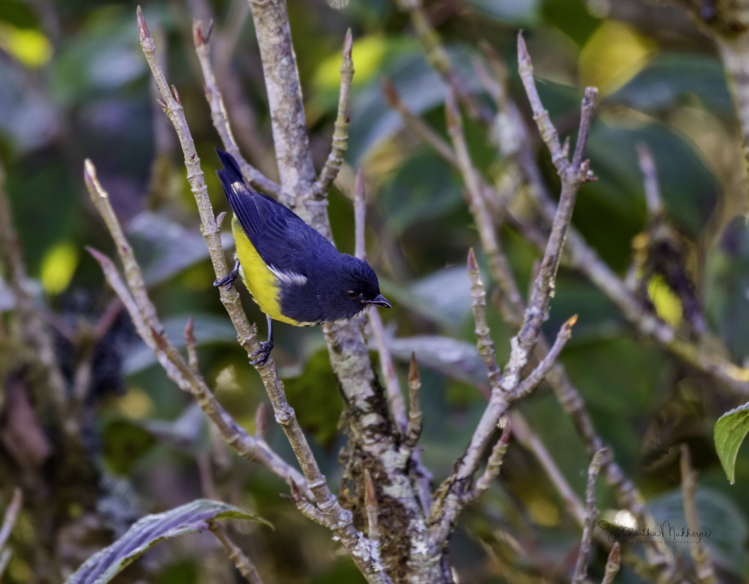
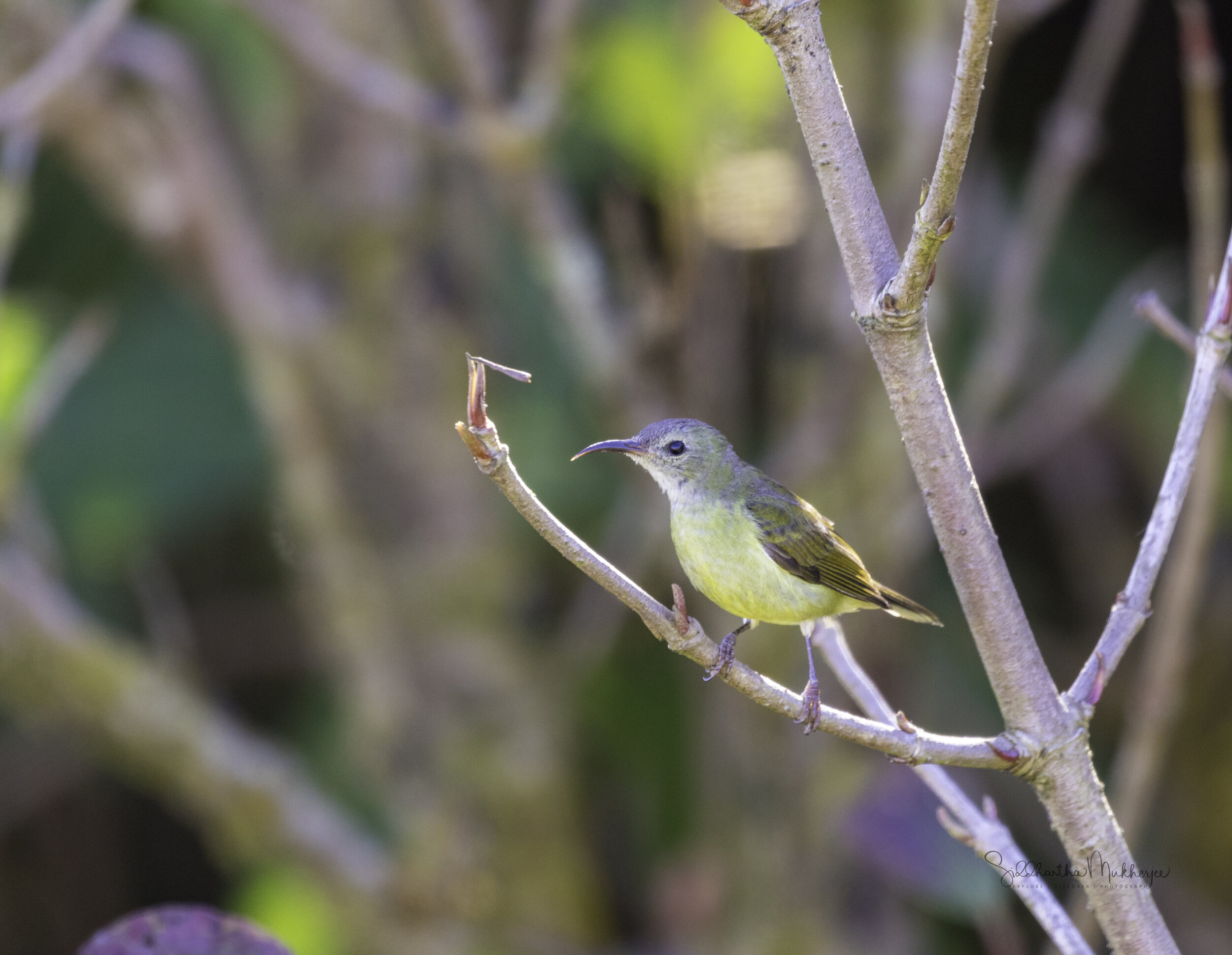
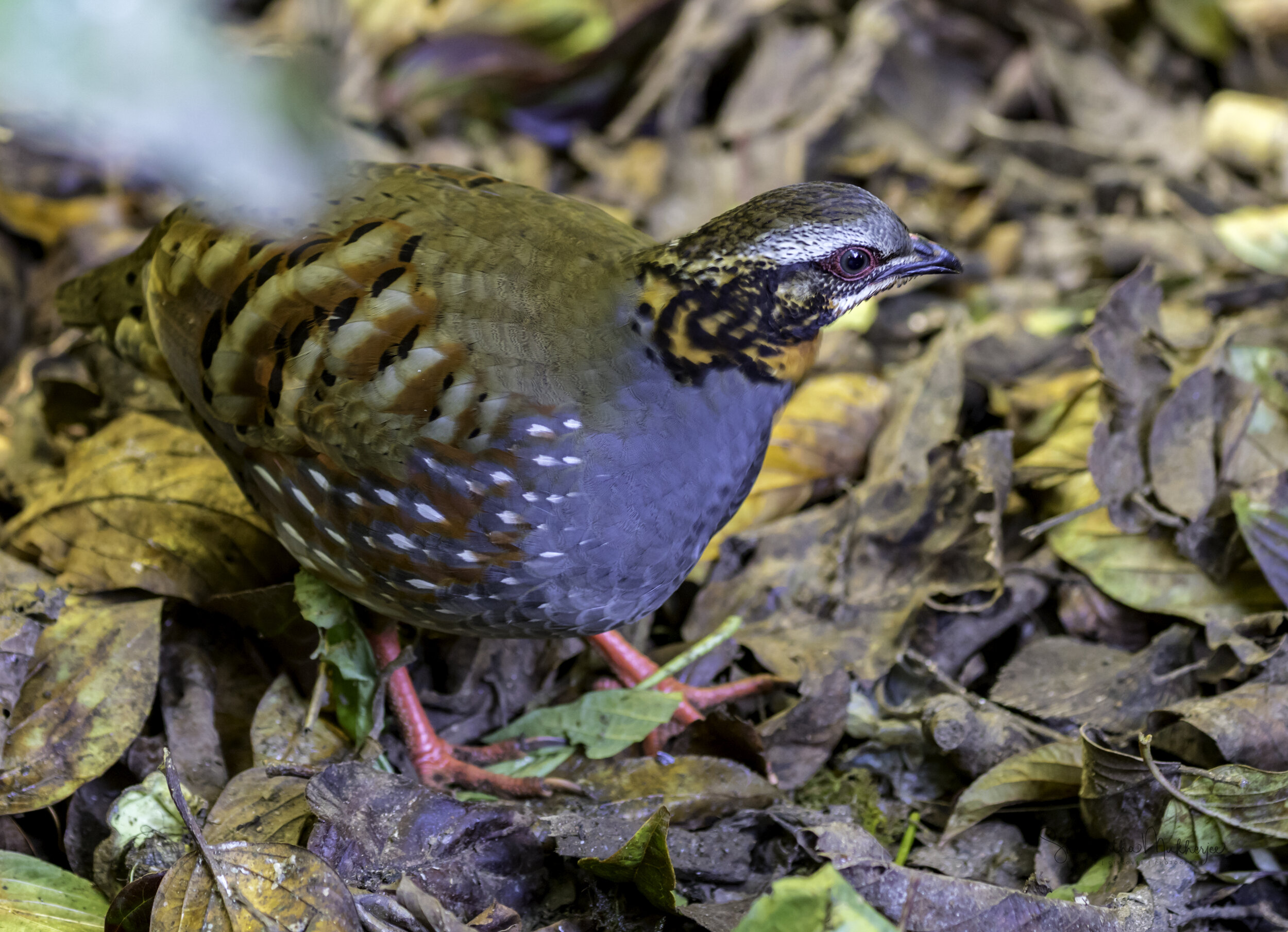
The following gallery is of some of the birds I have observed and recorded on the stunning Dois of Chiang Mai. This is by no means a complete list and during my trips there I have recorded more than 95 species and that too, I am told, is far from what the dois host.
And a very special shout out to my friend Easwar Subramanian for identifying every single bird and pointing me in the right direction every time. Thank you! This massive list would not have been possible without you.
A number of these birds have been published in various blogs by the National Geographic & the Wild Bird Trust and can be seen on my Publications page. Some have been painted in watercolours and can be seen in my Birds as Art Gallery and for some I have detailed blogs. The blogs, where I have them, are linked directly from the photos so click through and enjoy a gallery of the species and how they co-exist with others.
‡‡‡‡‡